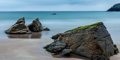
BEACHES IN HS8 5TR
Hotels near HS85TR
Nearest Beaches
Beaches near HS8 5TR
| Distance | Beach | Details |
|---|---|---|
85.7MILES | GANAVAN BEACHGANAVANArgyllshire |
Water quality: Bathing water at this beach meets or exceeds legal guidelines for water quality, and is safe for swimming/bathing. Compliant with the Blue Flag Directive 2010. |
105.9MILES | ACHMELVICH BEACHHIGHLANDHIGHLAND |
Water quality: Bathing water at this beach meets or exceeds legal guidelines for water quality, and is safe for swimming/bathing. Compliant with the Blue Flag Directive 2010. |
115.2MILES | DORES BEACHDORESHIGHLAND |
Water quality: Bathing water at this beach complies with mandatory requirements for water quality, and is safe for swimming/bathing Compliant with the Blue Flag Directive 2010. |
122MILES | ETTRICK BAY BEACHETTRICK BAYArgyllshire |
Water quality: Bathing water at this beach complies with mandatory requirements for water quality, and is safe for swimming/bathing Compliant with the Blue Flag Directive 2010. |
125.1MILES | LUSS BAY BEACHLUSSArgyllshire |
Water quality: Bathing water at this beach complies with mandatory requirements for water quality, and is safe for swimming/bathing Compliant with the Blue Flag Directive 2010. |
125.3MILES | LUNDERSTON BAY BEACHLUNDERSTON BAYAyrshire |
Water quality: Bathing water at this beach meets or exceeds legal guidelines for water quality, and is safe for swimming/bathing. Compliant with the Blue Flag Directive 2010. |
126.2MILES | ROSEMARKIE BEACHROSEMARKIEHIGHLAND |
Water quality: Bathing water at this beach meets or exceeds legal guidelines for water quality, and is safe for swimming/bathing. Compliant with the Blue Flag Directive 2010. |
132.4MILES | MACHRIHANISH BEACHMACHRIHANISHArgyllshire |
Water quality: Bathing water at this beach complies with mandatory requirements for water quality, and is safe for swimming/bathing Compliant with the Blue Flag Directive 2010. |
132.5MILES | MILLPORT BAY BEACHMILLPORTAyrshire |
Water quality: Bathing water at this beach meets or exceeds legal guidelines for water quality, and is safe for swimming/bathing. Compliant with the Blue Flag Directive 2010. |
133MILES | LARGS (PENCIL BEACH) BEACHLARGSAyrshire |
Water quality: Bathing water at this beach complies with mandatory requirements for water quality, and is safe for swimming/bathing Compliant with the Blue Flag Directive 2010. |
134.4MILES | PORTBALLINTRAE (SALMON ROCK) BEACHCOLERAINENORTHERN IRELAND |
Water quality: Bathing water at this beach meets or exceeds legal guidelines for water quality, and is safe for swimming/bathing. Compliant with the Blue Flag Directive 2010. |
134.4MILES | PORTRUSH (MILL STRAND) BEACHCOLERAINENORTHERN IRELAND |
Water quality: Bathing water at this beach meets or exceeds legal guidelines for water quality, and is safe for swimming/bathing. Compliant with the Blue Flag Directive 2010. |
134.5MILES | PORTRUSH (CURRAN STRAND) BEACHCOLERAINENORTHERN IRELAND |
Water quality: Bathing water at this beach meets or exceeds legal guidelines for water quality, and is safe for swimming/bathing. Compliant with the Blue Flag Directive 2010. |
134.7MILES | PORTRUSH (WHITEROCKS) BEACHCOLERAINENORTHERN IRELAND |
Water quality: Bathing water at this beach meets or exceeds legal guidelines for water quality, and is safe for swimming/bathing. Compliant with the Blue Flag Directive 2010. |
134.8MILES | NAIRN (CENTRAL) BEACHNAIRNHIGHLAND |
Water quality: Bathing water at this beach complies with mandatory requirements for water quality, and is safe for swimming/bathing Compliant with the Blue Flag Directive 2010. |
135.3MILES | NAIRN (EAST) BEACHNAIRNHIGHLAND |
Water quality: Bathing water at this beach complies with mandatory requirements for water quality, and is safe for swimming/bathing Compliant with the Blue Flag Directive 2010. |
135.5MILES | MAGILLIGAN (BENONE) BEACHLIMAVADYNORTHERN IRELAND |
Water quality: Bathing water at this beach meets or exceeds legal guidelines for water quality, and is safe for swimming/bathing. Compliant with the Blue Flag Directive 2010. |
135.5MILES | DORNOCH BEACHDORNOCHHIGHLAND |
Water quality: Bathing water at this beach meets or exceeds legal guidelines for water quality, and is safe for swimming/bathing. Compliant with the Blue Flag Directive 2010. |
135.8MILES | MAGILLIGAN (DOWNHILL) BEACHLIMAVADYNORTHERN IRELAND |
Water quality: Bathing water at this beach meets or exceeds legal guidelines for water quality, and is safe for swimming/bathing. Compliant with the Blue Flag Directive 2010. |
136MILES | CASTLEROCK BEACHCOLERAINENORTHERN IRELAND |
Water quality: Bathing water at this beach meets or exceeds legal guidelines for water quality, and is safe for swimming/bathing. Compliant with the Blue Flag Directive 2010. |


The nearest beach might be 86 away from HS8 5TR, but it still makes a great day out.
Grab the kids, the sun cream and the bucket and spade. HS8 5TR is never too far away that you should miss out on some family fun at the beach.
Luckily, we've got a list of the nearest beaches to HS8 5TR, so you can take your pick of the bunch!
Useful Resources
- The Beach Guide
A collection of the best beaches in Britain as of 2018. - Great British Beach Clean
The Great British Beach Clean is the biggest beach clean and survey in the UK. - Gov.uk
Find out how clean the water is on beaches and in other bathing areas in England, and if there is a problem with pollution. - Blue Flag
The iconic Blue Flag is one of the world’s most recognised voluntary eco-labels awarded to beaches, marinas, and sustainable boating tourism operators.
About Us
Postcode Area helps people in all areas of the UK to locate and find postcode data and information for cities and towns in England, Scotland, Northern Ireland and Wales.
Share and Share Alike
Find this information useful? Don't keep it a secret - spread the word.
© Postcode Area / CliqTo Ltd and Chris Haycock. Registered company number 7575287.
Unit 8 Palmbourne Industrial Park, Castle Street, Stafford, England, ST16 2TB,
UNITED KINGDOM.
