wolverhampton WV11 Postcodes
Spending a fortune on conveyancing?

Compare instant, low-cost online quotes from trusted conveyancing solicitors.
Backed by experts, our no-obligation service searches through the best conveyancing quotes on the market to save you time and money.
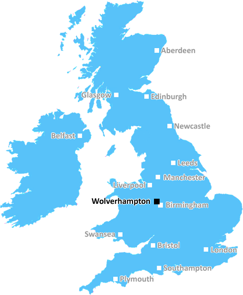
Wolverhampton (WV11)
The WV11 postcode area is located in the Wolverhampton postcode town region, within the county of West Midlands, and contains a total of 829 individual postcodes.
There are 13 electoral wards in the WV11 postcode area, including Bilston, Bridgnorth, Willenhall, Wolverhampton which come under the local authority of the Wolverhampton Council.
Combining the whole postcode region, 13% of people in WV11 are classed as having an AB social grade, (i.e. 'white-collar' middle-upper class), compared to 27% across the UK.
This does not mean that the people of WV11 are poorer than other areas, but it may give an indication that there are areas of deprivation.
WV11 postcode is located in the Wolverhampton District of the West Midlands region in England. It covers an area of approximately 6 square miles, with a population of more than 18,000, comprising of a mix of residential and commercial properties.
The area is served by two railway stations - Tettenhall and Codsall, with further connections to Birmingham and other destinations. The A41 is the main road running through the area providing pathways to areas such as Wombourne and Bloxwich.
WV11 is comprised of three main wards which are Tettenhall Wightwick, Codsall North & Codsall South. According to the 2011 census, the Tettenhall Wightwick and Codsall North ward populations were 11,742 and 6,364 respectively. The Codsall South ward population was 4925.
In terms of local amenities, the area boasts multiple schools and leisure facilities. Educational institutions in the area include the prestigious Wolverhampton Grammar School as well as other state-run schools and colleges. Also, there are various sporting venues in the area, such as Tettenhall Cricket Club, local football teams, golf courses, and tennis courts. Shopping wise, the area has a mix of supermarkets, local stores, and independent outlets.
In terms of public services, WV11 postcode falls under the jurisdiction of City of Wolverhampton council. There are multiple medical facilities in the area, including GP practices, pharmacies, dentists, opticians, and orthopedic clinics. Public health services, such as midwifery, health visitors, and community nursing, are also available in the area.
Additionally, there are several parks and public spaces in the area, including Summerfield Park which is a local nature reserve and Green Lane Park, offering people the opportunity to enjoy outdoor recreational activities. The area also has a number of churches and religious sites, such as St John's Church and Wightwick Manor.
From a cultural perspective, WV11 offers its residents plenty to keep them entertained. The area is home to multiple art galleries, theatres, and museums. It also hosts the yearly �Wolverhampton Show� and daytime festivals, which bring together locals and visitors alike for an exciting celebration.

Demographics

West Midlands

WV11 is located in the county of West Midlands, in England.
West Midlands has a total population of 2,864,900, making it the 2nd largest county in the UK.
West Midlands has a total area of 348 square miles, and a population density of 3177 people per square kilometre. For comparison, Greater London has a density of 5,618 people/km2.
| Outward Code | WV11 |
| Postal Town | Wolverhampton |
| MSOA Name | Wolverhampton 004 |
| LSOA Name | Wolverhampton 004B |
| County | West Midlands |
| Region | West Midlands |
| Country | England |
| Local Authority | Wolverhampton |
| Area Classification | Urban with Major Conurbation |
WV11 Electoral Wards
The postal region of WV11, includes the local towns, villages, electoral wards and stations of:
Dig even deeper into the WV11 postcode by clicking on a postcode below:
Click on an outward postal code below for more information about the area. Each 'outward' postcode give you a comprehensive list of all postcodes within the outward code area (WV) and estimated address.
Click on an 'outward' code for more information. For example, the outward postcode page 'EC2M' will give you an alphabetical list covering all postcodes located in the region, from 'EC2M 1BB' through to 'EC2M 7YA'.
Chris H
Thursday, May 9, 2024
We don't have any views of WV11 right now. If you live in WV11 or have visited it, please help us to help others by telling others what you think of this neighbourhood.
Add your view of WV11
People need your local expertise. If you live in WV11 or have first-hand knowledge of the neighbourhood, please consider sharing your views. It's completely anonymous - all we ask is for your initials.
Please tell us what you like about the WV11 postcode area, what you don't like, and what it's like to live or work here.
| LOCAL AMENITIES | |
| FAMILY FRIENDLY | |
| PARKING | |
| GREEN SPACES |
Local News Staffordshire
Options explored to partially reopen Wombourne household waste recycling centre
Wombourne residents are being reminded to continue to use neighbouring Bilbrook household waste recycling centre as the county council explores options to partially reopen their site.
Staffordshire County CouncilStill time to nominate in countys care awards
People from Staffordshire are being reminded that there is still time to nominate a carer, work colleague, friend or family member for a special award.
Staffordshire County CouncilFoster families share their experiences to encourage others to come forward
A Staffordshire foster family have shared their experiences of fostering to try and encourage others to come forward.
Staffordshire County CouncilCouncil given national recognition for supporting residents to learn vital employability skills
Staffordshire County Council's Community Learning service has been awarded the international quality Matrix Standard for providing high quality information and advice to residents about learning and w&hellip
Staffordshire County CouncilTraffic warden explains 10-minute rule and how to avoid a ticket
A traffic warden has spoken out about her job as an enforcement officer and the myths that surround it - including the fact that she doesn't get commission
Stoke SentinelArsonists hunted after lorry trailers blaze
Four lorry trailers were well alight and it took crews around six hours to put the blaze out.
BBC News'I want to be in the music industry forever'
Staffordshire's 17-year-old Belle, daughter of singer 'Lolly,' releases her 7th single.
BBC NewsFootball club and council team up for pitch revamp
The 1.4m plan will see the creation of a 3G artificial grass pitch and the pavilion refurbished.
BBC NewsFrom the Postcode Area blog

Deciphering Crime Rates - a Deep Dive Into UK Postcode Analysis
Ever wondered about the crime rate in your UK postcode? You're not alone. We've dug deep into the data, uncovering trends and patterns that'll make your head spin.

Death of the High Street?
The BBC reports that despite councils' attempts to kurb them, the UK's high streets have seen a huge growth in fast food outlets. Could this mark the death knell for the Great British high street, and what can we do about it to halt its decline?

Discrimination by Postcode
You really couldn't make it up, could you? Some of the country's most vulnerable people are missing out on their weekly £25 Cold Weather Payment, just because the system that's in operation is discriminating against them because payments are based on postcode, rather than geographic location.

The Redesign is Underway
Well, the current website was absolutely in dire need of a good redesign - from the ground up. So I set out to pull it all apart and get it up and running again to become the most comprehensive guide to every postcode in the UK. And it's been a long, tough job from start to finish - and quite possibly the biggest project I've ever undertaken.
SOCIAL GRADES
According to census records, 13% of people here have a social grade of AB (highest), compared to the national average of 27%.