walsall WS13 Postcodes
Spending a fortune on conveyancing?

Compare instant, low-cost online quotes from trusted conveyancing solicitors.
Backed by experts, our no-obligation service searches through the best conveyancing quotes on the market to save you time and money.
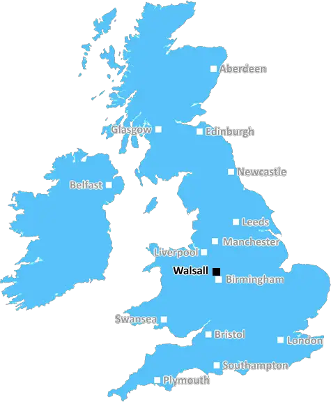
Walsall (WS13)
The WS13 postcode area is located in the Walsall postcode town region, within the county of Staffordshire, and contains a total of 938 individual postcodes.
There are 30 electoral wards in the WS13 postcode area, including Burntwood, Cannock, Lichfield, Rugeley, Walsall, Wednesbury which come under the local authority of the Lichfield Council.
Combining the whole postcode region, 32% of people in WS13 are classed as having an AB social grade, (i.e. 'white-collar' middle-upper class), compared to 27% across the UK.
This does not mean that the people of WS13 are wealthier - or higher class - than average, but it can be an indication that the area may be prospering and desirable to live in.
WS13 is a postcode district in the West Midlands county of Walsall. It is a suburban area on the outskirts of Walsall and is made up of many small villages and hamlets, including Armitage, Hatherton, Shelfield, The Chuckery and Shareshill.
The area has a notable population of younger adults, with the average age of 34 at the 2011 census. There is also a relatively diverse racial makeup, with the highest percentile being Asian/Asian British at 24.9%, closely followed by White British at 22.8%.
WS13 has a large amount of green space, with Hill Hook Nature Reserve and Walsall Arboretum being two of the most popular spots. The area also has an impressive transport network, with no fewer than 10 bus routes serving the district, enabling locals to quickly commute to the centre of Walsall.
The postcode is located close to local amenities, including several supermarkets, retailers and places of worship. It is home to Walsall Football Club and The Stadium Business Park, both of which attract a large number of visitors to the area each week.
The majority of residential property within WS13 is made up of terraces, semi-detached and detached houses, with an average house price of �181,000 in 2019. The area also has a selection of well-maintained streets, such as The Rise and the Oak Ridge Estate, which provide plenty of choice for potential buyers.
There are a range of schools in the WS13 area, ranging from primary and secondary to special education and independent schools. Erasmus Darwin Academy is the largest school in the district, serving over 1,000 students.
WS13 is a well-connected yet peaceful place to live, with plenty of amenities, a good transport network and lots of green space. It is a popular area for young professionals and families alike, due to its convenient location, affordability and diverse community.

Demographics

Staffordshire

WS13 is located in the county of Staffordshire, in England.
Staffordshire has a total population of 1,120,300, making it the 17th largest county in the UK.
Staffordshire has a total area of 1047 square miles, and a population density of 412 people per square kilometre. For comparison, Greater London has a density of 5,618 people/km2.
| Outward Code | WS13 |
| Postal Town | Walsall |
| MSOA Name | Lichfield 004 |
| LSOA Name | Lichfield 004E |
| County | Staffordshire |
| Region | Staffordshire |
| Country | England |
| Local Authority | Lichfield |
| Area Classification | Urban with Significant Rural (rural including hub towns 26-49%) |
WS13 Electoral Wards
The postal region of WS13, includes the local towns, villages, electoral wards and stations of:
Dig even deeper into the WS13 postcode by clicking on a postcode below:
Click on an outward postal code below for more information about the area. Each 'outward' postcode give you a comprehensive list of all postcodes within the outward code area (WS) and estimated address.
Click on an 'outward' code for more information. For example, the outward postcode page 'EC2M' will give you an alphabetical list covering all postcodes located in the region, from 'EC2M 1BB' through to 'EC2M 7YA'.
Chris H
Tuesday, May 7, 2024
We don't have any views of WS13 right now. If you live in WS13 or have visited it, please help us to help others by telling others what you think of this neighbourhood.
Add your view of WS13
People need your local expertise. If you live in WS13 or have first-hand knowledge of the neighbourhood, please consider sharing your views. It's completely anonymous - all we ask is for your initials.
Please tell us what you like about the WS13 postcode area, what you don't like, and what it's like to live or work here.
| LOCAL AMENITIES | |
| FAMILY FRIENDLY | |
| PARKING | |
| GREEN SPACES |
Local News Staffordshire
Temporary closure of Leek Household Waste Recycling Centre for electrical work
Leek household waste recycling centre (HWRC) is closing for a five-day electrical upgrade.
Staffordshire County Council'I'm no longer a VIP' - Disgusted Denise in Take That Ticketmaster row
Denise Taylor, from Stoke-on-Trent, had paid 250 for a VIP ticket to see Take That at Co-op Live
Stoke SentinelCouncil recognises logistics firm as an outstanding employer for supporting young people with SEND
Major logistics firm, Wincanton, has been recognised by Staffordshire County Council and learning disability charity Mencap as an Outstanding Employer in supporting young people with special education&hellip
Staffordshire County CouncilTeen singer's breakthrough hope with producer dad
The latest single from Lichfield singer Belle is produced by her father, who worked with Kylie and Gary Barlow.
BBC NewsLive: Multiple emergency services at the scene as smoke engulfs town centre
Staffordshire Police and Staffordshire Fire and Rescue Service are on Wharf Road, in Biddulph, tonight
Stoke SentinelFind out more about Burton Library's improvement scheme at April drop-in sessions
People can find out more about a 1.3million package of improvements at Burton Library at a series of informal drop-in events this month.
Staffordshire County CouncilRestaurant car park shut after hand grenade found
Bomb squad officers are investigating following the discovery near Miller & Carter in Cannock.
BBC NewsRedevelopment plan for library after grant win
Staffordshire County Council successfully bid for 199,000 from the Arts Council England to revamp Wombourne library.
Staffordshire County CouncilFrom the Postcode Area blog

Deciphering Crime Rates - a Deep Dive Into UK Postcode Analysis
Ever wondered about the crime rate in your UK postcode? You're not alone. We've dug deep into the data, uncovering trends and patterns that'll make your head spin.

Death of the High Street?
The BBC reports that despite councils' attempts to kurb them, the UK's high streets have seen a huge growth in fast food outlets. Could this mark the death knell for the Great British high street, and what can we do about it to halt its decline?

Discrimination by Postcode
You really couldn't make it up, could you? Some of the country's most vulnerable people are missing out on their weekly £25 Cold Weather Payment, just because the system that's in operation is discriminating against them because payments are based on postcode, rather than geographic location.

The Redesign is Underway
Well, the current website was absolutely in dire need of a good redesign - from the ground up. So I set out to pull it all apart and get it up and running again to become the most comprehensive guide to every postcode in the UK. And it's been a long, tough job from start to finish - and quite possibly the biggest project I've ever undertaken.
SOCIAL GRADES
According to census records, 32% of people here have a social grade of AB (highest), compared to the national average of 27%.