uxbridge UB3 Postcodes
Spending a fortune on conveyancing?

Compare instant, low-cost online quotes from trusted conveyancing solicitors.
Backed by experts, our no-obligation service searches through the best conveyancing quotes on the market to save you time and money.
Uxbridge (UB3)
The UB3 postcode area is located in the Uxbridge postcode town region, within the county of Greater London, and contains a total of 1597 individual postcodes.
There are 9 electoral wards in the UB3 postcode area, including Greenford, Hayes, Northolt, Southall, Uxbridge, West Drayton which come under the local authority of the Hillingdon Council.
Combining the whole postcode region, 14% of people in UB3 are classed as having an AB social grade, (i.e. 'white-collar' middle-upper class), compared to 27% across the UK.
This does not mean that the people of UB3 are poorer than other areas, but it may give an indication that there are areas of deprivation.
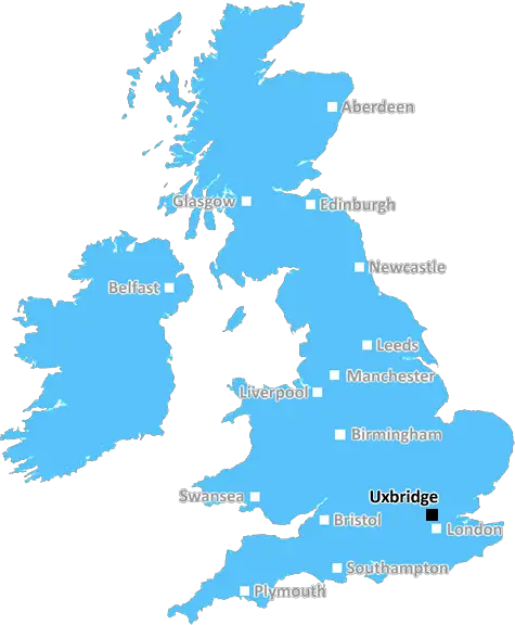
The UB3 postcode covers most of the Uxbridge district in London Borough of Hillingdon. It is located approximately 15 miles west-northwest of Charing Cross and it is largely residential, with more than 18,000 dwellings.
The central hub of UB3 is Uxbridge town centre, which is a major commercial destination in the area and offers a variety of shopping, leisure, and dining opportunities. It is home to the largest shopping centre in Hillingdon: The intu Uxbridge.
Other major landmarks include Uxbridge High Street, St Andrew's Church, the Garrick Theatre, St Margaret's Church, Royal Court Shopping Centre, and Uxbridge College. Uxbridge Cricket Club are based here and Uxbridge Little Theatre also attracts people from around the borough to attend their events and shows.
In terms of transport links, Uxbridge is located near the M25 Motorway, and offers a variety of rail services, with two stations within the postcode district: Uxbridge and Hillingdon stations. The district is serviced by many bus routes around the area, while London Underground also run underground services from Uxbridge station.
Education wise, there are several primary and secondary schools, as well as Uxbridge College, all of which provide educational opportunities for students of all ages.
In terms of leisure activities, UB3 offers a wealth of facilities. There are several parks and play areas within the postcode, such as the Park Road Nature Reserve and the Riverside Walk. Hillingdon Sports & Leisure Complex is also within the area, offering a range of sports clubs and activities.
With a wide range of attractions to keep visitors entertained, UB3 is a desirable destination for both locals and tourists. It's a great place to shop, eat, learn, and explore with excellent travel links and a thriving atmosphere.

Demographics
Greater London

UB3 is located in the county of Greater London, in England.
Greater London has a total population of 8,778,500, making it the 1st largest county in the UK.
Greater London has a total area of 606 square miles, and a population density of 5594 people per square kilometre. For comparison, Greater London has a density of 5,618 people/km2.
| Outward Code | UB3 |
| Postal Town | Uxbridge |
| MSOA Name | Hillingdon 030 |
| LSOA Name | Hillingdon 030A |
| County | Greater London |
| Region | Greater London |
| Country | England |
| Local Authority | Hillingdon |
| Area Classification | Urban with Major Conurbation |
UB3 Electoral Wards
The postal region of UB3, includes the local towns, villages, electoral wards and stations of:
Dig even deeper into the UB3 postcode by clicking on a postcode below:
Click on an outward postal code below for more information about the area. Each 'outward' postcode give you a comprehensive list of all postcodes within the outward code area (UB) and estimated address.
Click on an 'outward' code for more information. For example, the outward postcode page 'EC2M' will give you an alphabetical list covering all postcodes located in the region, from 'EC2M 1BB' through to 'EC2M 7YA'.
Chris H
Saturday, April 6, 2024
We don't have any views of UB3 right now. If you live in UB3 or have visited it, please help us to help others by telling others what you think of this neighbourhood.
Add your view of UB3
People need your local expertise. If you live in UB3 or have first-hand knowledge of the neighbourhood, please consider sharing your views. It's completely anonymous - all we ask is for your initials.
Please tell us what you like about the UB3 postcode area, what you don't like, and what it's like to live or work here.
| LOCAL AMENITIES | |
| FAMILY FRIENDLY | |
| PARKING | |
| GREEN SPACES |
From the Postcode Area blog

Deciphering Crime Rates - a Deep Dive Into UK Postcode Analysis
Ever wondered about the crime rate in your UK postcode? You're not alone. We've dug deep into the data, uncovering trends and patterns that'll make your head spin.

Death of the High Street?
The BBC reports that despite councils' attempts to kurb them, the UK's high streets have seen a huge growth in fast food outlets. Could this mark the death knell for the Great British high street, and what can we do about it to halt its decline?

Discrimination by Postcode
You really couldn't make it up, could you? Some of the country's most vulnerable people are missing out on their weekly £25 Cold Weather Payment, just because the system that's in operation is discriminating against them because payments are based on postcode, rather than geographic location.

The Redesign is Underway
Well, the current website was absolutely in dire need of a good redesign - from the ground up. So I set out to pull it all apart and get it up and running again to become the most comprehensive guide to every postcode in the UK. And it's been a long, tough job from start to finish - and quite possibly the biggest project I've ever undertaken.
SOCIAL GRADES
According to census records, 14% of people here have a social grade of AB (highest), compared to the national average of 27%.