tonbridge TN33 Postcodes
Spending a fortune on conveyancing?

Compare instant, low-cost online quotes from trusted conveyancing solicitors.
Backed by experts, our no-obligation service searches through the best conveyancing quotes on the market to save you time and money.
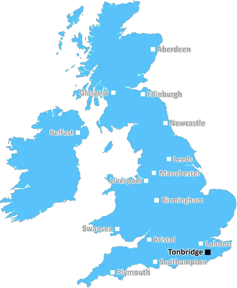
Tonbridge (TN33)
The TN33 postcode area is located in the Tonbridge postcode town region, within the county of East Sussex, and contains a total of 652 individual postcodes.
There are 68 electoral wards in the TN33 postcode area, including Ashford, Battle, Bexhill-On-Sea, Cranbrook, Crowborough, Edenbridge, Etchingham, Hartfield, Hastings, Heathfield, Mayfield, New Romney, Robertsbridge, Romney Marsh, Rye, Sevenoaks, St Leonards-On-Sea, Tenterden, Tonbridge, Tunbridge Wells, Uckfield, Wadhurst, Westerham, Winchelsea which come under the local authority of the Rother Council.
Combining the whole postcode region, 29% of people in TN33 are classed as having an AB social grade, (i.e. 'white-collar' middle-upper class), compared to 27% across the UK.
This does not mean that the people of TN33 are wealthier - or higher class - than average, but it can be an indication that the area may be prospering and desirable to live in.
TN33 is a postcode district located in the Tonbridge area of South East England. It covers an area of around 10.83 square miles and includes the towns of Five Oak Green, Tudeley and Lamberhurst, as well as other local villages such as Goudhurst, Wadhurst, Frant and Flimwell. It is in the Tunbridge Wells area and lies within the Tunbridge Wells Borough and Kent county.
The main A21 route links the TN33 postcode to the RNLI at Hastings, and the main A268 route continues further to Burwash Common and Battle in East Sussex. The key A21 road bypasses the districts of Pembury, Langton Green, Sherwood and Southborough, providing access to Tunbridge Wells, Tonbridge and other local areas. Other main roads help to link the postcode area to the nearby towns of Paddock Wood, Cranbrook and Hastings, as well as to Maidstone.
The population of the TN33 postcode was estimated at 6,400 in the 2011 census. The district has a predominantly rural character and is largely covered by the High Weald Area of Outstanding Natural Beauty. It is home to several large private estates, some of which date back to the 18th century, including Sissinghurst Castle and Great Dixter. There is a wide range of local amenities � including pubs, caf�s, shops, schools and leisure facilities.
The main industries in the area are agriculture and tourism, with numerous destinations providing for a range of outdoor activities, such as walking, cycling and horse riding. There is easy access to the Kent Downs, an area of outstanding beauty that provides an array of wildlife and countryside routes. TN33 is a popular destination for those looking to enjoy some of England's most picturesque towns and villages, as well as the Kentish coast. The nearby towns of Tunbridge Wells and Sevenoaks provide a selection of bars, restaurants and shopping opportunities for locals and visitors alike.

Demographics

East Sussex

TN33 is located in the county of East Sussex, in England.
East Sussex has a total population of 837,000, making it the 29th largest county in the UK.
East Sussex has a total area of 692 square miles, and a population density of 467 people per square kilometre. For comparison, Greater London has a density of 5,618 people/km2.
| Outward Code | TN33 |
| Postal Town | Tonbridge |
| MSOA Name | Rother 006 |
| LSOA Name | Rother 006A |
| County | East Sussex |
| Region | East Sussex |
| Country | England |
| Local Authority | Rother |
| Area Classification | Largely Rural (rural including hub towns 50-79%) |
TN33 Electoral Wards
The postal region of TN33, includes the local towns, villages, electoral wards and stations of:
Dig even deeper into the TN33 postcode by clicking on a postcode below:
Click on an outward postal code below for more information about the area. Each 'outward' postcode give you a comprehensive list of all postcodes within the outward code area (TN) and estimated address.
Click on an 'outward' code for more information. For example, the outward postcode page 'EC2M' will give you an alphabetical list covering all postcodes located in the region, from 'EC2M 1BB' through to 'EC2M 7YA'.
Chris H
Tuesday, April 16, 2024
We don't have any views of TN33 right now. If you live in TN33 or have visited it, please help us to help others by telling others what you think of this neighbourhood.
Add your view of TN33
People need your local expertise. If you live in TN33 or have first-hand knowledge of the neighbourhood, please consider sharing your views. It's completely anonymous - all we ask is for your initials.
Please tell us what you like about the TN33 postcode area, what you don't like, and what it's like to live or work here.
| LOCAL AMENITIES | |
| FAMILY FRIENDLY | |
| PARKING | |
| GREEN SPACES |
Local News Sussex
Plans to reopen former household refuse site
Lewes District Council wants to develop the site in Newhaven for the handling of food waste.
BBC NewsMan arrested after suspected arson attack - police
Sussex Police say a 34-year-old man from Hailsham remains in custody following the incident.
BBC NewsTwo XL bullies seized after dog killed in attack
Police are seeking an order to destroy two XL bullies after a dog was killed and its owner injured.
BBC NewsBogus removals man hid cocaine in piano
Francesco Role was caught when border security officers became suspicious of the piano's weight.
BBC NewsSussex social worker charged with sex offences
An investigation was launched by Sussex Police after "sexual messages" were found.
BBC NewsNo stopping rules introduced on Brighton roads
London Road, Preston Road and Lewes Road have restrictions implemented seven days a week.
BBC NewsLeicestershire and Sussex settle for rain-hit draw
Not a single ball is bowled on the final day because of rain as Leicestershire and Sussex draw in the County Championship.
BBC NewsCouncil to restore heritage Sussex rail bridge
East Sussex County Council says engineers will inspect the Church Road Bridge ahead of restoration.
BBC NewsFrom the Postcode Area blog

Deciphering Crime Rates - a Deep Dive Into UK Postcode Analysis
Ever wondered about the crime rate in your UK postcode? You're not alone. We've dug deep into the data, uncovering trends and patterns that'll make your head spin.

Death of the High Street?
The BBC reports that despite councils' attempts to kurb them, the UK's high streets have seen a huge growth in fast food outlets. Could this mark the death knell for the Great British high street, and what can we do about it to halt its decline?

Discrimination by Postcode
You really couldn't make it up, could you? Some of the country's most vulnerable people are missing out on their weekly £25 Cold Weather Payment, just because the system that's in operation is discriminating against them because payments are based on postcode, rather than geographic location.

The Redesign is Underway
Well, the current website was absolutely in dire need of a good redesign - from the ground up. So I set out to pull it all apart and get it up and running again to become the most comprehensive guide to every postcode in the UK. And it's been a long, tough job from start to finish - and quite possibly the biggest project I've ever undertaken.
SOCIAL GRADES
According to census records, 29% of people here have a social grade of AB (highest), compared to the national average of 27%.