swindon SN2 Postcodes
Spending a fortune on conveyancing?

Compare instant, low-cost online quotes from trusted conveyancing solicitors.
Backed by experts, our no-obligation service searches through the best conveyancing quotes on the market to save you time and money.
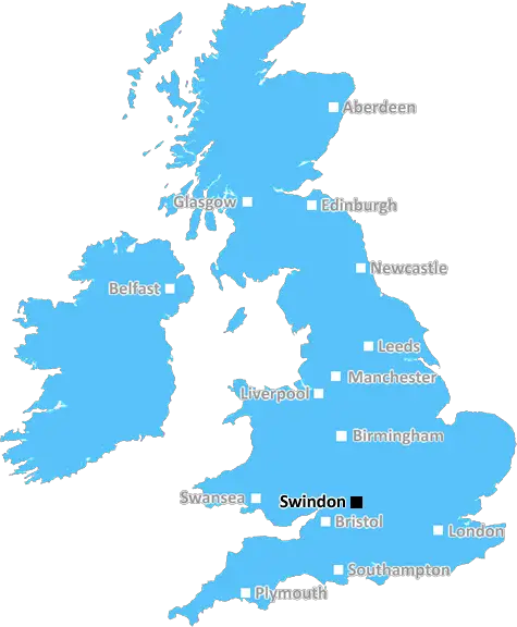
Swindon (SN2)
The SN2 postcode area is located in the Swindon postcode town region, within the county of Wiltshire, and contains a total of 2132 individual postcodes.
There are 14 electoral wards in the SN2 postcode area, including Calne, Chippenham, Corsham, Devizes, Faringdon, Malmesbury, Marlborough, Melksham, Pewsey, Swindon which come under the local authority of the Swindon Council.
Combining the whole postcode region, 19% of people in SN2 are classed as having an AB social grade, (i.e. 'white-collar' middle-upper class), compared to 27% across the UK.
This does not mean that the people of SN2 are poorer than other areas, but it may give an indication that there are areas of deprivation.
SN2 is a postcode district in the Swindon post town of Wiltshire in the South West of England. It is primarily a residential area, known for its Victorian terraced homes and parkland. Its main attractions include its close proximity to the popular town of Swindon, with major motorway links to London, Bristol, Salisbury, and Oxford. Furthermore, SN2 provides easy access to the famous Stonehenge site in Wiltshire and lush countryside scenery.
The postcode district itself lies within the parliamentary constituency of North Swindon, and the district is served by national primary and secondary schools as part of the Wiltshire County Council. Additionally, SN2 includes dentists, chemists, health centres, and a variety of supermarkets, eateries, and other shops. The postcode is also home to family attractions, such as the Designer Outlet Village, Steam, the Museum of the Great Western Railway, and a number of nature reserves.
SN2 has an enviable mix of both urban and rural amenities, with outdoor activities such as fishing, walking, golfing, and horse riding. There are also sports centres, leisure facilities, and green spaces, including Speedy's Walk and Valery Park.
The district is also accessible by bus, rail, and air, with rail links to London, Reading, Oxford, and Bristol. The region is served by the M4 motorway and the A419, which both provide road access to major towns and cities.
In spite of its urban sprawl, SN2 still retains a distinct �small village' feel that is increasingly rare in the UK. Its pleasant and thriving community atmosphere has made SN2 an increasingly popular choice for both young and established families. This, combined with its heritage buildings, nearby country parks, and education institutions make SN2 an attractive place to live.

Demographics

Wiltshire

SN2 is located in the county of Wiltshire, in England.
Wiltshire has a total population of 706,300, making it the 34th largest county in the UK.
Wiltshire has a total area of 1346 square miles, and a population density of 202 people per square kilometre. For comparison, Greater London has a density of 5,618 people/km2.
| Outward Code | SN2 |
| Postal Town | Swindon |
| MSOA Name | Swindon 010 |
| LSOA Name | Swindon 010C |
| County | Wiltshire |
| Region | Wiltshire |
| Country | England |
| Local Authority | Swindon |
| Area Classification | Urban with City and Town |
SN2 Electoral Wards
The postal region of SN2, includes the local towns, villages, electoral wards and stations of:
Dig even deeper into the SN2 postcode by clicking on a postcode below:
Click on an outward postal code below for more information about the area. Each 'outward' postcode give you a comprehensive list of all postcodes within the outward code area (SN) and estimated address.
Click on an 'outward' code for more information. For example, the outward postcode page 'EC2M' will give you an alphabetical list covering all postcodes located in the region, from 'EC2M 1BB' through to 'EC2M 7YA'.
Chris H
Tuesday, May 7, 2024
We don't have any views of SN2 right now. If you live in SN2 or have visited it, please help us to help others by telling others what you think of this neighbourhood.
Add your view of SN2
People need your local expertise. If you live in SN2 or have first-hand knowledge of the neighbourhood, please consider sharing your views. It's completely anonymous - all we ask is for your initials.
Please tell us what you like about the SN2 postcode area, what you don't like, and what it's like to live or work here.
| LOCAL AMENITIES | |
| FAMILY FRIENDLY | |
| PARKING | |
| GREEN SPACES |
Local News Wiltshire
Walsall 2-1 Swindon Town
Danny Johnson boosts Walsall's League Two play-off hopes as his 89th-minute winner earned them a 2-1 home victory over Swindon.
BBC NewsWalsall 2-1 Swindon Town
Danny Johnson boosts Walsall's League Two play-off hopes as his 89th-minute winner earned them a 2-1 home victory over Swindon.
BBC NewsDrink-driver admits causing death of partner
Paula Rendell crashed a car into a tree in Swindon, killing her partner and passenger Paul Morton.
BBC NewsInfected-blood victim 'angry' at lost records
Ann Swan was told she had hepatitis C after a blood transfusion in 1976 of which there is no record.
BBC NewsStriker Austin among 11 released by Swindon
Striker Charlie Austin is among 11 players released by Swindon Town at the end of the season.
BBC NewsFire destroys most of building in historic area
An investigation is underway into the cause of the fire in Bradford-on-Avon.
BBC NewsBabies splash their way to raising 700,000
More than 1,500 babies took part in the bi-annual Splashathon to fundraise for children's charities.
BBC News'The day Mikey was killed, my life changed forever'
Mikey Roynon's family speak of their grief as the teenager's killers are sentenced.
BBC NewsFrom the Postcode Area blog

Deciphering Crime Rates - a Deep Dive Into UK Postcode Analysis
Ever wondered about the crime rate in your UK postcode? You're not alone. We've dug deep into the data, uncovering trends and patterns that'll make your head spin.

Death of the High Street?
The BBC reports that despite councils' attempts to kurb them, the UK's high streets have seen a huge growth in fast food outlets. Could this mark the death knell for the Great British high street, and what can we do about it to halt its decline?

Discrimination by Postcode
You really couldn't make it up, could you? Some of the country's most vulnerable people are missing out on their weekly £25 Cold Weather Payment, just because the system that's in operation is discriminating against them because payments are based on postcode, rather than geographic location.

The Redesign is Underway
Well, the current website was absolutely in dire need of a good redesign - from the ground up. So I set out to pull it all apart and get it up and running again to become the most comprehensive guide to every postcode in the UK. And it's been a long, tough job from start to finish - and quite possibly the biggest project I've ever undertaken.
SOCIAL GRADES
According to census records, 19% of people here have a social grade of AB (highest), compared to the national average of 27%.