swindon SN14 Postcodes
Spending a fortune on conveyancing?

Compare instant, low-cost online quotes from trusted conveyancing solicitors.
Backed by experts, our no-obligation service searches through the best conveyancing quotes on the market to save you time and money.
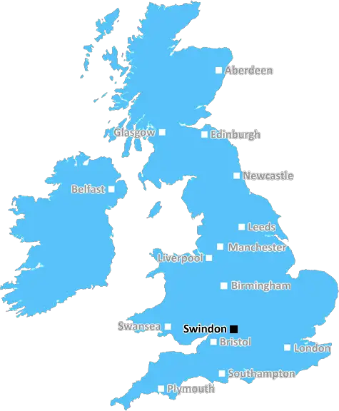
Swindon (SN14)
The SN14 postcode area is located in the Swindon postcode town region, within the county of Wiltshire, and contains a total of 1338 individual postcodes.
There are 97 electoral wards in the SN14 postcode area, including Calne, Chippenham, Corsham, Devizes, Faringdon, Malmesbury, Marlborough, Melksham, Pewsey, Swindon which come under the local authority of the Wiltshire Council.
Combining the whole postcode region, 33% of people in SN14 are classed as having an AB social grade, (i.e. 'white-collar' middle-upper class), compared to 27% across the UK.
This does not mean that the people of SN14 are wealthier - or higher class - than average, but it can be an indication that the area may be prospering and desirable to live in.
The SN14 postcode covers the north-west area of Swindon in the South West of England. It borders the Wiltshire counties of Gloucestershire, Wiltshire, Berkshire and Oxfordshire. The district is served by two railway stations - Swindon (SN14) and Chippenham (CHI).
The postcode area is mainly residential in nature, with a variety of styles of property available from row cottages to modern family homes. The area is popular with commuters due to its good transport links and proximity to the M4 motorway. There are also good local amenities in the area, including pubs, restaurants, supermarkets, banks, a post office, a library and leisure facilities such as the Link Centre, which has a pool and fitness suite.
The postcode area is served by several primary and secondary schools, including St Joseph's Catholic Primary School, Stratton Primary School and Grange Academy. Some of the larger secondary schools include the Swindon Academy, Commonweal School and Redland Green School.
The area is home to a number of green spaces, most notably Lydiard Park, which is a country estate located in the area. The park boasts over 300 acres of parkland, lakes, woodlands and gardens as well as several historic buildings. The park also hosts a wide range of events throughout the year. Additionally, there are a number of other public parks in the postcode area, including Coate Water Country Park and Old Town Gardens.
The area is a great location for commuters, with Swindon railway station providing easy access to London Paddington and on to other cities via the Great Western Railway. Further, Swindon Bus Station offers services to a number of destinations across the county, and there is easy access to the M4 motorway via junction 15.
For those looking for a spot of retail therapy, the area is home to The Designer Outlet Centre, which is located near the Clockwork junction off the M4. The centre offers a range of designer brands at discounted prices, along with various restaurants and cafes.
The SN14 postcode area is a desirable location to live in for those wanting to stay close to Swindon's amenities. With links to other major cities, great transport links, a plethora of parks and open spaces and some excellent educational facilities, residents of the SN14 postcode area have much to be proud of.

Demographics

Wiltshire

SN14 is located in the county of Wiltshire, in England.
Wiltshire has a total population of 706,300, making it the 34th largest county in the UK.
Wiltshire has a total area of 1346 square miles, and a population density of 202 people per square kilometre. For comparison, Greater London has a density of 5,618 people/km2.
| Outward Code | SN14 |
| Postal Town | Swindon |
| MSOA Name | Wiltshire 009 |
| LSOA Name | Wiltshire 009B |
| County | Wiltshire |
| Region | Wiltshire |
| Country | England |
| Local Authority | Wiltshire |
| Area Classification | Largely Rural (rural including hub towns 50-79%) |
SN14 Electoral Wards
The postal region of SN14, includes the local towns, villages, electoral wards and stations of:
Dig even deeper into the SN14 postcode by clicking on a postcode below:
Click on an outward postal code below for more information about the area. Each 'outward' postcode give you a comprehensive list of all postcodes within the outward code area (SN) and estimated address.
Click on an 'outward' code for more information. For example, the outward postcode page 'EC2M' will give you an alphabetical list covering all postcodes located in the region, from 'EC2M 1BB' through to 'EC2M 7YA'.
Chris H
Sunday, April 7, 2024
We don't have any views of SN14 right now. If you live in SN14 or have visited it, please help us to help others by telling others what you think of this neighbourhood.
Add your view of SN14
People need your local expertise. If you live in SN14 or have first-hand knowledge of the neighbourhood, please consider sharing your views. It's completely anonymous - all we ask is for your initials.
Please tell us what you like about the SN14 postcode area, what you don't like, and what it's like to live or work here.
| LOCAL AMENITIES | |
| FAMILY FRIENDLY | |
| PARKING | |
| GREEN SPACES |
Local News Wiltshire
Therapy and healing centre proposed at estate
New owners of Bowden Park Estate have proposed refurbishing a barn range within the estate.
BBC NewsEmpty town centre bar to be redeveloped
Planners give permission for the former nightspot to become shops and flats.
BBC NewsSwindon Town 2-1 Notts County
Swindon break a four-match winless streak as they beat Notts County thanks to two pieces of comedic defending.
BBC NewsBarrow 0-2 Swindon Town
Paul Glatzel continues his fine recent goalscoring form as Swindon stun League Two promotion-chasers Barrow with a 2-0 victory.
BBC NewsDriver disqualified after erratic motorway driving
Ion Tintiuc was arrested by police at his home in Swindon after being reported by a member of the public for "swerving all over the road".
BBC NewsSwindon Town 2-1 Notts County
Swindon break a four-match winless streak as they beat Notts County thanks to two pieces of comedic defending.
BBC NewsCounty awarded 375k for walking and cycling schemes
The local authority say the plans will help to improve air quality and decarbonisation in the county.
BBC NewsWarning ahead of fresh round of train strikes
Passengers told to plan ahead as rail and underground services to be hit by weekend walkouts.
BBC NewsFrom the Postcode Area blog

Deciphering Crime Rates - a Deep Dive Into UK Postcode Analysis
Ever wondered about the crime rate in your UK postcode? You're not alone. We've dug deep into the data, uncovering trends and patterns that'll make your head spin.

Death of the High Street?
The BBC reports that despite councils' attempts to kurb them, the UK's high streets have seen a huge growth in fast food outlets. Could this mark the death knell for the Great British high street, and what can we do about it to halt its decline?

Discrimination by Postcode
You really couldn't make it up, could you? Some of the country's most vulnerable people are missing out on their weekly £25 Cold Weather Payment, just because the system that's in operation is discriminating against them because payments are based on postcode, rather than geographic location.

The Redesign is Underway
Well, the current website was absolutely in dire need of a good redesign - from the ground up. So I set out to pull it all apart and get it up and running again to become the most comprehensive guide to every postcode in the UK. And it's been a long, tough job from start to finish - and quite possibly the biggest project I've ever undertaken.
SOCIAL GRADES
According to census records, 33% of people here have a social grade of AB (highest), compared to the national average of 27%.