swansea SA4 Postcodes
Spending a fortune on conveyancing?

Compare instant, low-cost online quotes from trusted conveyancing solicitors.
Backed by experts, our no-obligation service searches through the best conveyancing quotes on the market to save you time and money.
Swansea (SA4)
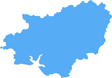
The SA4 postcode area is located in the Swansea postcode town region, within the county of Carmarthenshire, and contains a total of 2048 individual postcodes.
There are 77 electoral wards in the SA4 postcode area, including Aberaeron, Ammanford, Boncath, Burry Port, Cardigan, Carmarthen, Clarbeston Road, Clynderwen, Crymych, Ferryside, Fishguard, Glogue, Goodwick, Haverfordwest, Kidwelly, Kilgetty, Lampeter, Llanarth, Llandeilo, Llandovery, Llandysul, Llanelli, Llanfyrnach, Llangadog, Llanwrda, Llanybydder, Milford Haven, Narberth, Neath, New Quay, Newcastle Emlyn, Newport, Pembroke, Pembroke Dock, Pencader, Port Talbot, Saundersfoot, Swansea, Tenby, Whitland which come under the local authority of the Carmarthenshire Council.
Combining the whole postcode region, 22% of people in SA4 are classed as having an AB social grade, (i.e. 'white-collar' middle-upper class), compared to 27% across the UK.
This does not mean that the people of SA4 are poorer than other areas, but it may give an indication that there are areas of deprivation.
The SA4 postcode is an area in the UK that covers the town of Llanelli, Carmarthenshire. It has a population of 26,933 people, according to the latest figures.
Llanelli is a market town and former industrial centre located on the south coast of Carmarthen Bay. It was the birthplace of the famous 19th-century poet and artist Dylan Thomas, and is known for its rugby club, the Scarlets.
The area itself has a diverse range of neighbourhoods. Residents living in the more rural communities to the north of Llanelli benefit from some stunning views of the surrounding countryside, whereas those in the more urbanised parts of the town such as Penyfan and Trapp have good access to the nearby sand dunes as well as the towns of Morriston and Llangennech.
The SA4 area has several local services and amenities. The town centre of Llanelli is a bustling traditional shopping area where visitors can find all their essential shops, banks, and restaurants. There is also a leisure centre offering swimming, squash, and gym facilities, and a range of other cultural attractions like the National Wetland Centre Wales and the Glynn Vivian Art Gallery.
Schools in the area are generously provided for, with primary schools for all ages and a good selection of secondary education options, including Llanelli Church in Wales school and Ysgol y Strade.
For those looking to get out and about, the coastline provides an array of activities like sand yachting, windsurfing, and coastal walks. Areas such as Pembrey country park are also nearby, with plenty in the way of outdoor pursuits such as mountain biking and horse riding.
The SA4 postcode of Llanelli, Carmarthenshire, is a well-connected destination with a unique mix of rural and urban life, culture, and leisure activities for everyone to enjoy � making it an ideal area to live, work or visit.

Demographics

Carmarthenshire
SA4 is located in the county of Carmarthenshire, in Wales.
Carmarthenshire has a total population of 185,600, making it the 4th largest county in the UK.
Carmarthenshire has a total area of 925 square miles, and a population density of 78 people per square kilometre. For comparison, Greater London has a density of 5,618 people/km2.

| Outward Code | SA4 |
| Postal Town | Swansea |
| MSOA Name | Carmarthenshire 017 |
| LSOA Name | Carmarthenshire 017A |
| County | Carmarthenshire |
| Region | Carmarthenshire |
| Country | Wales |
| Local Authority | Carmarthenshire |
| Area Classification | Unclassified |
SA4 Electoral Wards
The postal region of SA4, includes the local towns, villages, electoral wards and stations of:
Dig even deeper into the SA4 postcode by clicking on a postcode below:
Click on an outward postal code below for more information about the area. Each 'outward' postcode give you a comprehensive list of all postcodes within the outward code area (SA) and estimated address.
Click on an 'outward' code for more information. For example, the outward postcode page 'EC2M' will give you an alphabetical list covering all postcodes located in the region, from 'EC2M 1BB' through to 'EC2M 7YA'.
Chris H
Monday, April 8, 2024
We don't have any views of SA4 right now. If you live in SA4 or have visited it, please help us to help others by telling others what you think of this neighbourhood.
Add your view of SA4
People need your local expertise. If you live in SA4 or have first-hand knowledge of the neighbourhood, please consider sharing your views. It's completely anonymous - all we ask is for your initials.
Please tell us what you like about the SA4 postcode area, what you don't like, and what it's like to live or work here.
| LOCAL AMENITIES | |
| FAMILY FRIENDLY | |
| PARKING | |
| GREEN SPACES |
From the Postcode Area blog

Deciphering Crime Rates - a Deep Dive Into UK Postcode Analysis
Ever wondered about the crime rate in your UK postcode? You're not alone. We've dug deep into the data, uncovering trends and patterns that'll make your head spin.

Death of the High Street?
The BBC reports that despite councils' attempts to kurb them, the UK's high streets have seen a huge growth in fast food outlets. Could this mark the death knell for the Great British high street, and what can we do about it to halt its decline?

Discrimination by Postcode
You really couldn't make it up, could you? Some of the country's most vulnerable people are missing out on their weekly £25 Cold Weather Payment, just because the system that's in operation is discriminating against them because payments are based on postcode, rather than geographic location.

The Redesign is Underway
Well, the current website was absolutely in dire need of a good redesign - from the ground up. So I set out to pull it all apart and get it up and running again to become the most comprehensive guide to every postcode in the UK. And it's been a long, tough job from start to finish - and quite possibly the biggest project I've ever undertaken.
SOCIAL GRADES
According to census records, 22% of people here have a social grade of AB (highest), compared to the national average of 27%.