sunderland SR5 Postcodes
Spending a fortune on conveyancing?

Compare instant, low-cost online quotes from trusted conveyancing solicitors.
Backed by experts, our no-obligation service searches through the best conveyancing quotes on the market to save you time and money.
Sunderland (SR5)
The SR5 postcode area is located in the Sunderland postcode town region, within the county of Tyne and Wear, and contains a total of 1378 individual postcodes.
There are 20 electoral wards in the SR5 postcode area, including Peterlee, Seaham, Sunderland which come under the local authority of the Sunderland Council.
Combining the whole postcode region, 10% of people in SR5 are classed as having an AB social grade, (i.e. 'white-collar' middle-upper class), compared to 27% across the UK.
This does not mean that the people of SR5 are poorer than other areas, but it may give an indication that there are areas of deprivation.
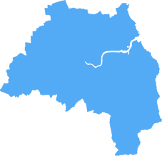
SR5 is a postcode located in Sunderland, England. It covers the western and northern parts of Sunderland including the areas of Millfield, Hendon, New Silksworth, Barnes, Ryhope and Grangetown. Areas of Seaburn, Roker, Fulwell, and Monkwearmouth are not included. This postcode district is within the Tyne and Wear area and comprises 15 postcode sectors.
The SR5 postcode is a largely residential area, with the main commercial centres located in nearby Monkwearmouth and the neighbouring postcode district, SR6. There are several primary and secondary schools located in the area, such as Millfield Primary School, Hendon Primary School, New Silksworth Primary School, Grangetown Primary School, and Ryhope Junior School. The area also has many local shops and amenities, such as convenience stores, takeaways, pubs, cafes, and leisure centres.
Public transport in the area is provided by Nexus, the regional transport operator. The SR5 postcode is served by a range of bus routes connecting it to Sunderland City Centre, as well as other nearby towns and cities. Train services are also available via Sunderland train station, with direct services to Newcastle and Hartlepool.
The SR5 postcode is also home to a number of sports clubs and activities, from tennis and running clubs to rugby and football teams. Parks and outdoor leisure activities are also available in the area, with leisure centres in Hendon, Monkwearmouth, Seaburn and New Silksworth all offering a range of activities.
House prices in the SR5 postcode vary depending on the area, though on average they are lower than nearby postcodes. The area tends to appeal to many first-time buyers due to its affordable property prices. However, house prices are increasing due to increased demand in the area, with rents also increasing in recent years.
The area is served by three local councillors who represent different wards: Hendon, Millfield, and Ryhope. The councillors serve as a link between residents and the council and work to address residents' concerns about local issues and developments.

Demographics

Tyne and Wear
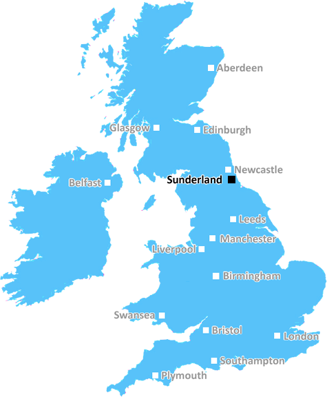
SR5 is located in the county of Tyne and Wear, in England.
Tyne and Wear has a total population of 1,128,800, making it the 16th largest county in the UK.
Tyne and Wear has a total area of 210 square miles, and a population density of 2090 people per square kilometre. For comparison, Greater London has a density of 5,618 people/km2.
| Outward Code | SR5 |
| Postal Town | Sunderland |
| MSOA Name | Sunderland 006 |
| LSOA Name | Sunderland 006F |
| County | Tyne and Wear |
| Region | Tyne and Wear |
| Country | England |
| Local Authority | Sunderland |
| Area Classification | Urban with Major Conurbation |
SR5 Electoral Wards
The postal region of SR5, includes the local towns, villages, electoral wards and stations of:
Dig even deeper into the SR5 postcode by clicking on a postcode below:
Click on an outward postal code below for more information about the area. Each 'outward' postcode give you a comprehensive list of all postcodes within the outward code area (SR) and estimated address.
Click on an 'outward' code for more information. For example, the outward postcode page 'EC2M' will give you an alphabetical list covering all postcodes located in the region, from 'EC2M 1BB' through to 'EC2M 7YA'.
Chris H
Sunday, April 7, 2024
We don't have any views of SR5 right now. If you live in SR5 or have visited it, please help us to help others by telling others what you think of this neighbourhood.
Add your view of SR5
People need your local expertise. If you live in SR5 or have first-hand knowledge of the neighbourhood, please consider sharing your views. It's completely anonymous - all we ask is for your initials.
Please tell us what you like about the SR5 postcode area, what you don't like, and what it's like to live or work here.
| LOCAL AMENITIES | |
| FAMILY FRIENDLY | |
| PARKING | |
| GREEN SPACES |
Local News County Durham
Strength testing of Grade-II* listed Piercebridge Bridge
Listed building consent has been submitted to Darlington Borough Council for the carrying out of intrusive testing of Piercebridge Bridge, which dates from the early 17th Century
Northern EchoDarlington tip has been closed due to high winds today
Darlington tip has been closed due to the strong winds today
Northern EchoPolice investigate serious crash on A1(M) near Darlington
Police spent hours last night investigating a 'serious crash' on the A1(M) southbound near Darlington
Northern EchoSix Teesside and Tyne and Wear drivers fined 2000 in court
The following cases were heard at Cleveland Magistrates' Court:
Northern EchoWho can you vote for at the North East mayoral election?
The full candidate list for the first North East mayoral election has been confirmed
Northern Echo5 of the most amazing castles in the North East to visit
Some of the best castles to visit across County Durham and the North East, now open for the 2024 season, including Raby Castle and Auckland Castle.
Northern EchoNewton Aycliffe man to be sentenced for affray at home of father
A man who was facing trial accused of making knife threats and assaulting his father in his own home is now to be sentenced having admitted a new charge of affray arising from the incident.
Northern EchoDarlington business thriving after retweet by Theo Paphitis
Darlington based business Rainbow Dandelion Crochet gets a Twitter boost from Theo Paphitis.
Northern EchoFrom the Postcode Area blog

Deciphering Crime Rates - a Deep Dive Into UK Postcode Analysis
Ever wondered about the crime rate in your UK postcode? You're not alone. We've dug deep into the data, uncovering trends and patterns that'll make your head spin.

Death of the High Street?
The BBC reports that despite councils' attempts to kurb them, the UK's high streets have seen a huge growth in fast food outlets. Could this mark the death knell for the Great British high street, and what can we do about it to halt its decline?

Discrimination by Postcode
You really couldn't make it up, could you? Some of the country's most vulnerable people are missing out on their weekly £25 Cold Weather Payment, just because the system that's in operation is discriminating against them because payments are based on postcode, rather than geographic location.

The Redesign is Underway
Well, the current website was absolutely in dire need of a good redesign - from the ground up. So I set out to pull it all apart and get it up and running again to become the most comprehensive guide to every postcode in the UK. And it's been a long, tough job from start to finish - and quite possibly the biggest project I've ever undertaken.
SOCIAL GRADES
According to census records, 10% of people here have a social grade of AB (highest), compared to the national average of 27%.