stoke-on-trent ST6 Postcodes
Spending a fortune on conveyancing?

Compare instant, low-cost online quotes from trusted conveyancing solicitors.
Backed by experts, our no-obligation service searches through the best conveyancing quotes on the market to save you time and money.
Stoke On Trent (ST6)
The ST6 postcode area is located in the Stoke On Trent postcode town region, within the county of Staffordshire, and contains a total of 2075 individual postcodes.
There are 38 electoral wards in the ST6 postcode area, including Leek, Newcastle, Stafford, Stoke-On-Trent, Stone, Uttoxeter which come under the local authority of the Stoke-on-Trent Council.
Combining the whole postcode region, 10% of people in ST6 are classed as having an AB social grade, (i.e. 'white-collar' middle-upper class), compared to 27% across the UK.
This does not mean that the people of ST6 are poorer than other areas, but it may give an indication that there are areas of deprivation.
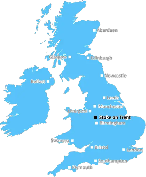
ST6 postcode in the Stoke on Trent district refers to an area located just nine miles (14 km) north of the city centre. It includes the townships of Norton-in-the-Moors, Burslem, Tunstall, Fenton, Smallthorne, Stockton Brook, Bucknall, Bradeley and Chell.
Norton-in-the-Moors is a small town in the former Potteries area known for its landmark St Lawrence's church, a Grade II listed building built in 1710 and featured in the BBC TV show Time Team. Burslem is known as the �Mother Town', being the oldest of the six towns that together make up the city of Stoke on Trent. It is home to the Gladstone Pottery Museum, the first museum dedicated to pottery, steelmaking and engineering. Tunstall is the second-largest of the Six Towns and is a popular shopping area. Fenton is home to the Potters' Brewery, the only commercial independent brewery in Stoke-on-Trent. Smallthorne is known for its urban park and Stockton Brook is renowned for its scenic views and countryside walks.
The postcode ST6 is served by the bus service operated by First Potteries, with its two main stations located in Tunstall and Burslem. The A53 (Chell Road) is a major transport route through the district and provides easy access to Stoke on Trent city centre. The area also has good cycling and walking routes connecting neighbouring locations such as Blythe Bridge and Clayton.
The district is served by a number of local schools, such as The Discovery Academy in Norton-in-the-Moors, St Peter's CE Primary School in Tunstall and St Francis Primary Academy in Burslem. The area also has three local NHS GP practices, Dorothy Clive Health Centre in Norton-in-the-Moors, St John's Medical Centre in Tunstall and Cowlishaw Practice in Fenton.
ST6 postcode district is a convenient location to live in due to its close proximity to the city centre, its transport links, its local schools and health services, as well as its variety of attractions such as the Gladstone Pottery Museum, St Lawrence's Church and many country walks.

Demographics

Staffordshire

ST6 is located in the county of Staffordshire, in England.
Staffordshire has a total population of 1,120,300, making it the 17th largest county in the UK.
Staffordshire has a total area of 1047 square miles, and a population density of 412 people per square kilometre. For comparison, Greater London has a density of 5,618 people/km2.
| Outward Code | ST6 |
| Postal Town | Stoke On Trent |
| MSOA Name | Stoke-on-Trent 009 |
| LSOA Name | Stoke-on-Trent 009A |
| County | Staffordshire |
| Region | Staffordshire |
| Country | England |
| Local Authority | Stoke-on-Trent |
| Area Classification | Urban with City and Town |
ST6 Electoral Wards
The postal region of ST6, includes the local towns, villages, electoral wards and stations of:
Dig even deeper into the ST6 postcode by clicking on a postcode below:
Click on an outward postal code below for more information about the area. Each 'outward' postcode give you a comprehensive list of all postcodes within the outward code area (ST) and estimated address.
Click on an 'outward' code for more information. For example, the outward postcode page 'EC2M' will give you an alphabetical list covering all postcodes located in the region, from 'EC2M 1BB' through to 'EC2M 7YA'.
Chris H
Sunday, April 7, 2024
We don't have any views of ST6 right now. If you live in ST6 or have visited it, please help us to help others by telling others what you think of this neighbourhood.
Add your view of ST6
People need your local expertise. If you live in ST6 or have first-hand knowledge of the neighbourhood, please consider sharing your views. It's completely anonymous - all we ask is for your initials.
Please tell us what you like about the ST6 postcode area, what you don't like, and what it's like to live or work here.
| LOCAL AMENITIES | |
| FAMILY FRIENDLY | |
| PARKING | |
| GREEN SPACES |
Local News Staffordshire
Staffordshire receives 286million transport funding boost over seven years
Staffordshire has secured a huge funding boost from central Government for local transport projects which will span a seven-year period.
Staffordshire County CouncilFree action-packed Easter fun lined up for children from low-income families
Thousands of children from low-income families will be able to enjoy free activities and nutritious meals this Easter as part of Staffordshire's Holiday Activity and Food (HAF) programme.
Staffordshire County CouncilCounty and city take steer on support for business and economic growth
Businesses across Staffordshire and Stoke-on-Trent will have a voice on a national level through a new joint committee set up by the county and city councils also ensuring they have expert support a&hellip
Staffordshire County CouncilEarly intervention scheme makes a difference
Staffordshire County Council is funding schools to step in at the first opportunity to help children with special educational needs progress at their local mainstream school - and the scheme is alread&hellip
Staffordshire County CouncilMother's plea after son killed by speeding driver
"There is no need for anyone else to know what this pain feels like," Jakki Hartland says.
BBC NewsA strategy to help unpaid carers of all ages across Staffordshire has been agreed by the county councils cabinet
The "Staffordshire's All Age Carers Strategy 2024 2029" has been produced by the county council and Integrated Care Board (ICB) alongside other partners.
Staffordshire County CouncilSaturday Night Takeaway back in Newcastle - with Olivia Attwood in Andrew's shed
Ant & Dec have surprised Andrew Archer on tonight's show
Stoke SentinelHighways improvements to start in Lichfield next week
A major highways improvements scheme in Lichfield will start on Monday 25 March.
Staffordshire County CouncilFrom the Postcode Area blog

Deciphering Crime Rates - a Deep Dive Into UK Postcode Analysis
Ever wondered about the crime rate in your UK postcode? You're not alone. We've dug deep into the data, uncovering trends and patterns that'll make your head spin.

Death of the High Street?
The BBC reports that despite councils' attempts to kurb them, the UK's high streets have seen a huge growth in fast food outlets. Could this mark the death knell for the Great British high street, and what can we do about it to halt its decline?

Discrimination by Postcode
You really couldn't make it up, could you? Some of the country's most vulnerable people are missing out on their weekly £25 Cold Weather Payment, just because the system that's in operation is discriminating against them because payments are based on postcode, rather than geographic location.

The Redesign is Underway
Well, the current website was absolutely in dire need of a good redesign - from the ground up. So I set out to pull it all apart and get it up and running again to become the most comprehensive guide to every postcode in the UK. And it's been a long, tough job from start to finish - and quite possibly the biggest project I've ever undertaken.
SOCIAL GRADES
According to census records, 10% of people here have a social grade of AB (highest), compared to the national average of 27%.