stoke-on-trent ST19 Postcodes
Spending a fortune on conveyancing?

Compare instant, low-cost online quotes from trusted conveyancing solicitors.
Backed by experts, our no-obligation service searches through the best conveyancing quotes on the market to save you time and money.
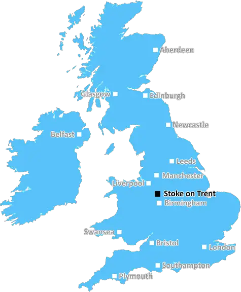
Stoke On Trent (ST19)
The ST19 postcode area is located in the Stoke On Trent postcode town region, within the county of Staffordshire, and contains a total of 502 individual postcodes.
There are 58 electoral wards in the ST19 postcode area, including Leek, Newcastle, Stafford, Stoke-On-Trent, Stone, Uttoxeter which come under the local authority of the South Staffordshire Council.
Combining the whole postcode region, 28% of people in ST19 are classed as having an AB social grade, (i.e. 'white-collar' middle-upper class), compared to 27% across the UK.
This does not mean that the people of ST19 are wealthier - or higher class - than average, but it can be an indication that the area may be prospering and desirable to live in.
The ST19 postcode is a postcode district in the Staffordshire post town that covers parts of the counties of Staffordshire, Shropshire, Herefordshire and Worcestershire in England. As of 2020, the postcode area contains both 2-digit postcode districts as well as the 3-digit postcode districts.
The ST19 postcode district consists of two sub-districts mainly covering the areas of Bagley, Brewood, Cannock Wood, Coven, Gnosall, Haughton, Huntington, Milford, Stretton and Woodseaves. The postcode stretches from the M6 near M6 Toll Interchange in the east to Haughton in the west, to Brewood in the south and to Brocton and Stretton in the north.
In terms of services in the local area, there is an abundance of shops, pubs, restaurants, takeaways, and other amenities. There are also two local primary schools located within the postcode district. Additionally, there is a library, some leisure centres, and two local churches in the area. Moreover, the postcode district has access to good public transport links with bus services serving most areas, two train stations, and three motorway junctions nearby.
The area is particularly well known for its stunning countryside scenery, housing a handful of National Trust properties and parks that offer visitors the chance to explore woodlands, fields and riverside trails. The canals of the region are also popular among those looking to get out into the natural environment and appreciate fresh air and views of the gentle countryside. Those visiting the area can also take a leisurely canal cruise along the network of waterways to experience a different way of travelling.
The historic market town of Cannock is also within the ST19 postcode district, offering an abundance of bustling high-street shopping outlets and the recently renovated Cannock Shopping Centre. The area also has its own railway station offering direct train services to destinations such as Birmingham, Stafford, Stoke-on-Trent and London.

Demographics

Staffordshire

ST19 is located in the county of Staffordshire, in England.
Staffordshire has a total population of 1,120,300, making it the 17th largest county in the UK.
Staffordshire has a total area of 1047 square miles, and a population density of 412 people per square kilometre. For comparison, Greater London has a density of 5,618 people/km2.
| Outward Code | ST19 |
| Postal Town | Stoke On Trent |
| MSOA Name | South Staffordshire 001 |
| LSOA Name | South Staffordshire 001A |
| County | Staffordshire |
| Region | Staffordshire |
| Country | England |
| Local Authority | South Staffordshire |
| Area Classification | Urban with Significant Rural (rural including hub towns 26-49%) |
ST19 Electoral Wards
The postal region of ST19, includes the local towns, villages, electoral wards and stations of:
Dig even deeper into the ST19 postcode by clicking on a postcode below:
Click on an outward postal code below for more information about the area. Each 'outward' postcode give you a comprehensive list of all postcodes within the outward code area (ST) and estimated address.
Click on an 'outward' code for more information. For example, the outward postcode page 'EC2M' will give you an alphabetical list covering all postcodes located in the region, from 'EC2M 1BB' through to 'EC2M 7YA'.
Chris H
Tuesday, April 9, 2024
We don't have any views of ST19 right now. If you live in ST19 or have visited it, please help us to help others by telling others what you think of this neighbourhood.
Add your view of ST19
People need your local expertise. If you live in ST19 or have first-hand knowledge of the neighbourhood, please consider sharing your views. It's completely anonymous - all we ask is for your initials.
Please tell us what you like about the ST19 postcode area, what you don't like, and what it's like to live or work here.
| LOCAL AMENITIES | |
| FAMILY FRIENDLY | |
| PARKING | |
| GREEN SPACES |
Local News Staffordshire
1,000 incentive to recruit childcare staff to be tested in Staffordshire
Staffordshire has been selected to join a national pilot to financially incentivise people to pursue a career in early years and childcare.
Staffordshire County CouncilMan cut wife's body into more than 200 pieces and kept her remains in kitchen
Nicholas Metson, 28, stabbed Holly Bramley, 26, at least four times before dismembering her and storing her body parts for a week
Stoke SentinelMother's plea after son killed by speeding driver
"There is no need for anyone else to know what this pain feels like," Jakki Hartland says.
BBC NewsResurfacing and bridge works begin on motorway
Essential maintenance works will be carried out between Junctions 8 and 10 from Monday.
BBC NewsFormer Dignity Champion urges others to nominate
A former Staffordshire Dignity in Care award winner is now urging others to nominate for this year's awards.
Staffordshire County CouncilMajor highways improvement scheme to start in Newcastle
A major highways improvements scheme on the A34 Talke Road in Newcastle is due to start on Monday 11 March.
Staffordshire County CouncilStaffordshire and Stoke On Trent to celebrate English Tourism Week
People are being reminded about the many great attractions and locations just waiting to be explored in Staffordshire and Stoke-on-Trent as part of the county's celebrations for English Tourism Week.
Staffordshire County CouncilMan jailed after locking woman in home for a week
Nigel Holdway, 49, is jailed after attacking the woman and locking her in his home for seven days.
BBC NewsFrom the Postcode Area blog

Deciphering Crime Rates - a Deep Dive Into UK Postcode Analysis
Ever wondered about the crime rate in your UK postcode? You're not alone. We've dug deep into the data, uncovering trends and patterns that'll make your head spin.

Death of the High Street?
The BBC reports that despite councils' attempts to kurb them, the UK's high streets have seen a huge growth in fast food outlets. Could this mark the death knell for the Great British high street, and what can we do about it to halt its decline?

Discrimination by Postcode
You really couldn't make it up, could you? Some of the country's most vulnerable people are missing out on their weekly £25 Cold Weather Payment, just because the system that's in operation is discriminating against them because payments are based on postcode, rather than geographic location.

The Redesign is Underway
Well, the current website was absolutely in dire need of a good redesign - from the ground up. So I set out to pull it all apart and get it up and running again to become the most comprehensive guide to every postcode in the UK. And it's been a long, tough job from start to finish - and quite possibly the biggest project I've ever undertaken.
SOCIAL GRADES
According to census records, 28% of people here have a social grade of AB (highest), compared to the national average of 27%.