stevenage SG12 Postcodes
Spending a fortune on conveyancing?

Compare instant, low-cost online quotes from trusted conveyancing solicitors.
Backed by experts, our no-obligation service searches through the best conveyancing quotes on the market to save you time and money.
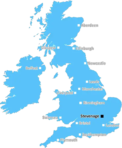
Stevenage (SG12)
The SG12 postcode area is located in the Stevenage postcode town region, within the county of Hertfordshire, and contains a total of 1350 individual postcodes.
There are 73 electoral wards in the SG12 postcode area, including Arlesey, Baldock, Biggleswade, Buntingford, Henlow, Hertford, Hitchin, Knebworth, Letchworth Garden City, Much Hadham, Royston, Sandy, Shefford, Stevenage, Ware which come under the local authority of the East Hertfordshire Council.
Combining the whole postcode region, 30% of people in SG12 are classed as having an AB social grade, (i.e. 'white-collar' middle-upper class), compared to 27% across the UK.
This does not mean that the people of SG12 are wealthier - or higher class - than average, but it can be an indication that the area may be prospering and desirable to live in.
SG12 is a postcode district located in the county of Hertfordshire, England. It is part of the Ware major urban area and is said to be within the area governed by East Hertfordshire District Council.
The SG12 postcode district covers the towns and villages of Aston, Bengeo, Hertford, Molehill Green, Nettleden, Stapleford, Stanstead Abbots, Thundridge, Wareside and Watton-at-Stone. The area is located east of London with close proximity to major towns and cities such as St Albans, Watford and Stevenage.
The SG12 area is well known for being close to the metropolitan area of London, while still being in the suburban village atmosphere. The village of Bengeo and the nearby area of Molehill Green are popular for their local pubs and restaurant, as well as the tranquil country lanes and beautiful countryside views.
Residents of the SG12 postcode district are served by several transport links, including the A10, connecting London to the east coast, the M25 and M1 motorways, and a direct rail line from Hertford North providing easy access to central London.
The SG12 postcode district is within easy reach of several attractions such as Knebworth House, Hatfield House and the River Lea. In the area, there is a multitude of leisure activities such as walking trails, horse riding and fishing, as well as the convenient location of Stanstead Airport making it a great spot to explore and travel to different places.
The area is also home to several good schools, including Hertford and Bengeo Primary Schools, Richard Hale Secondary School and Stanstead Abbots Primary. SG12 is a wonderful area with plenty of local amenities, shops, leisure activities and attractions, making it a great place to live and work.

Demographics

Hertfordshire

SG12 is located in the county of Hertfordshire, in England.
Hertfordshire has a total population of 1,176,700, making it the 12th largest county in the UK.
Hertfordshire has a total area of 634 square miles, and a population density of 716 people per square kilometre. For comparison, Greater London has a density of 5,618 people/km2.
| Outward Code | SG12 |
| Postal Town | Stevenage |
| MSOA Name | East Hertfordshire 013 |
| LSOA Name | East Hertfordshire 013E |
| County | Hertfordshire |
| Region | Hertfordshire |
| Country | England |
| Local Authority | East Hertfordshire |
| Area Classification | Unclassified |
SG12 Electoral Wards
The postal region of SG12, includes the local towns, villages, electoral wards and stations of:
Dig even deeper into the SG12 postcode by clicking on a postcode below:
Click on an outward postal code below for more information about the area. Each 'outward' postcode give you a comprehensive list of all postcodes within the outward code area (SG) and estimated address.
Click on an 'outward' code for more information. For example, the outward postcode page 'EC2M' will give you an alphabetical list covering all postcodes located in the region, from 'EC2M 1BB' through to 'EC2M 7YA'.
Chris H
Thursday, April 11, 2024
We don't have any views of SG12 right now. If you live in SG12 or have visited it, please help us to help others by telling others what you think of this neighbourhood.
Add your view of SG12
People need your local expertise. If you live in SG12 or have first-hand knowledge of the neighbourhood, please consider sharing your views. It's completely anonymous - all we ask is for your initials.
Please tell us what you like about the SG12 postcode area, what you don't like, and what it's like to live or work here.
| LOCAL AMENITIES | |
| FAMILY FRIENDLY | |
| PARKING | |
| GREEN SPACES |
Local News Hertfordshire
Police arrest man over alleged sex assault on runner
Police arrest a 20-year-old man after a report the woman was targeted while in a field.
BBC NewsLocal elections 2024: Is there an election in my area?
Use our lookup to see if there is an election in your area and who you can vote for on 2 May
BBC NewsWhitlock to retire after Paris Olympics
Britain's most successful gymnast Max Whitlock says it "feels right" to announce that he will retire after the Olympics this summer.
BBC NewsRAF officer to run marathon for mental health cause
Sqn Ldr Tamsin Wakeham has experienced suicidal thoughts but says "life is worth living".
BBC NewsDuo remain best friends after Race Across The World
The St Albans school friends say it was a challenge not having access to a phone.
BBC NewsKidnappers threatened to kill golfer, jury hears
A jury hears how a wealthy businessman was snatched from the golf course and then held to ransom for $15m.
BBC NewsHertfordshire's police commissioner candidates
The county is guaranteed a new commissioner as incumbent David Lloyd is standing down.
BBC NewsThames Valley's police commissioner candidates
Meet the candidates preparing for the election in May.
BBC NewsFrom the Postcode Area blog

Deciphering Crime Rates - a Deep Dive Into UK Postcode Analysis
Ever wondered about the crime rate in your UK postcode? You're not alone. We've dug deep into the data, uncovering trends and patterns that'll make your head spin.

Death of the High Street?
The BBC reports that despite councils' attempts to kurb them, the UK's high streets have seen a huge growth in fast food outlets. Could this mark the death knell for the Great British high street, and what can we do about it to halt its decline?

Discrimination by Postcode
You really couldn't make it up, could you? Some of the country's most vulnerable people are missing out on their weekly £25 Cold Weather Payment, just because the system that's in operation is discriminating against them because payments are based on postcode, rather than geographic location.

The Redesign is Underway
Well, the current website was absolutely in dire need of a good redesign - from the ground up. So I set out to pull it all apart and get it up and running again to become the most comprehensive guide to every postcode in the UK. And it's been a long, tough job from start to finish - and quite possibly the biggest project I've ever undertaken.
SOCIAL GRADES
According to census records, 30% of people here have a social grade of AB (highest), compared to the national average of 27%.