shrewsbury SY8 Postcodes
Spending a fortune on conveyancing?

Compare instant, low-cost online quotes from trusted conveyancing solicitors.
Backed by experts, our no-obligation service searches through the best conveyancing quotes on the market to save you time and money.
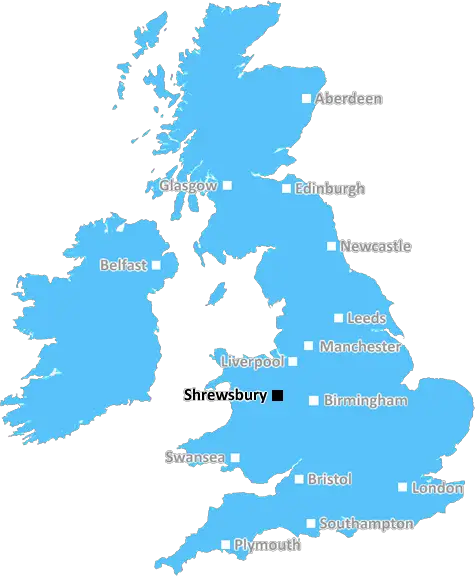
Shrewsbury (SY8)
The SY8 postcode area is located in the Shrewsbury postcode town region, within the county of Shropshire, and contains a total of 981 individual postcodes.
There are 149 electoral wards in the SY8 postcode area, including Aberystwyth, Bishops Castle, Borth, Bow Street, Bucknell, Caersws, Church Stretton, Craven Arms, Ellesmere, Llanbrynmair, Llandinam, Llanfechain, Llanfyllin, Llanidloes, Llanon, Llanrhystud, Llansantffraid, Llanymynech, Ludlow, Lydbury North, Machynlleth, Malpas, Meifod, Montgomery, Newtown, Oswestry, Shrewsbury, Talybont, Tregaron, Welshpool, Whitchurch, Ystrad Meurig which come under the local authority of the Shropshire Council.
Combining the whole postcode region, 22% of people in SY8 are classed as having an AB social grade, (i.e. 'white-collar' middle-upper class), compared to 27% across the UK.
This does not mean that the people of SY8 are poorer than other areas, but it may give an indication that there are areas of deprivation.
The SY8 postcode covers the area of Shrewsbury in England. Located in the beautiful county of Shropshire, the area is rich in history, culture and natural beauty. The SY8 postcode is a small but vibrant area, boasting an endless array of things to do and see.
Shrewsbury itself is a bustling market town with a host of independent shops, cafes, pubs and restaurants. The River Severn winds through the town centre; beneath the cobbled streets and past Shrewsbury Castle, one of the few medieval strongholds in the country. Buildings such as St. Nicholas' Church, The Welsh Bridge and other landmarks bear its centuries-long heritage.
Nearby is Attingham Park, a stunning 18th-century landscape that's the perfect place to explore the countryside and enjoy views over the River Severn. The surrounding Shropshire Hills AONB and Long Mynd offer stunning views of the Shropshire countryside and are popular for walkers, cyclists, horse riders and visitors. Residents and visitors to this area are also lucky to have access to some of the most prestigious golf courses in the country.
Within SY8 postcode there are some excellent educational establishments. Shrewsbury School is an independent school with a heritage stretching back more than 500 years. It is one of the leading schools in the country and is renowned for its academic excellence. Shrewsbury Sixth Form College and Shrewsbury College of Arts & Technology also serve the area.
Shrewsbury is connected to the rest of the country by the West Midlands mainline railway; alongside local buse services and the Shropshire star bus network. There is also an airfield located in the SY8 postcode, Shrewsbury Airfield, used by private aircrafts and as a test centre for military and civil aviation.
The SY8 postcode is a vibrant and beautiful area, full of historical significance, cultural attractions and recreational activities. Serving as the heart of Shropshire and giving its residents access to a high standard of education, transport and leisure activities, it's no wonder this postcode is so sought after.

Demographics
Shropshire

SY8 is located in the county of Shropshire, in England.
Shropshire has a total population of 486,300, making it the 42nd largest county in the UK.
Shropshire has a total area of 1346 square miles, and a population density of 139 people per square kilometre. For comparison, Greater London has a density of 5,618 people/km2.
| Outward Code | SY8 |
| Postal Town | Shrewsbury |
| MSOA Name | Shropshire 038 |
| LSOA Name | Shropshire 038H |
| County | Shropshire |
| Region | Shropshire |
| Country | England |
| Local Authority | Shropshire |
| Area Classification | Largely Rural (rural including hub towns 50-79%) |
SY8 Electoral Wards
The postal region of SY8, includes the local towns, villages, electoral wards and stations of:
Dig even deeper into the SY8 postcode by clicking on a postcode below:
Click on an outward postal code below for more information about the area. Each 'outward' postcode give you a comprehensive list of all postcodes within the outward code area (SY) and estimated address.
Click on an 'outward' code for more information. For example, the outward postcode page 'EC2M' will give you an alphabetical list covering all postcodes located in the region, from 'EC2M 1BB' through to 'EC2M 7YA'.
Chris H
Tuesday, April 9, 2024
We don't have any views of SY8 right now. If you live in SY8 or have visited it, please help us to help others by telling others what you think of this neighbourhood.
Add your view of SY8
People need your local expertise. If you live in SY8 or have first-hand knowledge of the neighbourhood, please consider sharing your views. It's completely anonymous - all we ask is for your initials.
Please tell us what you like about the SY8 postcode area, what you don't like, and what it's like to live or work here.
| LOCAL AMENITIES | |
| FAMILY FRIENDLY | |
| PARKING | |
| GREEN SPACES |
Local News Shropshire
Sticky situation for Shropshire Mud Run
Organiser Simon MacDonald explains why they need a new venue.
BBC NewsFish artwork marks King Charles III's Coronation
Planning permission is granted for the artwork which pays homage to Newport's fishing heritage.
BBC NewsViews sought on garden waste charge and recycling
Shropshire Council wants to know whether residents will pay 52 per year for garden waste collection.
BBC NewsHow people power won the day in NHS fight
Town's hospital beds reopen after protests turned to co-operation between campaigners and the NHS.
BBC NewsGet to know the West Midlands Podcast Club
Meet Rachael Botfield, from Bromsgrove, who shares top tips for getting started.
BBC NewsShrewsbury Town 1-1 Oxford United
Shrewsbury Town earn a draw with League One play-off hopefuls Oxford thanks to Jack Price's stunning late strike.
BBC News'My killer stepdad was silent but deadly risk to mum'
Georgia Gabriel-Hooper likens the control her shooter stepfather exerted to carbon monoxide poisoning.
BBC NewsCould there be a gold rush in Much Wenlock?
A large gold nugget was found by a metal detectorist in Shropshire.
BBC NewsFrom the Postcode Area blog

Deciphering Crime Rates - a Deep Dive Into UK Postcode Analysis
Ever wondered about the crime rate in your UK postcode? You're not alone. We've dug deep into the data, uncovering trends and patterns that'll make your head spin.

Death of the High Street?
The BBC reports that despite councils' attempts to kurb them, the UK's high streets have seen a huge growth in fast food outlets. Could this mark the death knell for the Great British high street, and what can we do about it to halt its decline?

Discrimination by Postcode
You really couldn't make it up, could you? Some of the country's most vulnerable people are missing out on their weekly £25 Cold Weather Payment, just because the system that's in operation is discriminating against them because payments are based on postcode, rather than geographic location.

The Redesign is Underway
Well, the current website was absolutely in dire need of a good redesign - from the ground up. So I set out to pull it all apart and get it up and running again to become the most comprehensive guide to every postcode in the UK. And it's been a long, tough job from start to finish - and quite possibly the biggest project I've ever undertaken.
SOCIAL GRADES
According to census records, 22% of people here have a social grade of AB (highest), compared to the national average of 27%.