shrewsbury SY2 Postcodes
Spending a fortune on conveyancing?

Compare instant, low-cost online quotes from trusted conveyancing solicitors.
Backed by experts, our no-obligation service searches through the best conveyancing quotes on the market to save you time and money.
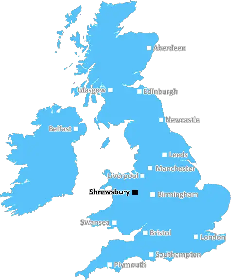
Shrewsbury (SY2)
The SY2 postcode area is located in the Shrewsbury postcode town region, within the county of Shropshire, and contains a total of 606 individual postcodes.
There are 12 electoral wards in the SY2 postcode area, including Aberystwyth, Bishops Castle, Borth, Bow Street, Bucknell, Caersws, Church Stretton, Craven Arms, Ellesmere, Llanbrynmair, Llandinam, Llanfechain, Llanfyllin, Llanidloes, Llanon, Llanrhystud, Llansantffraid, Llanymynech, Ludlow, Lydbury North, Machynlleth, Malpas, Meifod, Montgomery, Newtown, Oswestry, Shrewsbury, Talybont, Tregaron, Welshpool, Whitchurch, Ystrad Meurig which come under the local authority of the Shropshire Council.
Combining the whole postcode region, 23% of people in SY2 are classed as having an AB social grade, (i.e. 'white-collar' middle-upper class), compared to 27% across the UK.
This does not mean that the people of SY2 are poorer than other areas, but it may give an indication that there are areas of deprivation.
The SY2 postcode is a postcode district located in the Shrewsbury district in Shropshire, England. It covers the neighbourhoods of Belvidere, Blurton, Bayston Hill, Coton Hill, Cross Hill, Ditherington, Bank Farm, Harlescott, Meole Brace, Monkmoor, Northwest, Oxon, Priorslee, Radbrook, Sutton, Westhaven, Ternhill, and other surrounding areas.
The SY2 postcode district is located in the central part of the Shrewsbury district and is near the M54 motorway and is in close proximity to the Shrewsbury town center. This postcode is well-served by a variety of transportation options, including bus and rail links to the surrounding towns and cities, along with a number of taxi and limousine services for those wishing to travel further afield.
The SY2 postcode provides easy access to a number of amenities and attractions in the area, including the popular Quarry Park, with its abundance of walking and cycling trails, and the historic Shrewsbury Castle. Shrewsbury town center also provides a wealth of shops, cafes, pubs, restaurants, and other places of interest to explore.
Residents in this postcode district also benefit from a number of leisure facilities, such as the Ellesmere Swimming and Fitness Centre, as well as a range of parks, playing fields, and playgrounds. Education is also well catered for, with many primary and secondary schools located within the postcode district boundaries or a short distance away.
The economy in this area is mainly centred around the retail and hospitality sectors, although there are a handful of manufacturing and engineering businesses operating within the SY2 postcode district. The nearby Meole Brace Retail Park also provides a variety of shops and outlets.
TheSY2 postcode is a well-connected district situated in the heart of the Shrewsbury district, providing residents with excellent access to a range of amenities, attractions, leisure facilities, education, and employment opportunities.

Demographics
Shropshire

SY2 is located in the county of Shropshire, in England.
Shropshire has a total population of 486,300, making it the 42nd largest county in the UK.
Shropshire has a total area of 1346 square miles, and a population density of 139 people per square kilometre. For comparison, Greater London has a density of 5,618 people/km2.
| Outward Code | SY2 |
| Postal Town | Shrewsbury |
| MSOA Name | Shropshire 021 |
| LSOA Name | Shropshire 021C |
| County | Shropshire |
| Region | Shropshire |
| Country | England |
| Local Authority | Shropshire |
| Area Classification | Largely Rural (rural including hub towns 50-79%) |
SY2 Electoral Wards
The postal region of SY2, includes the local towns, villages, electoral wards and stations of:
Dig even deeper into the SY2 postcode by clicking on a postcode below:
Click on an outward postal code below for more information about the area. Each 'outward' postcode give you a comprehensive list of all postcodes within the outward code area (SY) and estimated address.
Click on an 'outward' code for more information. For example, the outward postcode page 'EC2M' will give you an alphabetical list covering all postcodes located in the region, from 'EC2M 1BB' through to 'EC2M 7YA'.
Chris H
Thursday, May 9, 2024
We don't have any views of SY2 right now. If you live in SY2 or have visited it, please help us to help others by telling others what you think of this neighbourhood.
Add your view of SY2
People need your local expertise. If you live in SY2 or have first-hand knowledge of the neighbourhood, please consider sharing your views. It's completely anonymous - all we ask is for your initials.
Please tell us what you like about the SY2 postcode area, what you don't like, and what it's like to live or work here.
| LOCAL AMENITIES | |
| FAMILY FRIENDLY | |
| PARKING | |
| GREEN SPACES |
Local News Shropshire
Shrewsbury's 1.34m piece of land
A piece of land that was wrongly sold in 2017 has been bought back by Shropshire Council.
BBC NewsThe Church Stretton man who's had a fight with Tom Hardy
Stuntman Justin Pearson has worked with a host of Hollywood A listers.
BBC NewsStrike disruption for Midlands rail passengers
Several operators are expected to be affected by strikes, including West Midlands Trains and CrossCountry.
BBC NewsAI cameras between Shrewsbury and Wellington
If you travel down the A5 you may well spot AI cameras scanning drivers.
BBC NewsWoman in critical condition after being hit by car
A man is arrested after a woman in her 40s suffers serious injuries in the collision.
BBC NewsWork needed before school out of special measures - Ofsted
Idsall School, in Shropshire, is still in special measures due to concerns about pupil behaviour.
BBC NewsMy mates have come with me from LA and are loving it!
Hollywood film producer Chris Ball flew from LA to watch Telford in the play off final.
BBC NewsShrewsbury Town 1-3 Leyton Orient
Leyton Orient cruise to a 3-1 victory at Shrewsbury to seal a top-half finish in their first season back in League One.
BBC NewsFrom the Postcode Area blog

Deciphering Crime Rates - a Deep Dive Into UK Postcode Analysis
Ever wondered about the crime rate in your UK postcode? You're not alone. We've dug deep into the data, uncovering trends and patterns that'll make your head spin.

Death of the High Street?
The BBC reports that despite councils' attempts to kurb them, the UK's high streets have seen a huge growth in fast food outlets. Could this mark the death knell for the Great British high street, and what can we do about it to halt its decline?

Discrimination by Postcode
You really couldn't make it up, could you? Some of the country's most vulnerable people are missing out on their weekly £25 Cold Weather Payment, just because the system that's in operation is discriminating against them because payments are based on postcode, rather than geographic location.

The Redesign is Underway
Well, the current website was absolutely in dire need of a good redesign - from the ground up. So I set out to pull it all apart and get it up and running again to become the most comprehensive guide to every postcode in the UK. And it's been a long, tough job from start to finish - and quite possibly the biggest project I've ever undertaken.
SOCIAL GRADES
According to census records, 23% of people here have a social grade of AB (highest), compared to the national average of 27%.