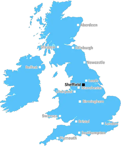
sheffield S8 Postcodes
Spending a fortune on conveyancing?

Compare instant, low-cost online quotes from trusted conveyancing solicitors.
Backed by experts, our no-obligation service searches through the best conveyancing quotes on the market to save you time and money.
Sheffield (S8)
The S8 postcode area is located in the Sheffield postcode town region, within the county of South Yorkshire, and contains a total of 1270 individual postcodes.
There are 25 electoral wards in the S8 postcode area, including Barnsley, Chesterfield, Dronfield, Hope Valley, Mexborough, Rotherham, Sheffield, Worksop which come under the local authority of the Sheffield Council.
Combining the whole postcode region, 26% of people in S8 are classed as having an AB social grade, (i.e. 'white-collar' middle-upper class), compared to 27% across the UK.
This does not mean that the people of S8 are poorer than other areas, but it may give an indication that there are areas of deprivation.
The S8 postcode of the Sheffield district is a largely residential area located to the southwest of the city centre.
The area referred to by the S8 postcode is considered to be relatively affluent, with a high proportion of owner-occupier households and property prices substantially higher than the city and national averages. This postcode area includes one of the most desirable residential districts in Sheffield - the Abbeydale Road area.
The S8 postcode is a popular location for retirees seeking to downsize, due to its largely residential nature and the availability of older properties that can be adapted for retirement living.
The area also includes the majority of the University of Sheffield accommodation, including the Endcliffe Village and Collegiate Crescent student complexes.
The postcode area has a diverse collection of shopping and leisure activities. Single-level shopping areas such as the Abbeydale Road Shopping Centre, Staunton Street Shopping Centre, and Ecclesfield Shopping Centre, as well as a higher concentration of multi-level shopping centres, such as Meadowhall, are all accessible within the S8 postcode area.
In terms of leisure activities, the S8 postcode area includes popular attractions such as the Millhouses Park, Norton Sports Club, and more recently constructed Millhouses Park Caf� & Mini Adventure Park. The area also boasts a range of restaurants, cafes, and pubs to suit almost everyone's taste.
Transport links in and around the S8 postcode area are excellent, with five train stations located within the postcode district, including Hunters Bar, Meadowhall, Darnall, Woodhouse, and Woodhouse Lane. Sheffield City Centre can be reached by bus, as can many of the other parts of the city. The Sheffield Supertram network also services the area with trams running at approximately 10-minute intervals.
TheS8 postcode of the Sheffield district is an affluent residential area with excellent transport links and a wide array of leisure activities and shopping opportunities. It is a popular destination for those looking to downsize in later life, as well those attending the University of Sheffield.

Demographics

South Yorkshire

S8 is located in the county of South Yorkshire, in England.
South Yorkshire has a total population of 1,385,000, making it the 10th largest county in the UK.
South Yorkshire has a total area of 599 square miles, and a population density of 892 people per square kilometre. For comparison, Greater London has a density of 5,618 people/km2.
| Outward Code | S8 |
| Postal Town | Sheffield |
| MSOA Name | Sheffield 042 |
| LSOA Name | Sheffield 042D |
| County | South Yorkshire |
| Region | South Yorkshire |
| Country | England |
| Local Authority | Sheffield |
| Area Classification | Urban with Minor Conurbation |
S8 Electoral Wards
The postal region of S8, includes the local towns, villages, electoral wards and stations of:
Dig even deeper into the S8 postcode by clicking on a postcode below:
Click on an outward postal code below for more information about the area. Each 'outward' postcode give you a comprehensive list of all postcodes within the outward code area (S) and estimated address.
Click on an 'outward' code for more information. For example, the outward postcode page 'EC2M' will give you an alphabetical list covering all postcodes located in the region, from 'EC2M 1BB' through to 'EC2M 7YA'.
Chris H
Sunday, April 7, 2024
We don't have any views of S8 right now. If you live in S8 or have visited it, please help us to help others by telling others what you think of this neighbourhood.
Add your view of S8
People need your local expertise. If you live in S8 or have first-hand knowledge of the neighbourhood, please consider sharing your views. It's completely anonymous - all we ask is for your initials.
Please tell us what you like about the S8 postcode area, what you don't like, and what it's like to live or work here.
| LOCAL AMENITIES | |
| FAMILY FRIENDLY | |
| PARKING | |
| GREEN SPACES |
From the Postcode Area blog

Deciphering Crime Rates - a Deep Dive Into UK Postcode Analysis
Ever wondered about the crime rate in your UK postcode? You're not alone. We've dug deep into the data, uncovering trends and patterns that'll make your head spin.

Death of the High Street?
The BBC reports that despite councils' attempts to kurb them, the UK's high streets have seen a huge growth in fast food outlets. Could this mark the death knell for the Great British high street, and what can we do about it to halt its decline?

Discrimination by Postcode
You really couldn't make it up, could you? Some of the country's most vulnerable people are missing out on their weekly £25 Cold Weather Payment, just because the system that's in operation is discriminating against them because payments are based on postcode, rather than geographic location.

The Redesign is Underway
Well, the current website was absolutely in dire need of a good redesign - from the ground up. So I set out to pull it all apart and get it up and running again to become the most comprehensive guide to every postcode in the UK. And it's been a long, tough job from start to finish - and quite possibly the biggest project I've ever undertaken.
SOCIAL GRADES
According to census records, 26% of people here have a social grade of AB (highest), compared to the national average of 27%.