romford RM16 Postcodes
Spending a fortune on conveyancing?

Compare instant, low-cost online quotes from trusted conveyancing solicitors.
Backed by experts, our no-obligation service searches through the best conveyancing quotes on the market to save you time and money.
Romford (RM16)
The RM16 postcode area is located in the Romford postcode town region, within the county of Essex, and contains a total of 1232 individual postcodes.
There are 10 electoral wards in the RM16 postcode area, including Dagenham, Grays, Hornchurch, Purfleet, Rainham, Romford, South Ockendon, Tilbury, Upminster which come under the local authority of the Thurrock Council.
Combining the whole postcode region, 18% of people in RM16 are classed as having an AB social grade, (i.e. 'white-collar' middle-upper class), compared to 27% across the UK.
This does not mean that the people of RM16 are poorer than other areas, but it may give an indication that there are areas of deprivation.
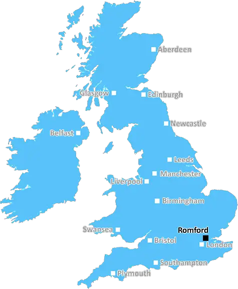
The RM16 postcode is an area in the Romford district covering parts of the boroughs of Havering and Thurrock. It falls primarily in the Thurrock borough and is made up of the towns of South Ockendon, Aveley, West Thurrock and part of Chafford Hundred.
Location wise, the postcode area lies to the east of London, with nearby postcodes including RM5, RM6 and RM7 in the east and RM13 and RM15 located to the west. The closest major towns include Basildon, Grays and Brentwood.
With the M25 motorway located nearby, there's easy access to London's airports and city centre, making the RM16 postcode an ideal place to live for commuters. The major transport links also make travel into the City, West End and docks easy.
The area benefits from an abundance of parks and open spaces, such as the South Ockendon Country Park, the Chafford Gorges Nature Park and the Thames Estuary Path National Trail. There are also several nature reserves located close by.
The area has a range of places to shop, eat and stay. Orsett Showground hosts a successful weekly market where visitors can browse a vast selection of goods. The Lakeside Shopping Centre is also just a short drive away in Thurrock and offers an impressive selection of high street stores and restaurants.
RM16 also has some impressive schools, ranging from primary to secondary, including St Clere's and The Dell Primary Schools, Ockendon Academy, and The Chafford School, which was founded in 1977 and was named as �Outstanding' by Ofsted in 2020.
Sports fans can enjoy a range of local clubs and facilities, including Romford Golf Club, Thurrock Football Club and the South Ockendon Leisure Centre. Plus, the area is popular for its heritage and history, boasting its very own tower in the High House of Ockendon.
Not far away from RM16 is Purfleet's Top Red Army Training Camp, a former military firing range used during World War 2 which is now open to the public as a fascinating museum; an experience sure to please those interested in military history.

Demographics

Essex

RM16 is located in the county of Essex, in England.
Essex has a total population of 1,802,200, making it the 7th largest county in the UK.
Essex has a total area of 1417 square miles, and a population density of 491 people per square kilometre. For comparison, Greater London has a density of 5,618 people/km2.
| Outward Code | RM16 |
| Postal Town | Romford |
| MSOA Name | Thurrock 015 |
| LSOA Name | Thurrock 015F |
| County | Essex |
| Region | Essex |
| Country | England |
| Local Authority | Thurrock |
| Area Classification | Urban with Major Conurbation |
RM16 Electoral Wards
The postal region of RM16, includes the local towns, villages, electoral wards and stations of:
Dig even deeper into the RM16 postcode by clicking on a postcode below:
Click on an outward postal code below for more information about the area. Each 'outward' postcode give you a comprehensive list of all postcodes within the outward code area (RM) and estimated address.
Click on an 'outward' code for more information. For example, the outward postcode page 'EC2M' will give you an alphabetical list covering all postcodes located in the region, from 'EC2M 1BB' through to 'EC2M 7YA'.
CCU, romford
Tuesday, November 6, 2018
Lovely neighbourhood, quite and a lot of green areas around. Well looked after houses around and in the proximity of a very good primary and secondary school. The train station with free parking is only 10-12 min walk. Multiple grocery supermarkets are within easy reach. Overall I believe it is a safe environment for families and suitable for old as well as young people ( with lots of entertaining means around in Lakeside). Not far there is a huge retail park in Lakeside which is accessible by car as well as by walk.
Add your view of RM16
People need your local expertise. If you live in RM16 or have first-hand knowledge of the neighbourhood, please consider sharing your views. It's completely anonymous - all we ask is for your initials.
Please tell us what you like about the RM16 postcode area, what you don't like, and what it's like to live or work here.
| LOCAL AMENITIES | |
| FAMILY FRIENDLY | |
| PARKING | |
| GREEN SPACES |
Local News Essex
Redical hires leasing directors for Leeds and Romford shopping centres
Rachel Bradburn and Oliver Lloyd will be supported by newly appointed asset managers Javeria Hussain and Daniel Tucker.
Property WeekJohnson & Johnson signs lease at Tempo in Maidenhead
The pharmaceuticals giantwill move staff from its Thames Valley campuses in High Wycombe and Pinewood to the L&G-owned building.
Property WeekKnight Frank reports 25% leap in Golden Triangle life sciences take-up
Around 186,000 sq ft of space in London, Oxford and Cambridge was let in Q1 2024.
Property WeekLeigh Leighton Avenue shut off near Iceland supermarket
Leighton Avenue has been shut off by police at its junction with London Road, near Iceland supermarket this afternoon
The EchoBasildon Council apologise for six-month black bin delay
Mr Markey, 70, says Basildon Council failed to get a black bin delivered to his address despite his repeated requests
The EchoCharity work OBE for mum of murdered backpacker
Gillian Millane collects donated handbags and fills them with toiletries for domestic abuse victims.
BBC Newsc2c hundreds of extra trains from June 2 announced
Rail company c2c has announced hundreds of extra services per week and multiple timetable changes from June.
The EchoBasildon attempted murder investigation after serious attack
An attempted murder investigation has been launched as a man remains in critical condition after a serious attack in Basildon
The EchoFrom the Postcode Area blog

Deciphering Crime Rates - a Deep Dive Into UK Postcode Analysis
Ever wondered about the crime rate in your UK postcode? You're not alone. We've dug deep into the data, uncovering trends and patterns that'll make your head spin.

Death of the High Street?
The BBC reports that despite councils' attempts to kurb them, the UK's high streets have seen a huge growth in fast food outlets. Could this mark the death knell for the Great British high street, and what can we do about it to halt its decline?

Discrimination by Postcode
You really couldn't make it up, could you? Some of the country's most vulnerable people are missing out on their weekly £25 Cold Weather Payment, just because the system that's in operation is discriminating against them because payments are based on postcode, rather than geographic location.

The Redesign is Underway
Well, the current website was absolutely in dire need of a good redesign - from the ground up. So I set out to pull it all apart and get it up and running again to become the most comprehensive guide to every postcode in the UK. And it's been a long, tough job from start to finish - and quite possibly the biggest project I've ever undertaken.
SOCIAL GRADES
According to census records, 18% of people here have a social grade of AB (highest), compared to the national average of 27%.