plymouth PL29 Postcodes
Spending a fortune on conveyancing?

Compare instant, low-cost online quotes from trusted conveyancing solicitors.
Backed by experts, our no-obligation service searches through the best conveyancing quotes on the market to save you time and money.
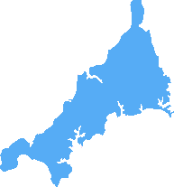
Plymouth (PL29)
The PL29 postcode area is located in the Plymouth postcode town region, within the county of Cornwall, and contains a total of 65 individual postcodes.
There are 7 electoral wards in the PL29 postcode area, including Bodmin, Boscastle, Callington, Calstock, Camelford, Delabole, Fowey, Gunnislake, Ivybridge, Launceston, Lifton, Liskeard, Looe, Lostwithiel, Padstow, Par, Plymouth, Port Isaac, Saltash, St Austell, Tavistock, Tintagel, Torpoint, Wadebridge, Yelverton which come under the local authority of the Cornwall,Isles of Scilly Council.
Combining the whole postcode region, 19% of people in PL29 are classed as having an AB social grade, (i.e. 'white-collar' middle-upper class), compared to 27% across the UK.
This does not mean that the people of PL29 are poorer than other areas, but it may give an indication that there are areas of deprivation.
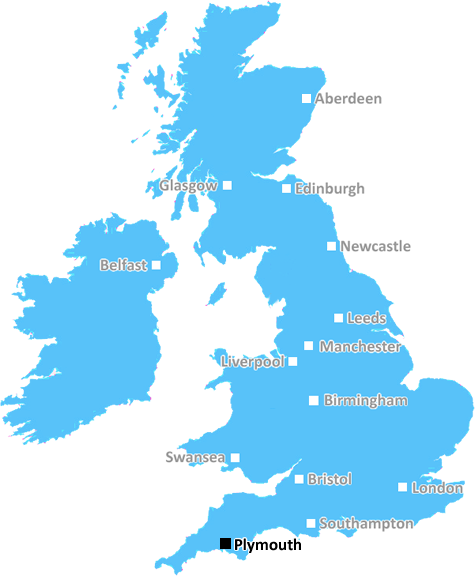
The PL29 postcode is located in the South West of England, in the district of Plymouth. It covers parts of South East Cornwall, as well as villages such as Tideford, St Erney, St Mellion, and St Dominick. The postcode lies within an area known as the Tamar Valley, which features an Area of Outstanding Natural Beauty and is known as a coastal gateway to Cornwall and Devon.
The PL29 postcode encompasses deeply rural villages, with easy access to both the coastline and Dartmoor National Park. Its villages serve as hubs for the small, local communities that call the area home. St Erney is home to St Erney Parish Church, which is considered one of the most charming churches in the area.
The area contains sites with historical and architectural significance, such as Morwelham Quay, which is Grade II listed and has been used since Roman times. Other notable places within the PL29 postcode include Saltash Church, Monkerton Chapel, and St Dominic Church.
The postcode surrounds the river Plym and is also close to the Tamar Estuary and hamlets such as Tideford. It is a popular location for river activities, such as walking and kayaking, and is well connected with cycle routes. Additionally, the area contains a variety of wooded areas, historic parks, and wildlife sites, which makes it ideal for nature lovers.
The PL29 postcode is well connected with good transport links, with regular bus services and good road networks, making it accessible to other areas. It also has its own railway station, Saltash station, which is on the main line to Plymouth. Shopping facilities are limited, so most people must travel or use online options to meet their needs.
ThePL29 postcode offers a peaceful environment that combines rural beauty with close proximity to Plymouth City. It mixes history with modern living and offers a variety of activities and outdoor activities for people of all ages. With its good transport links, historic sites, and picturesque views, it is one of the most desirable postcodes in the Plymouth district.

Demographics

Cornwall
PL29 is located in the county of Cornwall, in England.
Cornwall has a total population of 556,000, making it the 40th largest county in the UK.
Cornwall has a total area of 1375 square miles, and a population density of 156 people per square kilometre. For comparison, Greater London has a density of 5,618 people/km2.
| Outward Code | PL29 |
| Postal Town | Plymouth |
| MSOA Name | Cornwall 007 |
| LSOA Name | Cornwall 007B |
| County | Cornwall |
| Region | Cornwall |
| Country | England |
| Local Authority | Cornwall,Isles of Scilly |
| Area Classification | Mainly Rural (rural including hub towns >=80%) |
PL29 Electoral Wards
The postal region of PL29, includes the local towns, villages, electoral wards and stations of:
Dig even deeper into the PL29 postcode by clicking on a postcode below:
Click on an outward postal code below for more information about the area. Each 'outward' postcode give you a comprehensive list of all postcodes within the outward code area (PL) and estimated address.
Click on an 'outward' code for more information. For example, the outward postcode page 'EC2M' will give you an alphabetical list covering all postcodes located in the region, from 'EC2M 1BB' through to 'EC2M 7YA'.
Chris H
Friday, April 26, 2024
We don't have any views of PL29 right now. If you live in PL29 or have visited it, please help us to help others by telling others what you think of this neighbourhood.
Add your view of PL29
People need your local expertise. If you live in PL29 or have first-hand knowledge of the neighbourhood, please consider sharing your views. It's completely anonymous - all we ask is for your initials.
Please tell us what you like about the PL29 postcode area, what you don't like, and what it's like to live or work here.
| LOCAL AMENITIES | |
| FAMILY FRIENDLY | |
| PARKING | |
| GREEN SPACES |
Local News Cornwall
EE customers in Cornish town without phone signal
EE says it is working to resolve the issue as residents and businesses complain of no phone signal.
BBC NewsLithium-ion battery fire breaks out in back of Cornwall bin lorry
The blaze has sparked a warning from the fire service and Cornwall Council
Cornwall LiveWhen are the local elections and who can vote?
Voters in parts of England will elect councillors, mayors and police commissioners in May.
BBC NewsPedestrian seriously injured in crash
The A390 was closed in both directions after the crash involving a car and a pedestrian.
BBC NewsCornwall giant poly tunnel 'makes a mockery' of local planning
Cornwall Council is looking into the planning issues, but the project's supporters claim they are merely attempting to assist the local residents and wildlife.
Cornwall LiveFalmouth neighbours plea to buy Cornwall Council land to 'save it from flats'
The community green space is one of 2,000 council-owned assets which could be sold or given away to save money
Cornwall LivePottery building fire believed to be arson
Cornwall Fire and Rescue Service says crews from Delabole, Wadebridge and Bude tackled the flames.
BBC NewsJeremy Clarkson says he's 'unbelievably sad' farm scenes
Jeremy Clarkson has opened up about a tragic disaster that struck his farm, Diddly Squat, as he attempted to diversify into pig farming, just as new episodes of Clarkson's Farm are set to premiere
Cornwall LiveFrom the Postcode Area blog

Deciphering Crime Rates - a Deep Dive Into UK Postcode Analysis
Ever wondered about the crime rate in your UK postcode? You're not alone. We've dug deep into the data, uncovering trends and patterns that'll make your head spin.

Death of the High Street?
The BBC reports that despite councils' attempts to kurb them, the UK's high streets have seen a huge growth in fast food outlets. Could this mark the death knell for the Great British high street, and what can we do about it to halt its decline?

Discrimination by Postcode
You really couldn't make it up, could you? Some of the country's most vulnerable people are missing out on their weekly £25 Cold Weather Payment, just because the system that's in operation is discriminating against them because payments are based on postcode, rather than geographic location.

The Redesign is Underway
Well, the current website was absolutely in dire need of a good redesign - from the ground up. So I set out to pull it all apart and get it up and running again to become the most comprehensive guide to every postcode in the UK. And it's been a long, tough job from start to finish - and quite possibly the biggest project I've ever undertaken.
SOCIAL GRADES
According to census records, 19% of people here have a social grade of AB (highest), compared to the national average of 27%.