peterborough PE4 Postcodes
Spending a fortune on conveyancing?

Compare instant, low-cost online quotes from trusted conveyancing solicitors.
Backed by experts, our no-obligation service searches through the best conveyancing quotes on the market to save you time and money.
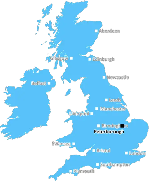
Peterborough (PE4)
The PE4 postcode area is located in the Peterborough postcode town region, within the county of Cambridgeshire, and contains a total of 753 individual postcodes.
There are 5 electoral wards in the PE4 postcode area, including Boston, Bourne, Chatteris, Downham Market, Hunstanton, Huntingdon, King's Lynn, March, Peterborough, Sandringham, Skegness, Spalding, Spilsby, St Ives, St Neots, Stamford, Swaffham, Wisbech which come under the local authority of the Peterborough Council.
Combining the whole postcode region, 15% of people in PE4 are classed as having an AB social grade, (i.e. 'white-collar' middle-upper class), compared to 27% across the UK.
This does not mean that the people of PE4 are poorer than other areas, but it may give an indication that there are areas of deprivation.
PE4 is a postcode located in the city of Peterborough, in the East of England. It covers the north-east of Peterborough, from Newborough to Stanground, and from Eastfield to Werrington. It is part of the PE postcode area, which is a geographical region encompassing the area of 10 ceremonial counties, Cambridgeshire, Norfolk, Suffolk, Bedfordshire, Hertfordshire, Essex, Buckinghamshire, Oxfordshire, Northamptonshire and Lincolnshire.
The postcode was introduced in 1999 and is designed to help the Royal Mail efficiently distribute post. It identifies a smaller group of addresses than the larger area known as the post town. The Royal Mail takes postcodes and puts them into numerical machines that can sort the mail in a fraction of the time it would take a human.
In the area covered by PE4, there are a number of residential estates, such as Lynch Wood, as well as industrial and retail sites. The city's main shopping centre, Queensgate, and the Peterborough United football stadium are also located within the PE4 area. There are several schools and local amenities in the postcode district, such as Peterborough City Hospital, City College Peterborough, East of England Ambulance Service Peterborough and The Pear Tree Medical Centre.
PE4 is not directly connected to the National Rail network, but there are several bus services that serve the postcode district. There are also a few local services, such as the CBeebies Land, which is located in a nearby postcode.
The area has a diverse range of property types, from traditional terraced housing to modern apartments and detached homes. There are open green spaces in and around PE4, such as Flagstaff Park, Central Park, Coneygree Park, Phantoms Field, Westgate Gardens, Eastfield Park, Flyover Park and Deans Court.
The average price of housing in PE4 has increased in recent years. According to Zoopla, the average house price in PE4 is �206,915, however this varies depending on location.

Demographics

Cambridgeshire

PE4 is located in the county of Cambridgeshire, in England.
Cambridgeshire has a total population of 849,000, making it the 27th largest county in the UK.
Cambridgeshire has a total area of 1309 square miles, and a population density of 250 people per square kilometre. For comparison, Greater London has a density of 5,618 people/km2.
| Outward Code | PE4 |
| Postal Town | Peterborough |
| MSOA Name | Peterborough 002 |
| LSOA Name | Peterborough 002A |
| County | Cambridgeshire |
| Region | Cambridgeshire |
| Country | England |
| Local Authority | Peterborough |
| Area Classification | Urban with City and Town |
PE4 Electoral Wards
The postal region of PE4, includes the local towns, villages, electoral wards and stations of:
Dig even deeper into the PE4 postcode by clicking on a postcode below:
Click on an outward postal code below for more information about the area. Each 'outward' postcode give you a comprehensive list of all postcodes within the outward code area (PE) and estimated address.
Click on an 'outward' code for more information. For example, the outward postcode page 'EC2M' will give you an alphabetical list covering all postcodes located in the region, from 'EC2M 1BB' through to 'EC2M 7YA'.
Chris H
Sunday, April 7, 2024
We don't have any views of PE4 right now. If you live in PE4 or have visited it, please help us to help others by telling others what you think of this neighbourhood.
Add your view of PE4
People need your local expertise. If you live in PE4 or have first-hand knowledge of the neighbourhood, please consider sharing your views. It's completely anonymous - all we ask is for your initials.
Please tell us what you like about the PE4 postcode area, what you don't like, and what it's like to live or work here.
| LOCAL AMENITIES | |
| FAMILY FRIENDLY | |
| PARKING | |
| GREEN SPACES |
Local News Northamptonshire
The Zutons: 'Northampton crowds are amazing'
Abi and Sean from The Zutons talk about playing Northampton and working with Nile Rodgers
BBC NewsKettering collector: 'Viv Westwood gave me a job!'
Lee Price has loaned his private Vivienne Westwood collection to Northampton Museum
BBC NewsCan Surrey be beaten as County Championship returns?
With the new County Championship season starting on Friday, can anyone prevent Surrey winning a third straight title?
BBC NewsNorthampton Great Escaper left us this treasure...
A 'swagger stick' owned by Marcel Zillessen who escaped Stalag Luft III is up for auction
BBC NewsDerek from Northants: 'I lived with armed bandits'
Northampton born Derek Adams has spent his life trekking the world for charity
BBC News'Fan' in non-league club's viral video 'delighted'
A tongue-in-cheek promo to support fundraising for a new scoreboard is viewed more than 220,000 times.
BBC NewsCouncil posts song lyric response to pothole signs
The authority replies to "Daventry Banksie" with mock-up of protester's sign on social media.
BBC NewsNorthampton Town 2-0 Port Vale
Mitch Pinnock and Shaun McWilliams score for Northampton as they beat struggling Port Vale 2-0 at Sixfields.
BBC NewsFrom the Postcode Area blog

Deciphering Crime Rates - a Deep Dive Into UK Postcode Analysis
Ever wondered about the crime rate in your UK postcode? You're not alone. We've dug deep into the data, uncovering trends and patterns that'll make your head spin.

Death of the High Street?
The BBC reports that despite councils' attempts to kurb them, the UK's high streets have seen a huge growth in fast food outlets. Could this mark the death knell for the Great British high street, and what can we do about it to halt its decline?

Discrimination by Postcode
You really couldn't make it up, could you? Some of the country's most vulnerable people are missing out on their weekly £25 Cold Weather Payment, just because the system that's in operation is discriminating against them because payments are based on postcode, rather than geographic location.

The Redesign is Underway
Well, the current website was absolutely in dire need of a good redesign - from the ground up. So I set out to pull it all apart and get it up and running again to become the most comprehensive guide to every postcode in the UK. And it's been a long, tough job from start to finish - and quite possibly the biggest project I've ever undertaken.
SOCIAL GRADES
According to census records, 15% of people here have a social grade of AB (highest), compared to the national average of 27%.