peterborough PE19 Postcodes
Spending a fortune on conveyancing?

Compare instant, low-cost online quotes from trusted conveyancing solicitors.
Backed by experts, our no-obligation service searches through the best conveyancing quotes on the market to save you time and money.
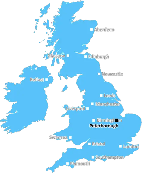
Peterborough (PE19)
The PE19 postcode area is located in the Peterborough postcode town region, within the county of Cambridgeshire, and contains a total of 2179 individual postcodes.
There are 69 electoral wards in the PE19 postcode area, including Boston, Bourne, Chatteris, Downham Market, Hunstanton, Huntingdon, King's Lynn, March, Peterborough, Sandringham, Skegness, Spalding, Spilsby, St Ives, St Neots, Stamford, Swaffham, Wisbech which come under the local authority of the Huntingdonshire Council.
Combining the whole postcode region, 28% of people in PE19 are classed as having an AB social grade, (i.e. 'white-collar' middle-upper class), compared to 27% across the UK.
This does not mean that the people of PE19 are wealthier - or higher class - than average, but it can be an indication that the area may be prospering and desirable to live in.
PE19 is a postcode district in the Peterborough district of England. It is encompassed by postcode areas PE, HP, SG, NN and CB. It stretches from Woodwalton in the north to Broxbourne in the south and east to Buckden in the west, covering roughly 73 square miles. Over 14,500 people live in the district.
The postcode district is mainly rural, with countryside and small villages making up the vast majority of PE19. Its main settlements are Broughton, St Neots and Godmanchester. St Neots is the largest settlement in the area, boasting a population of 14,000. It is also the primary urban centre for the postcode, providing the majority of shops, services and communities.
The area is also home to a number of historical sites, including Roman remains in Godmancroft and Norman castles in St Neots. It is also close to a number of popular tourist attractions, such as John Clare's cottage and Wimpole Hall.
Transport-wise, an hourly train service operates between Peterborough and London Kings Cross and bus services are frequent throughout the postcode district. The A428 road runs through the area, providing connections to Cambridge, Bedford and Northampton. The nearest airport is Stansted Airport, but London Luton and London Heathrow are both a short train journey away.
PE19 has one sixth form college, The St Neots Sixth Form College. Other educational institutions in the area include two primary schools (St Neots Primary Academy and The Dell Primary School) and an independent preparatory school (St Neots preparatory school).
Economically, the agriculture and engineering sectors are major employers in the area. In recent years, the area has also seen growth in the IT and telecoms sector. The district is also home to a number of small businesses and start-up companies.
Thepostcode district of PE19 is characterised by its rural environment, historical sites and small towns. It has good transport links and growing economic opportunities. It is an attractive place to live, work and visit.

Demographics

Cambridgeshire

PE19 is located in the county of Cambridgeshire, in England.
Cambridgeshire has a total population of 849,000, making it the 27th largest county in the UK.
Cambridgeshire has a total area of 1309 square miles, and a population density of 250 people per square kilometre. For comparison, Greater London has a density of 5,618 people/km2.
| Outward Code | PE19 |
| Postal Town | Peterborough |
| MSOA Name | Huntingdonshire 019 |
| LSOA Name | Huntingdonshire 019D |
| County | Cambridgeshire |
| Region | Cambridgeshire |
| Country | England |
| Local Authority | Huntingdonshire |
| Area Classification | Mainly Rural (rural including hub towns >=80%) |
PE19 Electoral Wards
The postal region of PE19, includes the local towns, villages, electoral wards and stations of:
Dig even deeper into the PE19 postcode by clicking on a postcode below:
Click on an outward postal code below for more information about the area. Each 'outward' postcode give you a comprehensive list of all postcodes within the outward code area (PE) and estimated address.
Click on an 'outward' code for more information. For example, the outward postcode page 'EC2M' will give you an alphabetical list covering all postcodes located in the region, from 'EC2M 1BB' through to 'EC2M 7YA'.
Chris H
Thursday, April 11, 2024
We don't have any views of PE19 right now. If you live in PE19 or have visited it, please help us to help others by telling others what you think of this neighbourhood.
Add your view of PE19
People need your local expertise. If you live in PE19 or have first-hand knowledge of the neighbourhood, please consider sharing your views. It's completely anonymous - all we ask is for your initials.
Please tell us what you like about the PE19 postcode area, what you don't like, and what it's like to live or work here.
| LOCAL AMENITIES | |
| FAMILY FRIENDLY | |
| PARKING | |
| GREEN SPACES |
Local News Cambridgeshire
Car abandoned after crashing into ditch
The driver left the scene before officers arrived and has not yet been identified.
BBC NewsWhere art now for Shakespeare troupe?
A Shakespeare theatre group seeks a new home after having to leave its venue of 65 years.
BBC NewsPeterborough United 3-0 Port Vale
Peterborough boost their League One automatic promotion hopes by beating relegation-threatened Port Vale.
BBC NewsLocal elections 2024: Is there an election in my area?
Use our lookup to see if there is an election in your area and who you can vote for on 2 May
BBC NewsPhoto of dad stuck in Wembley turnstile goes viral
"Win, lose or draw. Don't care. Saw my dad get stuck in a turnstile so all worth it," says son.
BBC News'People were eating dog food. Now we feed them'
A mother and daughter fund and cook meals in their kitchen for people struggling to afford food.
BBC NewsBurrows stars as Posh beat Wycombe to lift EFL Trophy
Harrison Burrows scores twice, including a stoppage-time winner, as Peterborough beat Wycombe at Wembley to secure the EFL Trophy for a second time.
BBC NewsSecond bus firm fills gaps on route after cutbacks
A new operator picks up some gaps left in a bus route's timetable after cutbacks by another firm.
BBC NewsFrom the Postcode Area blog

Deciphering Crime Rates - a Deep Dive Into UK Postcode Analysis
Ever wondered about the crime rate in your UK postcode? You're not alone. We've dug deep into the data, uncovering trends and patterns that'll make your head spin.

Death of the High Street?
The BBC reports that despite councils' attempts to kurb them, the UK's high streets have seen a huge growth in fast food outlets. Could this mark the death knell for the Great British high street, and what can we do about it to halt its decline?

Discrimination by Postcode
You really couldn't make it up, could you? Some of the country's most vulnerable people are missing out on their weekly £25 Cold Weather Payment, just because the system that's in operation is discriminating against them because payments are based on postcode, rather than geographic location.

The Redesign is Underway
Well, the current website was absolutely in dire need of a good redesign - from the ground up. So I set out to pull it all apart and get it up and running again to become the most comprehensive guide to every postcode in the UK. And it's been a long, tough job from start to finish - and quite possibly the biggest project I've ever undertaken.
SOCIAL GRADES
According to census records, 28% of people here have a social grade of AB (highest), compared to the national average of 27%.