oxford OX9 Postcodes
Spending a fortune on conveyancing?

Compare instant, low-cost online quotes from trusted conveyancing solicitors.
Backed by experts, our no-obligation service searches through the best conveyancing quotes on the market to save you time and money.
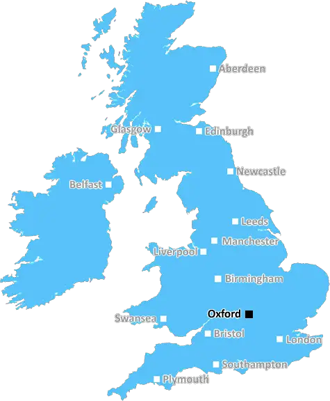
Oxford (OX9)
The OX9 postcode area is located in the Oxford postcode town region, within the county of Oxfordshire, and contains a total of 2263 individual postcodes.
There are 37 electoral wards in the OX9 postcode area, including Abingdon, Bampton, Banbury, Bicester, Burford, Carterton, Chinnor, Chipping Norton, Didcot, Kidlington, Oxford, Thame, Wallingford, Wantage, Watlington, Witney, Woodstock which come under the local authority of the South Oxfordshire Council.
Combining the whole postcode region, 36% of people in OX9 are classed as having an AB social grade, (i.e. 'white-collar' middle-upper class), compared to 27% across the UK.
This does not mean that the people of OX9 are wealthier - or higher class - than average, but it can be an indication that the area may be prospering and desirable to live in.
The OX9 postcode is located in Oxfordshire, in the south-eastern part of England. It covers around 46 square miles and includes a number of different villages, towns and cities.
The main town in the OX9 postcode area is Thame. It is a traditional market town, with a wealth of friendly independent shops and cafes. It is home to a few historic buildings, including the Market House, built in 1762 and the impressive St Mary's Church.
The village of Wheatley is also located within the OX9 postcode. It was first documented in 958AD as �Weteleya� and still retains a very traditional atmosphere. There are winding roads, ancient houses, woodlands and farmers' fields within the village. The village also includes the spectacular Cuddesdon Palace, which was home to the Bishops of Oxford from the 15th century.
Vicarage Lane, which is in the Post Town of Horspath, is in the OX9 postcode. It is home to a farm, a church, a pub and a few small shops. It is a peaceful village surrounded by countryside and farmland.
The OX9 postcode also includes the towns of Haddenham, Wheatley and Chinnor. Haddenham is a very traditional village, with thatched cottages, an old manor house, a church and a winding stream. While traditionally known for the production of chalk, today Haddenham is a popular tourist destination.
Wheatley and Chinnor are two nearby villages that are part of the OX9 postcode. Wheatley is an old village, with a traditional village green, a Grade I listed church and many old timbered buildings. Chinnor is an idyllic village, with many listed buildings and stunning countryside views.
The villages and towns within the OX9 postcode are all within easy reach of Oxford city centre, which can be accessed by bus or train. Oxford offers plenty of things to do, including a great selection of museums, galleries, theatres, restaurants, bars and shops. It also offers excellent educational opportunities, with renowned universities and colleges to choose from.

Demographics

Oxfordshire

OX9 is located in the county of Oxfordshire, in England.
Oxfordshire has a total population of 683,200, making it the 35th largest county in the UK.
Oxfordshire has a total area of 1005 square miles, and a population density of 262 people per square kilometre. For comparison, Greater London has a density of 5,618 people/km2.
| Outward Code | OX9 |
| Postal Town | Oxford |
| MSOA Name | South Oxfordshire 001 |
| LSOA Name | South Oxfordshire 001A |
| County | Oxfordshire |
| Region | Oxfordshire |
| Country | England |
| Local Authority | South Oxfordshire |
| Area Classification | Mainly Rural (rural including hub towns >=80%) |
OX9 Electoral Wards
The postal region of OX9, includes the local towns, villages, electoral wards and stations of:
Dig even deeper into the OX9 postcode by clicking on a postcode below:
Click on an outward postal code below for more information about the area. Each 'outward' postcode give you a comprehensive list of all postcodes within the outward code area (OX) and estimated address.
Click on an 'outward' code for more information. For example, the outward postcode page 'EC2M' will give you an alphabetical list covering all postcodes located in the region, from 'EC2M 1BB' through to 'EC2M 7YA'.
Chris H
Tuesday, April 9, 2024
We don't have any views of OX9 right now. If you live in OX9 or have visited it, please help us to help others by telling others what you think of this neighbourhood.
Add your view of OX9
People need your local expertise. If you live in OX9 or have first-hand knowledge of the neighbourhood, please consider sharing your views. It's completely anonymous - all we ask is for your initials.
Please tell us what you like about the OX9 postcode area, what you don't like, and what it's like to live or work here.
| LOCAL AMENITIES | |
| FAMILY FRIENDLY | |
| PARKING | |
| GREEN SPACES |
Local News Oxfordshire
First-time buyers account for record third of all housing sales
Hamptons' research also showsthe most popular area to a buy home for first-time buyers is Slough.
Property WeekPlans for city centre life sciences hub revealed
The proposals include the demolition of three buildings to make way for the new facility.
BBC NewsMan charged with murder after fatal stabbing
34-year-old Ryan Byrne, of Stratford-upon-Avon, has been charged for the murder of Tobias Bruce.
BBC NewsGove rejects 12-storey hotel and energy park plan for Bucks village
Developer Adveneco had proposed an exemplar of sustainable development for the site in Dorney.
Property WeekMirabaud buys Virgin Atlantic HQ in UK debut
Swiss investor snaps up grade-A office scheme let to Virgin Atlantic until 2032.
Property WeekQuadrant gets green light for residential-led scheme in Kent
The project will also include the development of more than 376,700 sq ft of grade-A commercial space.
Property WeekArtist's latest mural inspired by active residents
The artwork in Oxford features people rollerblading, skateboarding and a scootering dog.
BBC NewsAbri and Vistry partner to develop 1,500 homes in West Sussex
The 50/50 joint venture will develop the scheme on a former airfield site in Arundel.
Property WeekFrom the Postcode Area blog

Deciphering Crime Rates - a Deep Dive Into UK Postcode Analysis
Ever wondered about the crime rate in your UK postcode? You're not alone. We've dug deep into the data, uncovering trends and patterns that'll make your head spin.

Death of the High Street?
The BBC reports that despite councils' attempts to kurb them, the UK's high streets have seen a huge growth in fast food outlets. Could this mark the death knell for the Great British high street, and what can we do about it to halt its decline?

Discrimination by Postcode
You really couldn't make it up, could you? Some of the country's most vulnerable people are missing out on their weekly £25 Cold Weather Payment, just because the system that's in operation is discriminating against them because payments are based on postcode, rather than geographic location.

The Redesign is Underway
Well, the current website was absolutely in dire need of a good redesign - from the ground up. So I set out to pull it all apart and get it up and running again to become the most comprehensive guide to every postcode in the UK. And it's been a long, tough job from start to finish - and quite possibly the biggest project I've ever undertaken.
SOCIAL GRADES
According to census records, 36% of people here have a social grade of AB (highest), compared to the national average of 27%.