oxford OX16 Postcodes
Spending a fortune on conveyancing?

Compare instant, low-cost online quotes from trusted conveyancing solicitors.
Backed by experts, our no-obligation service searches through the best conveyancing quotes on the market to save you time and money.
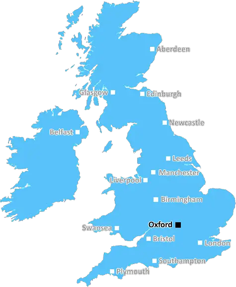
Oxford (OX16)
The OX16 postcode area is located in the Oxford postcode town region, within the county of Oxfordshire, and contains a total of 2476 individual postcodes.
There are 9 electoral wards in the OX16 postcode area, including Abingdon, Bampton, Banbury, Bicester, Burford, Carterton, Chinnor, Chipping Norton, Didcot, Kidlington, Oxford, Thame, Wallingford, Wantage, Watlington, Witney, Woodstock which come under the local authority of the Cherwell Council.
Combining the whole postcode region, 19% of people in OX16 are classed as having an AB social grade, (i.e. 'white-collar' middle-upper class), compared to 27% across the UK.
This does not mean that the people of OX16 are poorer than other areas, but it may give an indication that there are areas of deprivation.
The OX16 postcode is a postcode district in the Oxford area of England. It is located within the Oxfordshire area and has a population of 11,683 people.
The main town covered by the OX16 postcode district is Banbury, which is a small market town in Oxfordshire. Banbury is known for its popular market which dates back to the 13th century. Other settlements in the OX16 postcode area include Banbury Cross, Hanwell, Hempton, Hardwick, Bloxham, Drayton and Clattercote.
The OX16 postcode district is mostly rural in nature, with its main industry being agriculture and horticulture. The area is known for its beautiful rolling hills and green fields. In recent years, the area has become increasingly popular among tourists with attractions including the National Trust-managed Blenheim Palace, which is in the neighbouring OX7 postcode zone. There are also a variety of recreational activities available around the area, such as fishing, golfing and horse-riding.
The major transport link in the district is the A4260, which runs from Banbury to Kidlington before eventually ending in Oxford. The A44 also runs through the OX16 postcode area, connecting to both Stratford upon Avon and Chipping Norton. The nearest railway stations are located in Banbury and Oxford.
The OX16 postcode district is served by a range of local services, such as Banbury Academy, which is a secondary school for 11 to 18-year-olds. There are also several primary schools in the area, such as Drayton, Hanwell, Hardwick and Bloxham primary schools. There are a number of independent businesses located in the area, including art galleries, antiques shops, country pubs and clothing stores.
Banbury is also home to the East Midlands Ambulance Service, who provide emergency medical services to the postcode district. The OX16 postcode district is served by the Thames Valley Police who operate three police stations in the area; one in Banbury and the other two in Bicester and Leamington Spa. The fire service is provided by the Oxfordshire Fire and Rescue Service, with stations located in Banbury, Bicester and Leamington Spa.

Demographics

Oxfordshire

OX16 is located in the county of Oxfordshire, in England.
Oxfordshire has a total population of 683,200, making it the 35th largest county in the UK.
Oxfordshire has a total area of 1005 square miles, and a population density of 262 people per square kilometre. For comparison, Greater London has a density of 5,618 people/km2.
| Outward Code | OX16 |
| Postal Town | Oxford |
| MSOA Name | Cherwell 004 |
| LSOA Name | Cherwell 004A |
| County | Oxfordshire |
| Region | Oxfordshire |
| Country | England |
| Local Authority | Cherwell |
| Area Classification | Urban with Significant Rural (rural including hub towns 26-49%) |
OX16 Electoral Wards
The postal region of OX16, includes the local towns, villages, electoral wards and stations of:
Dig even deeper into the OX16 postcode by clicking on a postcode below:
Click on an outward postal code below for more information about the area. Each 'outward' postcode give you a comprehensive list of all postcodes within the outward code area (OX) and estimated address.
Click on an 'outward' code for more information. For example, the outward postcode page 'EC2M' will give you an alphabetical list covering all postcodes located in the region, from 'EC2M 1BB' through to 'EC2M 7YA'.
Chris H
Sunday, April 7, 2024
We don't have any views of OX16 right now. If you live in OX16 or have visited it, please help us to help others by telling others what you think of this neighbourhood.
Add your view of OX16
People need your local expertise. If you live in OX16 or have first-hand knowledge of the neighbourhood, please consider sharing your views. It's completely anonymous - all we ask is for your initials.
Please tell us what you like about the OX16 postcode area, what you don't like, and what it's like to live or work here.
| LOCAL AMENITIES | |
| FAMILY FRIENDLY | |
| PARKING | |
| GREEN SPACES |
Local News Oxfordshire
UK Space Agency primed for Harwell Campus landing
The government agency has taken around 10,500 sq ft of space in the Quad Two building.
Property WeekTT Group sells BT's old Southampton offices to consortium
BT's former Friary House office building has permission for residential conversion under permitted development rights.
Property WeekSurrey strikes 32.2m deal to buy offices from cash-strapped Woking Council
Surrey County Council will move staff into Victoria Gate building, formerly let to McLaren, later this year.
Property WeekSee 'remarkable' concealed Roman villa unearthed
Archaeologists unearthed the villa complex while working on a housing development in Grove.
BBC NewsMP's 'exhausted and traumatised' family flees Gaza
Oxford West and Abingdon MP Layla Moran says family members have escaped Gaza and are in Bahrain.
BBC NewsGames retailer signs HQ pre-let at London Brentwood Commercial Park
Wayland Games will occupy the space at Goodman's Essex development from 2025.
Property WeekLuton Airport operating company buys hangars of collapsed airline Monarch
Hangars can accommodate wide body jets up to the size of a Boeing 767.
Property WeekFusion power plant plan reaches 'major milestone'
First Light Fusion, in Oxfordshire, hopes to develop a commercial fusion power plant.
BBC NewsFrom the Postcode Area blog

Deciphering Crime Rates - a Deep Dive Into UK Postcode Analysis
Ever wondered about the crime rate in your UK postcode? You're not alone. We've dug deep into the data, uncovering trends and patterns that'll make your head spin.

Death of the High Street?
The BBC reports that despite councils' attempts to kurb them, the UK's high streets have seen a huge growth in fast food outlets. Could this mark the death knell for the Great British high street, and what can we do about it to halt its decline?

Discrimination by Postcode
You really couldn't make it up, could you? Some of the country's most vulnerable people are missing out on their weekly £25 Cold Weather Payment, just because the system that's in operation is discriminating against them because payments are based on postcode, rather than geographic location.

The Redesign is Underway
Well, the current website was absolutely in dire need of a good redesign - from the ground up. So I set out to pull it all apart and get it up and running again to become the most comprehensive guide to every postcode in the UK. And it's been a long, tough job from start to finish - and quite possibly the biggest project I've ever undertaken.
SOCIAL GRADES
According to census records, 19% of people here have a social grade of AB (highest), compared to the national average of 27%.