nottingham NG16 Postcodes
Spending a fortune on conveyancing?

Compare instant, low-cost online quotes from trusted conveyancing solicitors.
Backed by experts, our no-obligation service searches through the best conveyancing quotes on the market to save you time and money.
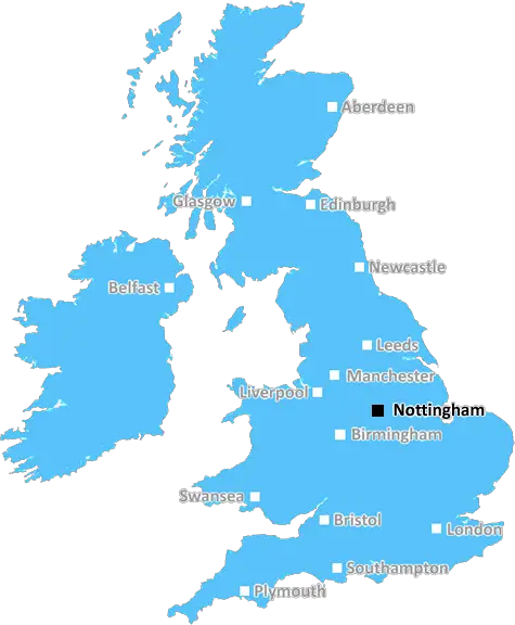
Nottingham (NG16)
The NG16 postcode area is located in the Nottingham postcode town region, within the county of Nottinghamshire, and contains a total of 1667 individual postcodes.
There are 76 electoral wards in the NG16 postcode area, including Grantham, Mansfield, Newark, Nottingham, Sleaford, Southwell, Sutton-In-Ashfield which come under the local authority of the Broxtowe Council.
Combining the whole postcode region, 17% of people in NG16 are classed as having an AB social grade, (i.e. 'white-collar' middle-upper class), compared to 27% across the UK.
This does not mean that the people of NG16 are poorer than other areas, but it may give an indication that there are areas of deprivation.
NG16 postcode comes under the Nottingham district in the East Midlands region of England. It falls under the area code of Nottingham 6 and covers towns and suburbs such as Basford, Eastwood, Jacksdale, Newthorpe, Nuthall and Strelley.
NG16 postcode has a population of approximately 28,242 according to the 2011 UK census. The majority of the population are aged between 16 and 65, with a majority of them being employed in transport and retail trade occupations. There are several local amenities within the area including; Basford United F.C, local shops, pubs, parks and schools.
NG16 postcode area is served by Broadway railway station within the district as well as Nottingham's Victoria and Nottingham Midland railway stations, which are located just outside the boundaries of the area in the neighbouring NG2 post-code. The postcode also has numerous bus routes servicing the area and direct routes to Nottingham City Centre.
The area is mainly residential, with some retail and banks. The post-code also has a selection of local green areas and woodland including Strelley Wood and Nuthall Temple.
In terms of local attractions, NG16 postcode district is within easy reach of Clumber Park National Trust site which is located just 10 miles away. The area is also within close proximity to The Nottingham Ice Arena, The Galleries of Justice Museum and numerous high street shopping arcades.
NG16 postcode district is the home of the annual Goose Fair, which has been produced since the seventeenth century. The fair includes thirty rides, traditional stalls, fairground games and donkeys. It is a popular event amongst local community members, bringing people together from around the district and all walks of life.
The postcode also falls within the borough of Broxtowe, making it part of the Ashfield parliamentary constituency. The local MP is Gareth E Davis and the postcode falls under Nottinghamshire County Council.

Demographics

Nottinghamshire

NG16 is located in the county of Nottinghamshire, in England.
Nottinghamshire has a total population of 1,136,000, making it the 15th largest county in the UK.
Nottinghamshire has a total area of 834 square miles, and a population density of 526 people per square kilometre. For comparison, Greater London has a density of 5,618 people/km2.
| Outward Code | NG16 |
| Postal Town | Nottingham |
| MSOA Name | Broxtowe 016 |
| LSOA Name | Broxtowe 016D |
| County | Nottinghamshire |
| Region | Nottinghamshire |
| Country | England |
| Local Authority | Broxtowe |
| Area Classification | Urban with Minor Conurbation |
NG16 Electoral Wards
The postal region of NG16, includes the local towns, villages, electoral wards and stations of:
Dig even deeper into the NG16 postcode by clicking on a postcode below:
Click on an outward postal code below for more information about the area. Each 'outward' postcode give you a comprehensive list of all postcodes within the outward code area (NG) and estimated address.
Click on an 'outward' code for more information. For example, the outward postcode page 'EC2M' will give you an alphabetical list covering all postcodes located in the region, from 'EC2M 1BB' through to 'EC2M 7YA'.
WH, nottingham
Monday, December 3, 2018
Quiet area, few, if any children. Mix of residents ages.
Add your view of NG16
People need your local expertise. If you live in NG16 or have first-hand knowledge of the neighbourhood, please consider sharing your views. It's completely anonymous - all we ask is for your initials.
Please tell us what you like about the NG16 postcode area, what you don't like, and what it's like to live or work here.
| LOCAL AMENITIES | |
| FAMILY FRIENDLY | |
| PARKING | |
| GREEN SPACES |
Local News Nottinghamshire
Photos released as new neonatal unit takes shape
The new unit in Nottingham will be almost three times as big as the one it is replacing.
BBC NewsMan sought over assault on rail staff on train
British Transport Police hope the man in the image can help with their investigation into the assault.
BBC NewsHotel Chocolat could set up at Nottinghamshire retail park after dropping big hint
Hotel Chocolat are seemingly planning to open a new store in coming months at the Victoria Retail Park
Nottingham PostStunning Nottinghamshire manor house with tennis courts and hot tubs that's available Airbnb
It is the perfect accommodation for someone getting married or planning a family gathering
Nottingham PostI tried Nottingham's International Market where the food was 'heavenly'
It has a little something for everyone and is a must-visit
Nottingham PostForest beat Fulham to boost survival hopes
Nottingham Forest give their hopes of Premier League survival a crucial boost with a convincing victory over Fulham at the City Ground.
BBC NewsStorm Kathleen to bring strong winds and hottest day of year so far
It's the 11th named storm in eight months to hit the country
Nottingham PostBulwell shoppers ready to 'embrace' new B&M opening in former Wilko building
There are plans for it to open in the summer
Nottingham PostFrom the Postcode Area blog

Deciphering Crime Rates - a Deep Dive Into UK Postcode Analysis
Ever wondered about the crime rate in your UK postcode? You're not alone. We've dug deep into the data, uncovering trends and patterns that'll make your head spin.

Death of the High Street?
The BBC reports that despite councils' attempts to kurb them, the UK's high streets have seen a huge growth in fast food outlets. Could this mark the death knell for the Great British high street, and what can we do about it to halt its decline?

Discrimination by Postcode
You really couldn't make it up, could you? Some of the country's most vulnerable people are missing out on their weekly £25 Cold Weather Payment, just because the system that's in operation is discriminating against them because payments are based on postcode, rather than geographic location.

The Redesign is Underway
Well, the current website was absolutely in dire need of a good redesign - from the ground up. So I set out to pull it all apart and get it up and running again to become the most comprehensive guide to every postcode in the UK. And it's been a long, tough job from start to finish - and quite possibly the biggest project I've ever undertaken.
SOCIAL GRADES
According to census records, 17% of people here have a social grade of AB (highest), compared to the national average of 27%.