norwich NR8 Postcodes
Spending a fortune on conveyancing?

Compare instant, low-cost online quotes from trusted conveyancing solicitors.
Backed by experts, our no-obligation service searches through the best conveyancing quotes on the market to save you time and money.
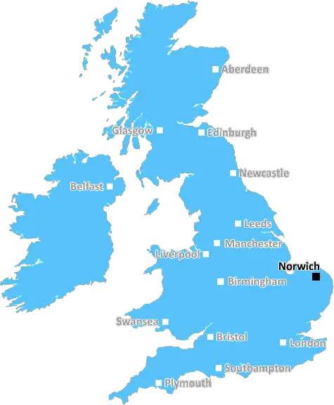
Norwich (NR8)
The NR8 postcode area is located in the Norwich postcode town region, within the county of Norfolk, and contains a total of 515 individual postcodes.
There are 9 electoral wards in the NR8 postcode area, including Attleborough, Beccles, Bungay, Cromer, Dereham, Fakenham, Great Yarmouth, Holt, Lowestoft, Melton Constable, North Walsham, Norwich, Sheringham, Walsingham, Wells-Next-The-Sea, Wymondham which come under the local authority of the South Norfolk Council.
Combining the whole postcode region, 24% of people in NR8 are classed as having an AB social grade, (i.e. 'white-collar' middle-upper class), compared to 27% across the UK.
This does not mean that the people of NR8 are poorer than other areas, but it may give an indication that there are areas of deprivation.
The NR8 postcode is in the much desired suburb of the Norwich district. It falls under the area known as Drayton and covers the town of Spixworth. This postcode is popular with families and people of all ages because of its excellent transport links, larger family homes, good schools and a variety of activities and amenities.
Located just to the north-east of Norwich, the NR8 postcode has access to the city centre via the A47 and the A140. Regular bus services and direct trains to London in a little over two hours also serve the area. It is only thirteen miles from the coast and open foliage of Norfolk, making it a great location for tourists to explore.
The NR8 has a huge amount of outdoor space including parks, the Drayton Hall Nature Reserve, and Hickling Broad, a stunning Norwich Nature Reserve, the UK's largest area of open water. There are plenty of leisure facilities in the area too, including a skate and bike park, an outdoor pool, gyms, and tennis courts.
The postcode area also has some excellent educational institutions, including Thorpe St Andrew School and Sixth Form College and Norwich Primary School.
Additionally, the NR8 boasts an array of shops, cafes, pubs and restaurants for residents and visitors to enjoy. There are several large supermarkets, plenty of convenience stores, and farm shops as well as post offices. With a number of health care services including GP surgeries and pharmacies, NR8 is equipped for the needs of its inhabitants.
The area has seen excellent growth over the last few years, with an increase in housing projects, various refurbishment projects, and access to trusted builders and tradespeople, all of which has helped to boost the local economy and add value to local properties.
For all of these reasons, the NR8 postcode area has become a very sought after area for families, and is a great place to live or own a second home.

Demographics

Norfolk

NR8 is located in the county of Norfolk, in England.
Norfolk has a total population of 892,900, making it the 25th largest county in the UK.
Norfolk has a total area of 2080 square miles, and a population density of 165 people per square kilometre. For comparison, Greater London has a density of 5,618 people/km2.
| Outward Code | NR8 |
| Postal Town | Norwich |
| MSOA Name | South Norfolk 001 |
| LSOA Name | South Norfolk 001H |
| County | Norfolk |
| Region | Norfolk |
| Country | England |
| Local Authority | South Norfolk |
| Area Classification | Mainly Rural (rural including hub towns >=80%) |
NR8 Electoral Wards
The postal region of NR8, includes the local towns, villages, electoral wards and stations of:
Dig even deeper into the NR8 postcode by clicking on a postcode below:
Click on an outward postal code below for more information about the area. Each 'outward' postcode give you a comprehensive list of all postcodes within the outward code area (NR) and estimated address.
Click on an 'outward' code for more information. For example, the outward postcode page 'EC2M' will give you an alphabetical list covering all postcodes located in the region, from 'EC2M 1BB' through to 'EC2M 7YA'.
Chris H
Sunday, April 7, 2024
We don't have any views of NR8 right now. If you live in NR8 or have visited it, please help us to help others by telling others what you think of this neighbourhood.
Add your view of NR8
People need your local expertise. If you live in NR8 or have first-hand knowledge of the neighbourhood, please consider sharing your views. It's completely anonymous - all we ask is for your initials.
Please tell us what you like about the NR8 postcode area, what you don't like, and what it's like to live or work here.
| LOCAL AMENITIES | |
| FAMILY FRIENDLY | |
| PARKING | |
| GREEN SPACES |
Local News Norfolk
Norwich Castle keep re-opening delayed
The reopening of Norwich's medieval castle keep has been delayed until after the summer.
BBC NewsCharity hopes 'Big Bum' fundraiser will attract hundreds
The organisation is hosting events at the weekend to highlight the symptoms of bowel cancer.
BBC NewsIpswich legends beat rivals on the golf course
Former footballers swap their boots for golf clubs as they battle it out ahead of Saturday's clash.
BBC NewsReopening of a 900-year-old landmark delayed again
Norwich Castle is undergoing a 15m refurbishment, partly funded by the National Lottery Heritage Fund.
BBC NewsThe Great Escapee memento found in a cupboard
A Gresham School swagger stick owned by a wartime escapee is found in an airing cupboard.
BBC NewsAnglian Water rules out hosepipe ban in East
A summer hosepipe ban "won't be necessary" in the East of England due to the wet winter, it says.
BBC NewsIpswich Town fans predict derby result
As the East Anglian derby approaches, Ipswich have won more games this season than rivals Norwich.
BBC News'A good time to launch a pub,' say new owners
A pub that closed in 2022 amid claims of anti-social behaviour has a new name and ownership.
BBC NewsFrom the Postcode Area blog

Deciphering Crime Rates - a Deep Dive Into UK Postcode Analysis
Ever wondered about the crime rate in your UK postcode? You're not alone. We've dug deep into the data, uncovering trends and patterns that'll make your head spin.

Death of the High Street?
The BBC reports that despite councils' attempts to kurb them, the UK's high streets have seen a huge growth in fast food outlets. Could this mark the death knell for the Great British high street, and what can we do about it to halt its decline?

Discrimination by Postcode
You really couldn't make it up, could you? Some of the country's most vulnerable people are missing out on their weekly £25 Cold Weather Payment, just because the system that's in operation is discriminating against them because payments are based on postcode, rather than geographic location.

The Redesign is Underway
Well, the current website was absolutely in dire need of a good redesign - from the ground up. So I set out to pull it all apart and get it up and running again to become the most comprehensive guide to every postcode in the UK. And it's been a long, tough job from start to finish - and quite possibly the biggest project I've ever undertaken.
SOCIAL GRADES
According to census records, 24% of people here have a social grade of AB (highest), compared to the national average of 27%.