norwich NR34 Postcodes
Spending a fortune on conveyancing?

Compare instant, low-cost online quotes from trusted conveyancing solicitors.
Backed by experts, our no-obligation service searches through the best conveyancing quotes on the market to save you time and money.
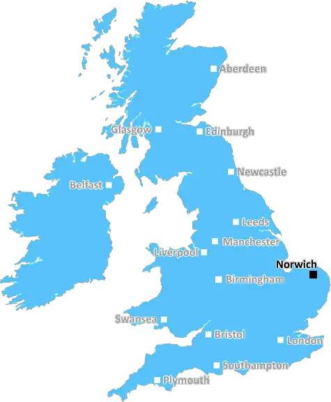
Norwich (NR34)
The NR34 postcode area is located in the Norwich postcode town region, within the county of Norfolk, and contains a total of 924 individual postcodes.
There are 90 electoral wards in the NR34 postcode area, including Attleborough, Beccles, Bungay, Cromer, Dereham, Fakenham, Great Yarmouth, Holt, Lowestoft, Melton Constable, North Walsham, Norwich, Sheringham, Walsingham, Wells-Next-The-Sea, Wymondham which come under the local authority of the South Norfolk Council.
Combining the whole postcode region, 20% of people in NR34 are classed as having an AB social grade, (i.e. 'white-collar' middle-upper class), compared to 27% across the UK.
This does not mean that the people of NR34 are poorer than other areas, but it may give an indication that there are areas of deprivation.
The NR34 postcode covers the coastal village of Corton and the villages of Lowestoft, Kirkley, Oulton Broad, Pakefield and Carlton Colville in the Waveney district of Suffolk in the United Kingdom. The total population of the postcode area is 13,861, with 6.9% of those being of retirement age, 24.8% of working age, and 68.3% of school-age children.
Corton, with an estimated population of 1,704, is the largest settlement in the postcode area. It is known for its beach, as well as the medieval church of St Andrew's. Corton, like much of the Suffolk coast, offers a great variety of activities and attractions, including a wide range of shops, pubs and restaurants, golf courses, and a seaside amusement park.
Lowestoft is a small town and a civil parish in the Waveney district, with an estimated population of 60,627. It is the easternmost settlement in the United Kingdom, and has been home to the famous Sparrows Fish & Chips restaurant since the 1800s. Lowestoft is home to the award-winning Lowestoft Seafront, which is a popular location for fishing, boat trips and beach sports.
Kirkley, with an estimated population of 2,783, is a small village located to the east of Lowestoft. The village offers a wide range of amenities, including a cricket club, the Kirkley Hall zoological gardens, a museum and a variety of shops. It is also home to the popular Kirkley Mills, which are well known for their attendance at the Lowestoft Saturday market.
Oulton Broad is a broad located next to the town of Lowestoft, and has an estimated population of 3,629. It is part of the Broads network, and is home to a variety of outdoor activities such as kayaking, fishing, sailing and power boat racing.
Pakefield, with an estimated population of 6,392, is a coastal village located to the north of Lowestoft. It is popular for its Blue Flag beaches, which have provided many opportunities for sailing, jet-skiing and a number of other activities. It is one of the closest towns to the historic site of Sutton Hoo, which is a popular destination for day-trippers.
Carlton Colville, with an estimated population of 4,289, is a large village located to the north-west of Lowestoft. It is home to a variety of historical landmarks, including the ruins of the 13th century St Mary the Virgin church, as well as a variety of shops and businesses. It is also home to the Carlton Colville Golf and Country Club, which has an 18-hole golf course, and a variety of outdoor activities such as tennis, squash and lawn bowls.

Demographics

Norfolk

NR34 is located in the county of Norfolk, in England.
Norfolk has a total population of 892,900, making it the 25th largest county in the UK.
Norfolk has a total area of 2080 square miles, and a population density of 165 people per square kilometre. For comparison, Greater London has a density of 5,618 people/km2.
| Outward Code | NR34 |
| Postal Town | Norwich |
| MSOA Name | South Norfolk 010 |
| LSOA Name | South Norfolk 010C |
| County | Norfolk |
| Region | Norfolk |
| Country | England |
| Local Authority | South Norfolk |
| Area Classification | Mainly Rural (rural including hub towns >=80%) |
NR34 Electoral Wards
The postal region of NR34, includes the local towns, villages, electoral wards and stations of:
Dig even deeper into the NR34 postcode by clicking on a postcode below:
Click on an outward postal code below for more information about the area. Each 'outward' postcode give you a comprehensive list of all postcodes within the outward code area (NR) and estimated address.
Click on an 'outward' code for more information. For example, the outward postcode page 'EC2M' will give you an alphabetical list covering all postcodes located in the region, from 'EC2M 1BB' through to 'EC2M 7YA'.
Chris H
Wednesday, May 8, 2024
We don't have any views of NR34 right now. If you live in NR34 or have visited it, please help us to help others by telling others what you think of this neighbourhood.
Add your view of NR34
People need your local expertise. If you live in NR34 or have first-hand knowledge of the neighbourhood, please consider sharing your views. It's completely anonymous - all we ask is for your initials.
Please tell us what you like about the NR34 postcode area, what you don't like, and what it's like to live or work here.
| LOCAL AMENITIES | |
| FAMILY FRIENDLY | |
| PARKING | |
| GREEN SPACES |
Local News Suffolk
'Footballer has made my dog a local celebrity'
Emma Mildwater says people are recognising Teddy after Ipswich's Harry Clarke was pictured with him.
BBC NewsHighpoint: Jail to job training success
How Suffolk's prisoners are being prepared for work.
BBC NewsEd Sheeran to celebrate with Ipswich Town players
The Suffolk-born popstar calls the team to plan a big celebration once he is back in the UK.
BBC NewsSchool cleaner changes tack to help deaf pupils
Kim Farthing recalls her own struggles and she now helps schoolchildren who have hearing impairments.
BBC NewsBluetongue virus warning as midges blown into UK
Midges blown from northern Europe could spread a serious virus across farms in England, experts warn.
BBC NewsLord of the Rings actor Bernard Hill dies aged 79
His fellow actors from the 1997 Oscar-winning film pay tribute to a star whose career spanned decades.
BBC NewsWill Ipswich Town promotion boost the economy?
Businesses in the area are saying that the local economy will get a boost
BBC NewsMcKenna guides Ipswich back to 'promised land'
Just two and a half years into his managerial career, Kieran McKenna has guided Ipswich to two promotions and a return to the Premier League.
BBC NewsFrom the Postcode Area blog

Deciphering Crime Rates - a Deep Dive Into UK Postcode Analysis
Ever wondered about the crime rate in your UK postcode? You're not alone. We've dug deep into the data, uncovering trends and patterns that'll make your head spin.

Death of the High Street?
The BBC reports that despite councils' attempts to kurb them, the UK's high streets have seen a huge growth in fast food outlets. Could this mark the death knell for the Great British high street, and what can we do about it to halt its decline?

Discrimination by Postcode
You really couldn't make it up, could you? Some of the country's most vulnerable people are missing out on their weekly £25 Cold Weather Payment, just because the system that's in operation is discriminating against them because payments are based on postcode, rather than geographic location.

The Redesign is Underway
Well, the current website was absolutely in dire need of a good redesign - from the ground up. So I set out to pull it all apart and get it up and running again to become the most comprehensive guide to every postcode in the UK. And it's been a long, tough job from start to finish - and quite possibly the biggest project I've ever undertaken.
SOCIAL GRADES
According to census records, 20% of people here have a social grade of AB (highest), compared to the national average of 27%.