norwich NR13 Postcodes
Spending a fortune on conveyancing?

Compare instant, low-cost online quotes from trusted conveyancing solicitors.
Backed by experts, our no-obligation service searches through the best conveyancing quotes on the market to save you time and money.
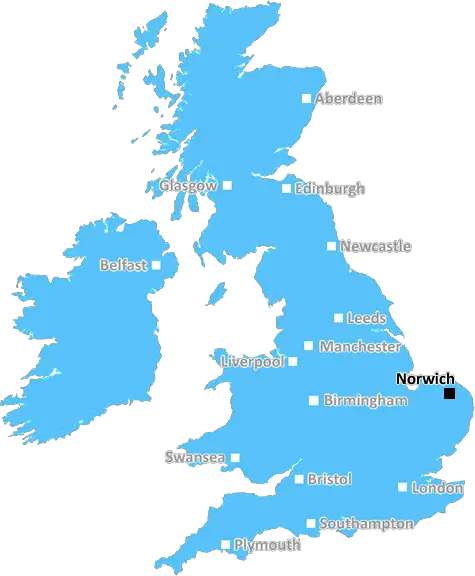
Norwich (NR13)
The NR13 postcode area is located in the Norwich postcode town region, within the county of Norfolk, and contains a total of 1131 individual postcodes.
There are 83 electoral wards in the NR13 postcode area, including Attleborough, Beccles, Bungay, Cromer, Dereham, Fakenham, Great Yarmouth, Holt, Lowestoft, Melton Constable, North Walsham, Norwich, Sheringham, Walsingham, Wells-Next-The-Sea, Wymondham which come under the local authority of the Broadland Council.
Combining the whole postcode region, 23% of people in NR13 are classed as having an AB social grade, (i.e. 'white-collar' middle-upper class), compared to 27% across the UK.
This does not mean that the people of NR13 are poorer than other areas, but it may give an indication that there are areas of deprivation.
NR13 is a postcode in the Norwich district of Norfolk, England. It covers most of Wroxham and Hoveton, two villages situated just north of Norwich. Additionally, part of the postcode area includes Coltishall, the former site of RAF Coltishall.
The area is well known for its close proximity to the River Bure and the Norfolk Broads. The area is popular for fishing, sailing, birdwatching, and boat trips. Additionally, Wroxham and Hoveton are popular destinations for day trippers, and Wroxham is nicknamed �The Capital of the Broads'.
The NR13 postcode area is mainly rural, with its sole urban area, Coltishall, having a population of 2,040 people as of the 2011 Census. The population of the area is around 11,000 people living in around 4,000 homes.
Local education is provided mainly by Wroxham and Hoveton Primary School. Furthermore, the area is served by East Tuddenham & Scottow Parish Council, which oversees local issues such as traffic management, planning, and environmental policy.
The area is served by regular bus services to Norwich and beyond, as well as rail services to Norwich provided by Wroxham Station. A number of local shops, pubs, and cafes are located in the area, including the White Horse Inn located in Hoveton, and the award-winning Yachtsman Pub in Wroxham. The area is home to several attractive and historic churches, including St.Mary's Church in Coltishall, and the Grade I listed St. John the Baptist Church in Hoveton.
The postcode also includes several important historical sites, such as Horstead Manor and Ranworth Broad. The village of Horstead is known for its old mill, one of the oldest working mills in the country, and Ranworth Broad is a National Nature Reserve with abundant birdlife.
TheNR13 postcode area is a peaceful and rural area with a wide range of things to do and see. It offers an array of natural beauty from the River Bure, the Norfolk Broads, and the quaint villages of Wroxham and Hoveton. Additionally, the area provides convenient access to the city of Norwich and its surrounding attractions.

Demographics

Norfolk

NR13 is located in the county of Norfolk, in England.
Norfolk has a total population of 892,900, making it the 25th largest county in the UK.
Norfolk has a total area of 2080 square miles, and a population density of 165 people per square kilometre. For comparison, Greater London has a density of 5,618 people/km2.
| Outward Code | NR13 |
| Postal Town | Norwich |
| MSOA Name | Broadland 018 |
| LSOA Name | Broadland 018A |
| County | Norfolk |
| Region | Norfolk |
| Country | England |
| Local Authority | Broadland |
| Area Classification | Urban with Significant Rural (rural including hub towns 26-49%) |
NR13 Electoral Wards
The postal region of NR13, includes the local towns, villages, electoral wards and stations of:
Dig even deeper into the NR13 postcode by clicking on a postcode below:
Click on an outward postal code below for more information about the area. Each 'outward' postcode give you a comprehensive list of all postcodes within the outward code area (NR) and estimated address.
Click on an 'outward' code for more information. For example, the outward postcode page 'EC2M' will give you an alphabetical list covering all postcodes located in the region, from 'EC2M 1BB' through to 'EC2M 7YA'.
Chris H
Tuesday, May 7, 2024
We don't have any views of NR13 right now. If you live in NR13 or have visited it, please help us to help others by telling others what you think of this neighbourhood.
Add your view of NR13
People need your local expertise. If you live in NR13 or have first-hand knowledge of the neighbourhood, please consider sharing your views. It's completely anonymous - all we ask is for your initials.
Please tell us what you like about the NR13 postcode area, what you don't like, and what it's like to live or work here.
| LOCAL AMENITIES | |
| FAMILY FRIENDLY | |
| PARKING | |
| GREEN SPACES |
Local News Norfolk
Knifeman killed victim then confessed to ex-partner
A judge describes Theodore Lynch as a "a habitual carrier of knives".
BBC NewsTeen charged with attempted murder absconds
A police search is under way to find the teenager after he left a care facility.
BBC NewsTories lose majority on South Norfolk Council
The district elects its first Green councillor, wiping out a slim majority for the Tories.
BBC NewsWhat makes ginger tom cats so adventurous?
One expert believes it could be a "Viking disposition" making them fearless and more confident.
BBC NewsMan receives caution after BB gun seized on bus
Police say that armed officers had to board the bus in Norwich city centre at the time.
BBC NewsDrivers facing 64-mile diversion at major road
The rerouting over the next few days is to allow for new road markings, says National Highways.
BBC NewsNorfolk elects Labour police and crime commissioner
Sarah Taylor becomes the first woman and first Labour candidate to hold the role.
BBC NewsLocal election results in maps and charts
Analysis of results in the local elections 2024, including the London mayor and councils around England.
BBC NewsFrom the Postcode Area blog

Deciphering Crime Rates - a Deep Dive Into UK Postcode Analysis
Ever wondered about the crime rate in your UK postcode? You're not alone. We've dug deep into the data, uncovering trends and patterns that'll make your head spin.

Death of the High Street?
The BBC reports that despite councils' attempts to kurb them, the UK's high streets have seen a huge growth in fast food outlets. Could this mark the death knell for the Great British high street, and what can we do about it to halt its decline?

Discrimination by Postcode
You really couldn't make it up, could you? Some of the country's most vulnerable people are missing out on their weekly £25 Cold Weather Payment, just because the system that's in operation is discriminating against them because payments are based on postcode, rather than geographic location.

The Redesign is Underway
Well, the current website was absolutely in dire need of a good redesign - from the ground up. So I set out to pull it all apart and get it up and running again to become the most comprehensive guide to every postcode in the UK. And it's been a long, tough job from start to finish - and quite possibly the biggest project I've ever undertaken.
SOCIAL GRADES
According to census records, 23% of people here have a social grade of AB (highest), compared to the national average of 27%.