milton-keynes MK7 Postcodes
Spending a fortune on conveyancing?

Compare instant, low-cost online quotes from trusted conveyancing solicitors.
Backed by experts, our no-obligation service searches through the best conveyancing quotes on the market to save you time and money.
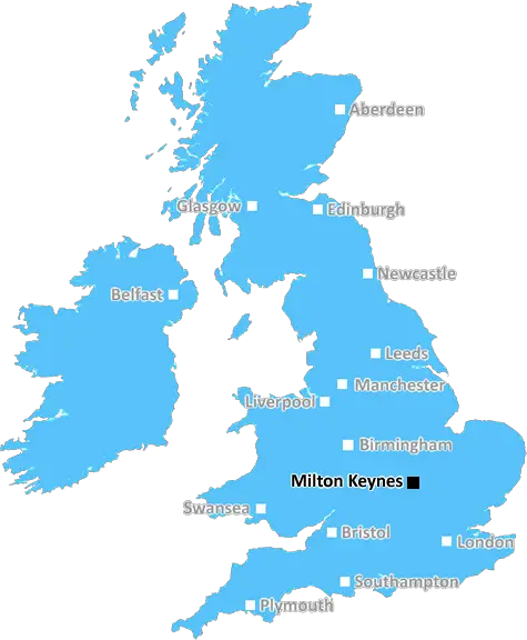
Milton Keynes (MK7)
The MK7 postcode area is located in the Milton Keynes postcode town region, within the county of Buckinghamshire, and contains a total of 642 individual postcodes.
There are 12 electoral wards in the MK7 postcode area, including Bedford, Buckingham, Milton Keynes, Newport Pagnell, Olney which come under the local authority of the Milton Keynes Council.
Combining the whole postcode region, 31% of people in MK7 are classed as having an AB social grade, (i.e. 'white-collar' middle-upper class), compared to 27% across the UK.
This does not mean that the people of MK7 are wealthier - or higher class - than average, but it can be an indication that the area may be prospering and desirable to live in.
The MK7 postcode is an area in the Milton Keynes urban district, in the county of Buckinghamshire, United Kingdom. It is neighboured by several other postcodes, including MK6 to the north, MK8 to the east, MK9 to the south, and MK11 to the west. MK7 covers a total area of 19.68 square kilometres, and a population of approximately 7,400, as of the 2011 census.
Locals of MK7 are served by three primary schools; Shenley Brook End, Brooklands and Blecheley. The area also hosts a leisure centre, a 26 acre park, a library, and the Milton Keynes Arts Centre. Directly south of MK7 lies Stony Stratford where locals can find supermarkets, pubs, shops, services and takeaway food outlets.
MK7 features many residential neighbourhoods, each with its own distinct character and selection of amenities. Furzton neighbourhood is located at the northern tip of MK7, and is one of the district's largest areas. It has a large lake and wetlands, and is home to a variety of wildlife, with foxes, rabbits, roe deer, ducks, and geese among the locals. To the south, there is Bancroft, an idyllic suburb filled with malls, restaurants, and outdoor green spaces to explore.
The area's roads are well maintained and equipped with a number of bus services, to provide locals with easy access to the nearby city of Milton Keynes. A cycle path also winds its way through MK7, allowing cyclists to easily explore the district. The area is a great place to live, and a perfect spot for commuters who prefer to hop on a train, as Wolverton railway station is only a short distance away.
The local council of MK7 is known as the Milton Keynes Borough Council, and has a number of leisure facilities, and services available to its residents, such as a weekly waste collection, libraries, and community centres. The council also provides educational and health services in the area.

Demographics
Buckinghamshire

MK7 is located in the county of Buckinghamshire, in England.
Buckinghamshire has a total population of 799,200, making it the 30th largest county in the UK.
Buckinghamshire has a total area of 723 square miles, and a population density of 426 people per square kilometre. For comparison, Greater London has a density of 5,618 people/km2.
| Outward Code | MK7 |
| Postal Town | Milton Keynes |
| MSOA Name | Milton Keynes 017 |
| LSOA Name | Milton Keynes 017C |
| County | Buckinghamshire |
| Region | Buckinghamshire |
| Country | England |
| Local Authority | Milton Keynes |
| Area Classification | Urban with City and Town |
MK7 Electoral Wards
The postal region of MK7, includes the local towns, villages, electoral wards and stations of:
Dig even deeper into the MK7 postcode by clicking on a postcode below:
Click on an outward postal code below for more information about the area. Each 'outward' postcode give you a comprehensive list of all postcodes within the outward code area (MK) and estimated address.
Click on an 'outward' code for more information. For example, the outward postcode page 'EC2M' will give you an alphabetical list covering all postcodes located in the region, from 'EC2M 1BB' through to 'EC2M 7YA'.
Chris H
Thursday, May 9, 2024
We don't have any views of MK7 right now. If you live in MK7 or have visited it, please help us to help others by telling others what you think of this neighbourhood.
Add your view of MK7
People need your local expertise. If you live in MK7 or have first-hand knowledge of the neighbourhood, please consider sharing your views. It's completely anonymous - all we ask is for your initials.
Please tell us what you like about the MK7 postcode area, what you don't like, and what it's like to live or work here.
| LOCAL AMENITIES | |
| FAMILY FRIENDLY | |
| PARKING | |
| GREEN SPACES |
Local News Buckinghamshire
Cancer scans delayed over supply issues - hospital
The problem was over the "failure" of a radioactive liquid used in the procedure, an NHS trust said.
BBC NewsFormer school in Kent leads Clive Emson's May auction
The May catalogue features 149 residential and commercial lotsfrom across southern England.
Property WeekBedfordshire elects first Labour PCC in eight years
John Tizard becomes police and crime commissioner, beating Conservative Festus Akinbusoye.
BBC NewsBeer keg logistics firm moves into MK 147
US-based company Kegstaris expanding its presence in Europe.
Property WeekChancerygate gets greenlight for Leatherhead logistics scheme
Victory Parkwill comprise 13 leasehold units ranging from 3,000 to 19,000 sq ft.
Property WeekDeveloping housing in the South East Nimby heartlands'
Thakeham chief executive Rob Boughton talks to Ciaran Nerval about combating Nimbyism and negative views of development.
Property WeekKnight Frank reports 25% leap in Golden Triangle life sciences take-up
Around 186,000 sq ft of space in London, Oxford and Cambridge was let in Q1 2024.
Property WeekWarburtons signs pre-let at Symmetry Park Biggleswade
The bakery brand has agreed a 25-year lease withTritax Symmetry for65,847 sq ft.
Property WeekFrom the Postcode Area blog

Deciphering Crime Rates - a Deep Dive Into UK Postcode Analysis
Ever wondered about the crime rate in your UK postcode? You're not alone. We've dug deep into the data, uncovering trends and patterns that'll make your head spin.

Death of the High Street?
The BBC reports that despite councils' attempts to kurb them, the UK's high streets have seen a huge growth in fast food outlets. Could this mark the death knell for the Great British high street, and what can we do about it to halt its decline?

Discrimination by Postcode
You really couldn't make it up, could you? Some of the country's most vulnerable people are missing out on their weekly £25 Cold Weather Payment, just because the system that's in operation is discriminating against them because payments are based on postcode, rather than geographic location.

The Redesign is Underway
Well, the current website was absolutely in dire need of a good redesign - from the ground up. So I set out to pull it all apart and get it up and running again to become the most comprehensive guide to every postcode in the UK. And it's been a long, tough job from start to finish - and quite possibly the biggest project I've ever undertaken.
SOCIAL GRADES
According to census records, 31% of people here have a social grade of AB (highest), compared to the national average of 27%.