leicester LE11 Postcodes
Spending a fortune on conveyancing?

Compare instant, low-cost online quotes from trusted conveyancing solicitors.
Backed by experts, our no-obligation service searches through the best conveyancing quotes on the market to save you time and money.
Leicester (LE11)
The LE11 postcode area is located in the Leicester postcode town region, within the county of Leicestershire, and contains a total of 2015 individual postcodes.
There are 8 electoral wards in the LE11 postcode area, including Ashby-De-La-Zouch, Coalville, Hinckley, Ibstock, Leicester, Loughborough, Lutterworth, Market Harborough, Markfield, Melton Mowbray, Oakham, Wigston which come under the local authority of the Charnwood Council.
Combining the whole postcode region, 25% of people in LE11 are classed as having an AB social grade, (i.e. 'white-collar' middle-upper class), compared to 27% across the UK.
This does not mean that the people of LE11 are poorer than other areas, but it may give an indication that there are areas of deprivation.
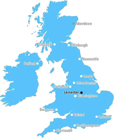
The LE11 postcode is an area code for the town of Loughborough, located in the county of Leicestershire in England. It covers central Loughborough, including the well-known Loughborough University, and parts of surrounding villages such as Rothley, Mountsorrel, Quorn, Barrow-upon-Soar and Woodhouse Eaves.
Loughborough is a large town in the midlands of England, located close to Leicester, Nottingham and Derby. The area has a population of around 57,000 and is the home of Loughborough University, a world-renowned higher education establishment since 1909. Loughborough is known for its entrepreneurial spirit and is home to many highly respected businesses.
The LE11 postcode covers many different areas, from busy streets with restaurants, bars and retail outlets, to peaceful residential areas and picturesque villages. There are a large number of parks and open spaces, some of which are managed by Charnwood Borough Council, and plenty of places to visit in the area. Attractions in the LE11 postcode include Queen's Park, with a lake for fishing, ten-pin bowling and adventure golf; Loughborough Town Hall, a Grade II listed building; and Great Central Railway, which provides steam train rides from Leicester to Loughborough.
The area is well linked to the rest of the district with an efficient public transport system. By car, visitors to the area can take the A6 and M1 motorways, or the A512 and A6116 roads. Bus routes serve the area and there are rail links to Nottingham and Leicester; East Midlands Airport is also nearby.
Leicester is just a short drive from the LE11 postcode, offering extensive shopping, cultural attractions, and entertainment. The city also houses the National Space Centre, a fantastic visitor attraction with many interactive activities and educational displays.
Loughborough is a vibrant and welcoming town, with many events taking place throughout the year. These include the Loughborough Carnival, an annual event in May; the Summer Fete, which is held at the University campus; the Loughborough Show each August; and the popular Melton Mowbray Food Festival each October.

Demographics

Leicestershire

LE11 is located in the county of Leicestershire, in England.
Leicestershire has a total population of 1,031,300, making it the 21st largest county in the UK.
Leicestershire has a total area of 832 square miles, and a population density of 478 people per square kilometre. For comparison, Greater London has a density of 5,618 people/km2.
| Outward Code | LE11 |
| Postal Town | Leicester |
| MSOA Name | Charnwood 003 |
| LSOA Name | Charnwood 003A |
| County | Leicestershire |
| Region | Leicestershire |
| Country | England |
| Local Authority | Charnwood |
| Area Classification | Urban with City and Town |
LE11 Electoral Wards
The postal region of LE11, includes the local towns, villages, electoral wards and stations of:
Dig even deeper into the LE11 postcode by clicking on a postcode below:
Click on an outward postal code below for more information about the area. Each 'outward' postcode give you a comprehensive list of all postcodes within the outward code area (LE) and estimated address.
Click on an 'outward' code for more information. For example, the outward postcode page 'EC2M' will give you an alphabetical list covering all postcodes located in the region, from 'EC2M 1BB' through to 'EC2M 7YA'.
Chris H
Saturday, April 6, 2024
We don't have any views of LE11 right now. If you live in LE11 or have visited it, please help us to help others by telling others what you think of this neighbourhood.
Add your view of LE11
People need your local expertise. If you live in LE11 or have first-hand knowledge of the neighbourhood, please consider sharing your views. It's completely anonymous - all we ask is for your initials.
Please tell us what you like about the LE11 postcode area, what you don't like, and what it's like to live or work here.
| LOCAL AMENITIES | |
| FAMILY FRIENDLY | |
| PARKING | |
| GREEN SPACES |
Local News Leicestershire
Warning to 'stay on guard' after cyber-attack
The council says work is ongoing to find out the amount and nature of data which was taken.
BBC NewsBody in caravan thought to be wanted sex offender
Police said Richard Scatchard had links to Leicestershire and was on prison recall.
BBC NewsBaby whose heart works at 20% reaches first birthday
Doctors feared Willow, who has dilated cardiomyopathy, would not survive but she defied the odds.
BBC NewsNearly 100 drivers flagged in car cruise crackdown
Officers targeted nuisance drivers in the Castle Donington area over the Easter weekend.
BBC NewsYorkshire bowlers chip away at Leics at Headingley
George Hill takes three wickets as Yorkshire chip away at Leicestershire on a rain-hit opening day.
BBC NewsMP 'sorry' for sharing private numbers on dating app
Leicestershire Police say they are investigating one of up to 12 cases reported nationally.
BBC NewsTMS commentator Agnew signs new deal with BBC Sport
Jonathan Agnew will continue to lead the Test Match Special team after agreeing a new four-year deal with BBC Sport.
BBC NewsCommunity rallies to help fire-damaged pub reopen
The Leicestershire pub was badly damaged by a fire more than a year ago.
BBC NewsFrom the Postcode Area blog

Deciphering Crime Rates - a Deep Dive Into UK Postcode Analysis
Ever wondered about the crime rate in your UK postcode? You're not alone. We've dug deep into the data, uncovering trends and patterns that'll make your head spin.

Death of the High Street?
The BBC reports that despite councils' attempts to kurb them, the UK's high streets have seen a huge growth in fast food outlets. Could this mark the death knell for the Great British high street, and what can we do about it to halt its decline?

Discrimination by Postcode
You really couldn't make it up, could you? Some of the country's most vulnerable people are missing out on their weekly £25 Cold Weather Payment, just because the system that's in operation is discriminating against them because payments are based on postcode, rather than geographic location.

The Redesign is Underway
Well, the current website was absolutely in dire need of a good redesign - from the ground up. So I set out to pull it all apart and get it up and running again to become the most comprehensive guide to every postcode in the UK. And it's been a long, tough job from start to finish - and quite possibly the biggest project I've ever undertaken.
SOCIAL GRADES
According to census records, 25% of people here have a social grade of AB (highest), compared to the national average of 27%.