hemel-hempstead HP3 Postcodes
Spending a fortune on conveyancing?

Compare instant, low-cost online quotes from trusted conveyancing solicitors.
Backed by experts, our no-obligation service searches through the best conveyancing quotes on the market to save you time and money.
Hemel Hempstead (HP3)
The HP3 postcode area is located in the Hemel Hempstead postcode town region, within the county of Hertfordshire, and contains a total of 993 individual postcodes.
There are 34 electoral wards in the HP3 postcode area, including Amersham, Aylesbury, Beaconsfield, Berkhamsted, Chalfont St Giles, Chesham, Great Missenden, Hemel Hempstead, High Wycombe, Princes Risborough, Tring which come under the local authority of the Dacorum Council.
Combining the whole postcode region, 29% of people in HP3 are classed as having an AB social grade, (i.e. 'white-collar' middle-upper class), compared to 27% across the UK.
This does not mean that the people of HP3 are wealthier - or higher class - than average, but it can be an indication that the area may be prospering and desirable to live in.
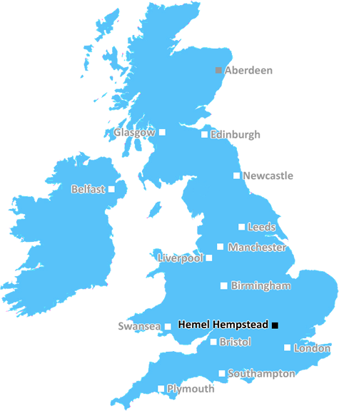
The postcode HP3 is located in affiliation with the Hemel Hempstead district of Hertfordshire in the UK. It has an approximate radius of 0.2 miles (320 metres) and is the postcode used for many residential and commercial properties from across the town. This area consists of the towns of Apsley, Aston Clinton, Bourne End, Bovingdon, Dancers End, Gaddesden Row, Green End, Leverstock Green, Nash Mills, Potten End, Two Waters, and Wilstone.
The HP3 postcode is bordered by the postcodes HP1, HP2 and HP27 in the Hemel Hempstead district. HP3 is considered to be part of the Hemel Hempstead parish, meaning that local services, such as schools, healthcare, social services, and more will be provided by Hertfordshire County Council.
A large number of businesses can be found in the HP3 postcode ranging from the retail sector such as supermarkets and department stores, to corporate headquarters. The businesses located in HP3 will be essential to the local economy, providing employment opportunities and a range of services to the area.
In terms of transport networks, the HP3 postcode has access to both bus and train services. The main bus route servicing HP3 is the 30/31 Circle Line which is operated by Arriva Hertfordshire and takes passengers in and around Hemel Hempstead. Hemel Hempstead Railway Station is the closest station to HP3, and offers direct services to London Euston and Milton Keynes Central.
The demographics of HP3 are diverse with a variety of age groups living in the area. It is also predominantly a safe place to live as it has relatively low levels of crime compared to other postcodes within Hertfordshire.
As with many areas of the UK, HP3 is subject to weather conditions and experiences cold winters and wet, warm summers. The area has colourful character with a range of outdoor activities to enjoy such as parks, sports fields, and the Grand Union Canal. All of these provide local residents with plenty of options to get outdoors, explore, stay fit, and enjoy nature.

Demographics

Hertfordshire

HP3 is located in the county of Hertfordshire, in England.
Hertfordshire has a total population of 1,176,700, making it the 12th largest county in the UK.
Hertfordshire has a total area of 634 square miles, and a population density of 716 people per square kilometre. For comparison, Greater London has a density of 5,618 people/km2.
| Outward Code | HP3 |
| Postal Town | Hemel Hempstead |
| MSOA Name | Dacorum 022 |
| LSOA Name | Dacorum 022B |
| County | Hertfordshire |
| Region | Hertfordshire |
| Country | England |
| Local Authority | Dacorum |
| Area Classification | Urban with Significant Rural (rural including hub towns 26-49%) |
HP3 Electoral Wards
The postal region of HP3, includes the local towns, villages, electoral wards and stations of:
Dig even deeper into the HP3 postcode by clicking on a postcode below:
Click on an outward postal code below for more information about the area. Each 'outward' postcode give you a comprehensive list of all postcodes within the outward code area (HP) and estimated address.
Click on an 'outward' code for more information. For example, the outward postcode page 'EC2M' will give you an alphabetical list covering all postcodes located in the region, from 'EC2M 1BB' through to 'EC2M 7YA'.
BAC, hemel-hempstead
Sunday, July 28, 2019
We love living here, and have done so for 34 years. The houses are well built and spacious with good sized gardens. We are very much part of the Leverstock Green Community, and the emphasis is on Comunity. (Once moved to Leverstock Green area, most people tend to stay in the area even if they move house We have excellent primary schools, and Longdean Secondary School is in the area. Although I am not personally into sport, there are thriving football and cricket clubs. The area has a very long and interesting history, going back to the Iron Age and before. Bunkers Park is a short walk, and although much developed since the coming of the New Town, there is still a semi-rural feel to the area. It is a great place to live.
Add your view of HP3
People need your local expertise. If you live in HP3 or have first-hand knowledge of the neighbourhood, please consider sharing your views. It's completely anonymous - all we ask is for your initials.
Please tell us what you like about the HP3 postcode area, what you don't like, and what it's like to live or work here.
| LOCAL AMENITIES | |
| FAMILY FRIENDLY | |
| PARKING | |
| GREEN SPACES |
Local News Hertfordshire
DJ Greg James apologises for glass eye comment
James and Chris Smith say sorry for saying a glass eye would make a book character "more revolting".
BBC NewsForest Green Rovers 0-2 Milton Keynes Dons
MK Dons' automatic promotion hopes are handed a boost as goals in each half from Max Dean and Alex Gilbey sealed a 2-0 League Two win at bottom club Forest Green.
BBC News99 for a private ambulance in Hertfordshire
MET Medical has launched the service for St Albans, Harpenden, Hatfield and Welwyn.
BBC NewsFour-year-old girl and mum missing, say police
The pair were last seen at their home in February and have links to Birmingham, police say.
BBC NewsA huge victory' - Morris' 90th-minute goal lifts Luton
Carlton Morris' late winner boosts Luton's Premier League survival hopes as they come from behind to beat Bournemouth.
BBC NewsAm-dram group thankful for support after burglary
The group says equipment worth about 5,000 was taken from its village hall base.
BBC NewsBus driver in hospital after crashing into wall
Police are appealing for information, such as dashcam footage, following the collision in St Albans.
BBC NewsExeter City 1-0 Stevenage
Exeter move into the top half of the League One table with a 1-0 win that dented Stevenage's hopes of making the play-offs.
BBC NewsFrom the Postcode Area blog

Deciphering Crime Rates - a Deep Dive Into UK Postcode Analysis
Ever wondered about the crime rate in your UK postcode? You're not alone. We've dug deep into the data, uncovering trends and patterns that'll make your head spin.

Death of the High Street?
The BBC reports that despite councils' attempts to kurb them, the UK's high streets have seen a huge growth in fast food outlets. Could this mark the death knell for the Great British high street, and what can we do about it to halt its decline?

Discrimination by Postcode
You really couldn't make it up, could you? Some of the country's most vulnerable people are missing out on their weekly £25 Cold Weather Payment, just because the system that's in operation is discriminating against them because payments are based on postcode, rather than geographic location.

The Redesign is Underway
Well, the current website was absolutely in dire need of a good redesign - from the ground up. So I set out to pull it all apart and get it up and running again to become the most comprehensive guide to every postcode in the UK. And it's been a long, tough job from start to finish - and quite possibly the biggest project I've ever undertaken.
SOCIAL GRADES
According to census records, 29% of people here have a social grade of AB (highest), compared to the national average of 27%.