hemel-hempstead HP12 Postcodes
Spending a fortune on conveyancing?

Compare instant, low-cost online quotes from trusted conveyancing solicitors.
Backed by experts, our no-obligation service searches through the best conveyancing quotes on the market to save you time and money.
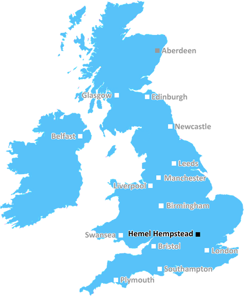
Hemel Hempstead (HP12)
The HP12 postcode area is located in the Hemel Hempstead postcode town region, within the county of Buckinghamshire, and contains a total of 809 individual postcodes.
There are 8 electoral wards in the HP12 postcode area, including Amersham, Aylesbury, Beaconsfield, Berkhamsted, Chalfont St Giles, Chesham, Great Missenden, Hemel Hempstead, High Wycombe, Princes Risborough, Tring which come under the local authority of the Wycombe Council.
Combining the whole postcode region, 25% of people in HP12 are classed as having an AB social grade, (i.e. 'white-collar' middle-upper class), compared to 27% across the UK.
This does not mean that the people of HP12 are poorer than other areas, but it may give an indication that there are areas of deprivation.
The HP12 postcode in the Hemel Hempstead district covers parts of the towns of Great Missenden and Prestwood, as well as the Hemel Hempstead villages of Frogmore, Little Kingshill and Little Missenden. The area benefits from fantastic transport links, with bus routes to Hemel Hempstead and Wycombe, plus the nearby Great Missenden Station giving access to the rail network.
HP12 provides access to some superb open spaces, including the Chiltern Hills, bounded by the Misbourne and Chess valleys, and the Chilterns Area of Outstanding Natural Beauty. The area is home to the National Trust-protected Ashridge Estate, a 5,000-acre area of woodland, hills and open countryside, as well as Pencittall Hill, a chalk ridge and local nature reserve.
Shopping in HP12 is provided by independent stores in the area, as well as the large retail park on the A40 at High Wycombe. There is also a great choice of acclaimed restaurants, such as The Greyhound Pub in Great Missenden and Quality Fish & Chip shops in Prestwood.
Due to the area's superb transport links, HP12 locals have easy access to fantastic attractions during their spare time. Amenities on offer in the Hemel Hempstead town centre include the waterside Riverside Shopping Centre, the Snow Centre ski slope, the Gadebridge Park adventure playground, a multiplex cinema, and the Magic Roundabout mini-golf course. Other attractions within a short drive away include the Waddesdon Manor in Buckinghamshire and The Ridgeway National Trail.
The area is home to a variety of excellent schools, including the outstanding Great Missenden Primary School, Buckinghamshire Grammar School, and The Marlowe Academy. It has a warm and close-knit community, and benefits from several well-maintained public spaces, such as Nickey Line Park and Desborough Country park.

Demographics

Buckinghamshire

HP12 is located in the county of Buckinghamshire, in England.
Buckinghamshire has a total population of 799,200, making it the 30th largest county in the UK.
Buckinghamshire has a total area of 723 square miles, and a population density of 426 people per square kilometre. For comparison, Greater London has a density of 5,618 people/km2.
| Outward Code | HP12 |
| Postal Town | Hemel Hempstead |
| MSOA Name | Wycombe 013 |
| LSOA Name | Wycombe 013C |
| County | Buckinghamshire |
| Region | Buckinghamshire |
| Country | England |
| Local Authority | Wycombe |
| Area Classification | Urban with Significant Rural (rural including hub towns 26-49%) |
HP12 Electoral Wards
The postal region of HP12, includes the local towns, villages, electoral wards and stations of:
Dig even deeper into the HP12 postcode by clicking on a postcode below:
Click on an outward postal code below for more information about the area. Each 'outward' postcode give you a comprehensive list of all postcodes within the outward code area (HP) and estimated address.
Click on an 'outward' code for more information. For example, the outward postcode page 'EC2M' will give you an alphabetical list covering all postcodes located in the region, from 'EC2M 1BB' through to 'EC2M 7YA'.
Chris H
Monday, April 15, 2024
We don't have any views of HP12 right now. If you live in HP12 or have visited it, please help us to help others by telling others what you think of this neighbourhood.
Add your view of HP12
People need your local expertise. If you live in HP12 or have first-hand knowledge of the neighbourhood, please consider sharing your views. It's completely anonymous - all we ask is for your initials.
Please tell us what you like about the HP12 postcode area, what you don't like, and what it's like to live or work here.
| LOCAL AMENITIES | |
| FAMILY FRIENDLY | |
| PARKING | |
| GREEN SPACES |
Local News Buckinghamshire
Former school in Kent leads Clive Emson's May auction
The May catalogue features 149 residential and commercial lotsfrom across southern England.
Property WeekThames Valley's police commissioner candidates
Meet the candidates preparing for the election in May.
BBC NewsMansfield edge towards promotion with big MK Dons win
Mansfield Town move closer to promotion from League Two after a comfortable 4-1 win over promotion rivals MK Dons.
BBC NewsPlaces for People acquires Rosewood Housing
The affordable homes provider was previously owned by housing developer Inland Homes.
Property WeekCountdown: Bucks doctor gets racist comments
Dr Nighat Arif received vitriol on social media after appearing on the Channel 4 show.
BBC NewsHundreds queue to hear plans for Universal resort
Universal Destinations and Experiences holds its first public event since buying land near Bedford.
BBC NewsPolice destroy cannabis factory at empty property
Officers discover 480 plants with an approximate value of over 250,000.
BBC NewsGP proud to wear hijab on Countdown despite racism
A TV doctor says she was abused on social media for wearing a hijab in dictionary corner.
BBC NewsFrom the Postcode Area blog

Deciphering Crime Rates - a Deep Dive Into UK Postcode Analysis
Ever wondered about the crime rate in your UK postcode? You're not alone. We've dug deep into the data, uncovering trends and patterns that'll make your head spin.

Death of the High Street?
The BBC reports that despite councils' attempts to kurb them, the UK's high streets have seen a huge growth in fast food outlets. Could this mark the death knell for the Great British high street, and what can we do about it to halt its decline?

Discrimination by Postcode
You really couldn't make it up, could you? Some of the country's most vulnerable people are missing out on their weekly £25 Cold Weather Payment, just because the system that's in operation is discriminating against them because payments are based on postcode, rather than geographic location.

The Redesign is Underway
Well, the current website was absolutely in dire need of a good redesign - from the ground up. So I set out to pull it all apart and get it up and running again to become the most comprehensive guide to every postcode in the UK. And it's been a long, tough job from start to finish - and quite possibly the biggest project I've ever undertaken.
SOCIAL GRADES
According to census records, 25% of people here have a social grade of AB (highest), compared to the national average of 27%.