guildford GU2 Postcodes
Spending a fortune on conveyancing?

Compare instant, low-cost online quotes from trusted conveyancing solicitors.
Backed by experts, our no-obligation service searches through the best conveyancing quotes on the market to save you time and money.
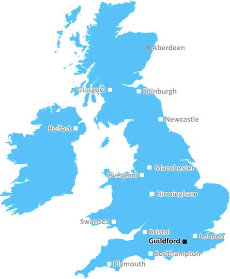
Guildford (GU2)
The GU2 postcode area is located in the Guildford postcode town region, within the county of Surrey, and contains a total of 1694 individual postcodes.
There are 13 electoral wards in the GU2 postcode area, including Aldershot, Alton, Bagshot, Bordon, Camberley, Cranleigh, Farnborough, Farnham, Fleet, Godalming, Guildford, Haslemere, Hindhead, Lightwater, Liphook, Liss, Midhurst, Petersfield, Petworth, Sandhurst, Virginia Water, Windlesham, Woking, Yateley which come under the local authority of the Guildford Council.
Combining the whole postcode region, 35% of people in GU2 are classed as having an AB social grade, (i.e. 'white-collar' middle-upper class), compared to 27% across the UK.
This does not mean that the people of GU2 are wealthier - or higher class - than average, but it can be an indication that the area may be prospering and desirable to live in.
The GU2 postcode covers areas that are around Guildford, a small city in Surrey, England. Nearby towns and villages include Aldershot, Ash vale, Badshot Lea, Ash and Aldershot Military Town. Other populated places in the GU2 area include Albury, Ash Green, Onslow Village, Normandy and Worplesdon.
The area is home to the University of Surrey, where approximiately 13,000 national and international students are currently enrolled. Guildford also hosts the Institute of Advanced Motorists, its highest performance driving school. The area has been the home of many historical figures, including Uriah Heap, the King of Crime. The area also has several local attractions, including Guildford Castle, Lord Onslow's Tilt Tour and Theatre, Guildford Cathedral and a range of good pubs.
The GU2 postcode is very well connected, with direct train links to London and regular bus services throughout the area. Residents can enjoy a good selection of shops including supermarkets, cafes, restaurants and boutiques. Guildford also offers a vibrant nightlife in the town centre, with yummy cocktails and delicious bar snacks.
Schooling in the GU2 postcode is of a high standard, with several local schools within close proximity. These include Ladymead Primary School, Lanesborough Primary School, St Catherine's College, Guildford County School and George Abbot School.
In terms of recreation, Guildford offers a wealth of options which include Guildford Ice Rink, Stoke Park, Shere Pump Rooms and The Spectrum for swimming, and the area also boasts two large parks; Stoke Hill Park and Giffords Park.
This postcode has a good balance of town and countryside, making it ideal for both families and commuters. The area continues to expand, driven by increasing house prices and development of new retail, leisure and business facilities.

Demographics

Surrey

GU2 is located in the county of Surrey, in England.
Surrey has a total population of 1,176,500, making it the 13th largest county in the UK.
Surrey has a total area of 642 square miles, and a population density of 707 people per square kilometre. For comparison, Greater London has a density of 5,618 people/km2.
| Outward Code | GU2 |
| Postal Town | Guildford |
| MSOA Name | Guildford 016 |
| LSOA Name | Guildford 016B |
| County | Surrey |
| Region | Surrey |
| Country | England |
| Local Authority | Guildford |
| Area Classification | Urban with City and Town |
GU2 Electoral Wards
The postal region of GU2, includes the local towns, villages, electoral wards and stations of:
Dig even deeper into the GU2 postcode by clicking on a postcode below:
Click on an outward postal code below for more information about the area. Each 'outward' postcode give you a comprehensive list of all postcodes within the outward code area (GU) and estimated address.
Click on an 'outward' code for more information. For example, the outward postcode page 'EC2M' will give you an alphabetical list covering all postcodes located in the region, from 'EC2M 1BB' through to 'EC2M 7YA'.
Chris H
Saturday, April 6, 2024
We don't have any views of GU2 right now. If you live in GU2 or have visited it, please help us to help others by telling others what you think of this neighbourhood.
Add your view of GU2
People need your local expertise. If you live in GU2 or have first-hand knowledge of the neighbourhood, please consider sharing your views. It's completely anonymous - all we ask is for your initials.
Please tell us what you like about the GU2 postcode area, what you don't like, and what it's like to live or work here.
| LOCAL AMENITIES | |
| FAMILY FRIENDLY | |
| PARKING | |
| GREEN SPACES |
Local News Surrey
Croydon hospital goes into partial lockdown after woman swallows poison
A woman was reported to have ingested a hazardous substance
Get SurreySurrey company fined 15k after illegally chopping down 100 protected trees
Two firms were fined almost 20,000 after pleading guilty to felling more than 100 protected tress
Get SurreyPolice find man missing since Easter Sunday
Liam has connections to Kensington and Notting Hill
Get SurreyThree-year fight for improved child road safety gets the green light
Construction of a raised zebra crossing outside St Lawrence Junior School in East Molesey can go ahead despite locals' concerns
Get SurreyLeisure centre awarded 86k from swimming pool fund
Guildford Borough Council says the funds will be used to improve the pool's energy efficiency.
BBC NewsCrackdown on boat owners moored on River Thames
The Environment Agency brought civil trespass proceedings against long-stay boaters in West Molesey.
BBC NewsResidents fear new Hersham Centre proposal will be 'another nail in the coffin'
Residents fear that the demolition of five retail units, loss of 97 car parking spaces and the addition of a six-storey building will "ruin" the Surrey village
Get SurreyLeatherhead station knifepoint phone robbery prompts police CCTV appeal
Officers believe the man and woman pictured may be able to help with the investigation
Get SurreyFrom the Postcode Area blog

Deciphering Crime Rates - a Deep Dive Into UK Postcode Analysis
Ever wondered about the crime rate in your UK postcode? You're not alone. We've dug deep into the data, uncovering trends and patterns that'll make your head spin.

Death of the High Street?
The BBC reports that despite councils' attempts to kurb them, the UK's high streets have seen a huge growth in fast food outlets. Could this mark the death knell for the Great British high street, and what can we do about it to halt its decline?

Discrimination by Postcode
You really couldn't make it up, could you? Some of the country's most vulnerable people are missing out on their weekly £25 Cold Weather Payment, just because the system that's in operation is discriminating against them because payments are based on postcode, rather than geographic location.

The Redesign is Underway
Well, the current website was absolutely in dire need of a good redesign - from the ground up. So I set out to pull it all apart and get it up and running again to become the most comprehensive guide to every postcode in the UK. And it's been a long, tough job from start to finish - and quite possibly the biggest project I've ever undertaken.
SOCIAL GRADES
According to census records, 35% of people here have a social grade of AB (highest), compared to the national average of 27%.