falkirk FK19 Postcodes
Spending a fortune on conveyancing?

Compare instant, low-cost online quotes from trusted conveyancing solicitors.
Backed by experts, our no-obligation service searches through the best conveyancing quotes on the market to save you time and money.
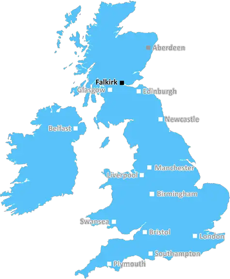
Falkirk (FK19)
The FK19 postcode area is located in the Falkirk postcode town region, within the county of Stirlingshire, and contains a total of 34 individual postcodes.
There are 13 electoral wards in the FK19 postcode area, including Alloa, Alva, Bonnybridge, Callander, Clackmannan, Crianlarich, Denny, Dollar, Doune, Dunblane, Falkirk, Grangemouth, Killin, Larbert, Lochearnhead, Menstrie, Stirling, Tillicoultry which come under the local authority of the Stirling Council.
Combining the whole postcode region, 0% of people in FK19 are classed as having an AB social grade, (i.e. 'white-collar' middle-upper class), compared to 27% across the UK.
This does not mean that the people of FK19 are poorer than other areas, but it may give an indication that there are areas of deprivation.
The FK19 postcode is part of the Central region of Scotland, located south of Stirling in the county of Clackmannanshire. It covers the small towns and villages of Dollar, Tillicoultry, Alva, Menstrie, and Coalsnaughton.
Dollar is the largest of these towns, and has a historic church, as well as the two remaining sites of the Woodside Valley and the Embro Water Valley. Tillicoultry is known for its Hosiery and Glove-Knitting industries, as well as its local museum. Alva is home to the Alva Games, which are held every July and involve a multi�sports event. Menstrie is a semi-rural village which is known for its large tower blocks, as well as the Wallace Monument, a monument to William Wallace from �Braveheart'. Coalsnaughton is a small village located near the River Devon in an area known as Devon Valley.
The FK19 postcode is also home to several schools and other educational institutions, such as Tillicoultry Primary School, Coalsnaughton Primary School, Alva Academy, and Dollar Academy. It is also home to several Ofsted outstanding facilities such as the Water of Leith and Aberfoyle Nursery.
The FK19 postcode is near the M9 and M90 motorways, and is connected to several major cities in Scotland such as Stirling (11 miles away) and Edinburgh (23 miles away). In addition, the postcode is connected to a number of bus services which provide access to the local towns and cities.
The FK19 postcode is home to a number of different amenities, from pubs and restaurants, to shops and sports centres. There is also a variety of outdoor activities available such as walking, cycling, golfing, and horse riding. There are several leisure centres and parks located in the postcode, which provide an ideal environment for families to enjoy the outdoors.
The FK19 postcode is also close to a number of historical sites such as The Doon Hill, the Glenfarg Battle Site, and the Roman Fort at Torwood. In addition, there are several visitor attractions such as the Sauchie Tower, which provides a bird's eye view of the area, and the Queen's View, which offers breathtaking views of the River Forth and the Ochils.

Demographics
Stirlingshire

FK19 is located in the county of Stirlingshire, in Scotland.
Stirlingshire has a total population of 0, making it the largest county in the UK.
Stirlingshire has a total area of square miles, and a population density of people per square kilometre. For comparison, Greater London has a density of 5,618 people/km2.
| Outward Code | FK19 |
| Postal Town | Falkirk |
| MSOA Name | Highland |
| LSOA Name | |
| County | Stirlingshire |
| Region | Stirlingshire |
| Country | Scotland |
| Local Authority | Stirling |
| Area Classification | Unclassified |
FK19 Electoral Wards
The postal region of FK19, includes the local towns, villages, electoral wards and stations of:
Dig even deeper into the FK19 postcode by clicking on a postcode below:
Click on an outward postal code below for more information about the area. Each 'outward' postcode give you a comprehensive list of all postcodes within the outward code area (FK) and estimated address.
Click on an 'outward' code for more information. For example, the outward postcode page 'EC2M' will give you an alphabetical list covering all postcodes located in the region, from 'EC2M 1BB' through to 'EC2M 7YA'.
Chris H
Wednesday, April 17, 2024
We don't have any views of FK19 right now. If you live in FK19 or have visited it, please help us to help others by telling others what you think of this neighbourhood.
Add your view of FK19
People need your local expertise. If you live in FK19 or have first-hand knowledge of the neighbourhood, please consider sharing your views. It's completely anonymous - all we ask is for your initials.
Please tell us what you like about the FK19 postcode area, what you don't like, and what it's like to live or work here.
| LOCAL AMENITIES | |
| FAMILY FRIENDLY | |
| PARKING | |
| GREEN SPACES |
From the Postcode Area blog

Deciphering Crime Rates - a Deep Dive Into UK Postcode Analysis
Ever wondered about the crime rate in your UK postcode? You're not alone. We've dug deep into the data, uncovering trends and patterns that'll make your head spin.

Death of the High Street?
The BBC reports that despite councils' attempts to kurb them, the UK's high streets have seen a huge growth in fast food outlets. Could this mark the death knell for the Great British high street, and what can we do about it to halt its decline?

Discrimination by Postcode
You really couldn't make it up, could you? Some of the country's most vulnerable people are missing out on their weekly £25 Cold Weather Payment, just because the system that's in operation is discriminating against them because payments are based on postcode, rather than geographic location.

The Redesign is Underway
Well, the current website was absolutely in dire need of a good redesign - from the ground up. So I set out to pull it all apart and get it up and running again to become the most comprehensive guide to every postcode in the UK. And it's been a long, tough job from start to finish - and quite possibly the biggest project I've ever undertaken.
SOCIAL GRADES
According to census records, 0% of people here have a social grade of AB (highest), compared to the national average of 27%.