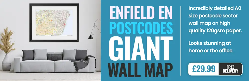
enfield EN11 Postcodes
Spending a fortune on conveyancing?

Compare instant, low-cost online quotes from trusted conveyancing solicitors.
Backed by experts, our no-obligation service searches through the best conveyancing quotes on the market to save you time and money.
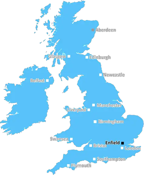
Enfield (EN11)
The EN11 postcode area is located in the Enfield postcode town region, within the county of Hertfordshire, and contains a total of 1011 individual postcodes.
There are 8 electoral wards in the EN11 postcode area, including Barnet, Broxbourne, Enfield, Hoddesdon, Potters Bar, Waltham Abbey, Waltham Cross which come under the local authority of the Broxbourne Council.
Combining the whole postcode region, 22% of people in EN11 are classed as having an AB social grade, (i.e. 'white-collar' middle-upper class), compared to 27% across the UK.
This does not mean that the people of EN11 are poorer than other areas, but it may give an indication that there are areas of deprivation.
The EN11 postcode, in United Kingdom English, covers the Enfield district, an area in northern London, England. This postcode area is bordered to the west and south by N21 and N13 postcode areas respectively, to the east by EN10 postcode area, and to the north by Brimsdown. Enfield, which constitutes of many differing settlements, is centred around the once historic town of Enfield itself.
The area is mainly residential, containing high streets, shopping centres, leisure and recreational facilities, as well as residential housing. A number of large parks can also be found throughout the district, including Trent Park, Grovelands Park, Forty Hall, and Whitewebbs Country Park.
The postcode area also provides a number of educational facilities for primary and secondary school-aged children. Some of the oldest schools operating in the area are Christ Church Primary School and St Mary Magdalene Primary School, both established in 1993. Other more recently developed establishments include St. George's Roman Catholic Primary School, St Michael's Primary School, and St Monica Roman Catholic Primary School. Oakthorpe Primary School, Cecil Jones College, and St Ignatius' College are also located in this postcode.
A number of recreational centres and leisure facilities are available throughout the district, with locations like Oak Hill Park, Paradise Wildlife Park, Enfield Market, and Waltham Abbey Garden Centre for the whole family. Popular cultural attractions in the district include the Dugdale Centre in London Borough of Enfield's Civic Centre, and Enfield Town Library which contains a range of books, magazines, DVDs, and other reference material.
Bus and rail services connecting Enfield to other parts of London and the surrounding areas are available throughout the postcode area. The Enfield Town railway station is managed by the National Rail, and is just a few miles from central London. For those who prefer surface transport, bus services covering much of the postcode area are operated by Transport for London.
In addition, the EN11 postcode is home to the Chase Farm Hospital, Broomfield House Surgery, Enfield Town Clinic, and the Barnet, Enfield and Haringey Mental Health Trust, with each of these providing the district with a range of healthcare services. As for local government services, this is provided by the London Borough of Enfield.

Demographics
Hertfordshire

EN11 is located in the county of Hertfordshire, in England.
Hertfordshire has a total population of 1,176,700, making it the 12th largest county in the UK.
Hertfordshire has a total area of 634 square miles, and a population density of 716 people per square kilometre. For comparison, Greater London has a density of 5,618 people/km2.
| Outward Code | EN11 |
| Postal Town | Enfield |
| MSOA Name | Broxbourne 002 |
| LSOA Name | Broxbourne 002E |
| County | Hertfordshire |
| Region | Hertfordshire |
| Country | England |
| Local Authority | Broxbourne |
| Area Classification | Urban with Major Conurbation |
EN11 Electoral Wards
The postal region of EN11, includes the local towns, villages, electoral wards and stations of:
Dig even deeper into the EN11 postcode by clicking on a postcode below:
Click on an outward postal code below for more information about the area. Each 'outward' postcode give you a comprehensive list of all postcodes within the outward code area (EN) and estimated address.
Click on an 'outward' code for more information. For example, the outward postcode page 'EC2M' will give you an alphabetical list covering all postcodes located in the region, from 'EC2M 1BB' through to 'EC2M 7YA'.
Chris H
Wednesday, April 10, 2024
We don't have any views of EN11 right now. If you live in EN11 or have visited it, please help us to help others by telling others what you think of this neighbourhood.
Add your view of EN11
People need your local expertise. If you live in EN11 or have first-hand knowledge of the neighbourhood, please consider sharing your views. It's completely anonymous - all we ask is for your initials.
Please tell us what you like about the EN11 postcode area, what you don't like, and what it's like to live or work here.
| LOCAL AMENITIES | |
| FAMILY FRIENDLY | |
| PARKING | |
| GREEN SPACES |
Local News Hertfordshire
Burglars targeted' Bedfordshire drama group
But the show must go on, says Barton Players secretary Keith Badham.
BBC NewsMaidenhead United 3-1 Hartlepool United
Maidenhead make sure of their National League status with a win over Hartlepool.
BBC NewsCyclist in his 60s dies after crash on major road
Police are now treating the incident as a single-vehicle collision.
BBC NewsHunting The Fox': A detective remembers
David Toes was 26 when he investigated the string of burglaries and sex attacks in 1984.
BBC NewsAthletics club saves track after pavilion closure
A charity has been set up to raise funds to build a new facility for runners to use.
BBC NewsPaul McGann remembers Withnail in Stony Stratford
The actor also talks about the specially-made replica of his Doctor Who costume.
BBC NewsTelegraph pole falls and blocks road after car crash
Police close the road so BT workers can help to restore the fallen infrastructure.
BBC NewsLuton Town boss criticises Everton points decision
The club's Chief Exec knows it could impact on whether Luton stays in the Premier League.
BBC NewsFrom the Postcode Area blog

Deciphering Crime Rates - a Deep Dive Into UK Postcode Analysis
Ever wondered about the crime rate in your UK postcode? You're not alone. We've dug deep into the data, uncovering trends and patterns that'll make your head spin.

Death of the High Street?
The BBC reports that despite councils' attempts to kurb them, the UK's high streets have seen a huge growth in fast food outlets. Could this mark the death knell for the Great British high street, and what can we do about it to halt its decline?

Discrimination by Postcode
You really couldn't make it up, could you? Some of the country's most vulnerable people are missing out on their weekly £25 Cold Weather Payment, just because the system that's in operation is discriminating against them because payments are based on postcode, rather than geographic location.

The Redesign is Underway
Well, the current website was absolutely in dire need of a good redesign - from the ground up. So I set out to pull it all apart and get it up and running again to become the most comprehensive guide to every postcode in the UK. And it's been a long, tough job from start to finish - and quite possibly the biggest project I've ever undertaken.
SOCIAL GRADES
According to census records, 22% of people here have a social grade of AB (highest), compared to the national average of 27%.