dundee DD11 Postcodes
Spending a fortune on conveyancing?

Compare instant, low-cost online quotes from trusted conveyancing solicitors.
Backed by experts, our no-obligation service searches through the best conveyancing quotes on the market to save you time and money.
Dundee (DD11)
The DD11 postcode area is located in the Dundee postcode town region, within the county of Angus, and contains a total of 1043 individual postcodes.
There are 77 electoral wards in the DD11 postcode area, including Arbroath, Brechin, Carnoustie, Dundee, Forfar, Kirriemuir, Montrose, Newport-On-Tay, Tayport which come under the local authority of the Angus Council.
Combining the whole postcode region, 0% of people in DD11 are classed as having an AB social grade, (i.e. 'white-collar' middle-upper class), compared to 27% across the UK.
This does not mean that the people of DD11 are poorer than other areas, but it may give an indication that there are areas of deprivation.
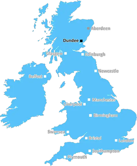
The DD11 postcode is located within the Dundee district in Scotland, UK. It covers a large portion of north eastern Dundee, encompassing the suburbs of Wellbank, Invergowrie, Baldovie and Hilltown and reaching down to Barry Links, a coastal area close to the border with Angus.
DD11 is predominantly a residential area, with much of the suburban housing in the postcode area having been built in the mid-20th century, alongside some older homes and buildings constructed in the Victorian era. It is a popular area with both owner-occupiers and tenants, with rental prices increasing in recent years due to its high demand. The area also hosts a number of parks and green spaces, which can be enjoyed by residents of the postcode and offer a pleasant escape.
Due to its convenient location, DD11 also offers access to local amenities. The postcode area includes its own library, which is situated in Hilltown, where a number of independent shops, cafes and restaurants can be found. Further shopping opportunities can be found in the nearby city centre, and a range of supermarkets are located close by too. Dundee City Airport is also only a few minutes away in DD11.
Within the postcode area, there is a variety of educational amenities, such as Montrose Primary School and St Paul's Roman Catholic Primary. Secondary schools in the area include Harris Academy, Baldragon Academy and St Paul's Roman Catholic High School. Finally, a number of higher educational facilities can be found nearby, offering students in the DD11 area the chance to gain qualifications up to degree level.
In terms of connectivity, DD11 is served by the Stagecoach One Dundee Bus services and also by train, as Invergowrie Railway Station is located just outside the postcode boundary. Additionally, the local area has a number of cycle routes, as part of Dundee City Council's Active TAY project, enabling residents to safely cycle through the district.

Demographics
Angus

DD11 is located in the county of Angus, in Scotland.
Angus has a total population of 0, making it the largest county in the UK.
Angus has a total area of square miles, and a population density of people per square kilometre. For comparison, Greater London has a density of 5,618 people/km2.
| Outward Code | DD11 |
| Postal Town | Dundee |
| MSOA Name | Arbroath Harbour |
| LSOA Name | |
| County | Angus |
| Region | Angus |
| Country | Scotland |
| Local Authority | Angus |
| Area Classification | Unclassified |
DD11 Electoral Wards
The postal region of DD11, includes the local towns, villages, electoral wards and stations of:
Dig even deeper into the DD11 postcode by clicking on a postcode below:
Click on an outward postal code below for more information about the area. Each 'outward' postcode give you a comprehensive list of all postcodes within the outward code area (DD) and estimated address.
Click on an 'outward' code for more information. For example, the outward postcode page 'EC2M' will give you an alphabetical list covering all postcodes located in the region, from 'EC2M 1BB' through to 'EC2M 7YA'.
Chris H
Friday, May 10, 2024
We don't have any views of DD11 right now. If you live in DD11 or have visited it, please help us to help others by telling others what you think of this neighbourhood.
Add your view of DD11
People need your local expertise. If you live in DD11 or have first-hand knowledge of the neighbourhood, please consider sharing your views. It's completely anonymous - all we ask is for your initials.
Please tell us what you like about the DD11 postcode area, what you don't like, and what it's like to live or work here.
| LOCAL AMENITIES | |
| FAMILY FRIENDLY | |
| PARKING | |
| GREEN SPACES |
From the Postcode Area blog

Deciphering Crime Rates - a Deep Dive Into UK Postcode Analysis
Ever wondered about the crime rate in your UK postcode? You're not alone. We've dug deep into the data, uncovering trends and patterns that'll make your head spin.

Death of the High Street?
The BBC reports that despite councils' attempts to kurb them, the UK's high streets have seen a huge growth in fast food outlets. Could this mark the death knell for the Great British high street, and what can we do about it to halt its decline?

Discrimination by Postcode
You really couldn't make it up, could you? Some of the country's most vulnerable people are missing out on their weekly £25 Cold Weather Payment, just because the system that's in operation is discriminating against them because payments are based on postcode, rather than geographic location.

The Redesign is Underway
Well, the current website was absolutely in dire need of a good redesign - from the ground up. So I set out to pull it all apart and get it up and running again to become the most comprehensive guide to every postcode in the UK. And it's been a long, tough job from start to finish - and quite possibly the biggest project I've ever undertaken.
SOCIAL GRADES
According to census records, 0% of people here have a social grade of AB (highest), compared to the national average of 27%.