derby DE56 Postcodes
Spending a fortune on conveyancing?

Compare instant, low-cost online quotes from trusted conveyancing solicitors.
Backed by experts, our no-obligation service searches through the best conveyancing quotes on the market to save you time and money.
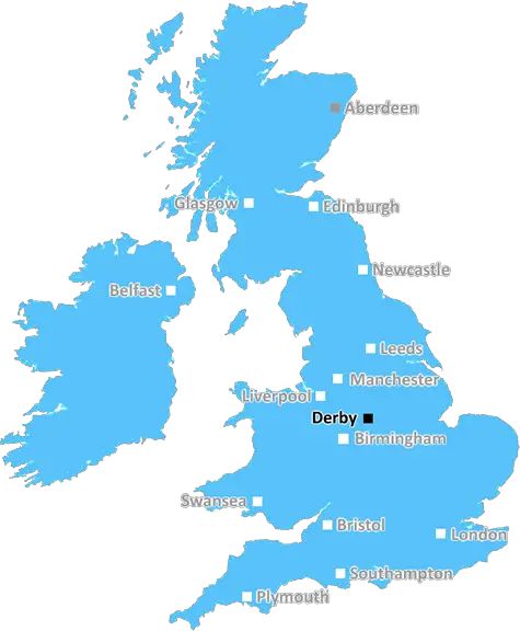
Derby (DE56)
The DE56 postcode area is located in the Derby postcode town region, within the county of Derbyshire, and contains a total of 1179 individual postcodes.
There are 75 electoral wards in the DE56 postcode area, including Alfreton, Ashbourne, Bakewell, Belper, Burton-On-Trent, Derby, Heanor, Ilkeston, Matlock, Ripley, Swadlincote which come under the local authority of the Amber Valley Council.
Combining the whole postcode region, 30% of people in DE56 are classed as having an AB social grade, (i.e. 'white-collar' middle-upper class), compared to 27% across the UK.
This does not mean that the people of DE56 are wealthier - or higher class - than average, but it can be an indication that the area may be prospering and desirable to live in.
The DE56 postcode is an area covering a number of areas in the Derbyshire district of England. It covers several towns and villages, including Ambergate, Belper, Crosshill, Codnor, Duffield and Heage. It is located in the East Midlands region of the UK, and borders to the south of the Derbyshire Dales and North West Leicestershire.
The DE56 postcode is served by Heage railway station, which provides transport links to Derby, Sheffield and Matlock. The nearby A610 road links the area with nearby towns and villages. The area is well-serviced in terms of bus services to the town of Derby.
It is home to a variety of attractions, such as the scenic Kedleston Hall, the historic Cromford Mills, and the National Stone Centre, which documents the history of masonry and stone from the 17th century onward.
The area is also well-known for its sporting achievements, with a local tennis club, and a thriving football team in Belper Town FC. The local Belper Leisure Centre provides a wide range of sports and leisure activities, such as swimming, table tennis, bowls, and squash.
The DE56 postcode is an area of countryside with a peaceful village atmosphere. There are a number of parks and public open spaces, including Hepley Wood to the north, Shottle Park to the south and Elvaston Country Park to the east. The area is also home to a range of educational establishments, such as Belper Idea Store, Duffield Primary School and Ambergate Sports College.
Furthermore, the DE56 postcode area is home to a wide range of pubs, shops, cafes and restaurants, including The Lion Inn, the King's Head and the Five Arrows. The villages of Duffield and Belper both have weekly farmer's markets, showcasing locally-produced food and drink, and hand crafted art and crafts.
TheDE56 postcode is a tranquil area that provides the perfect balance of rural living and modern amenities, while still being close to the larger towns and cities of the region.

Demographics

Derbyshire

DE56 is located in the county of Derbyshire, in England.
Derbyshire has a total population of 1,042,000, making it the 20th largest county in the UK.
Derbyshire has a total area of 1013 square miles, and a population density of 396 people per square kilometre. For comparison, Greater London has a density of 5,618 people/km2.
| Outward Code | DE56 |
| Postal Town | Derby |
| MSOA Name | Amber Valley 015 |
| LSOA Name | Amber Valley 015C |
| County | Derbyshire |
| Region | Derbyshire |
| Country | England |
| Local Authority | Amber Valley |
| Area Classification | Urban with Minor Conurbation |
DE56 Electoral Wards
The postal region of DE56, includes the local towns, villages, electoral wards and stations of:
Dig even deeper into the DE56 postcode by clicking on a postcode below:
Click on an outward postal code below for more information about the area. Each 'outward' postcode give you a comprehensive list of all postcodes within the outward code area (DE) and estimated address.
Click on an 'outward' code for more information. For example, the outward postcode page 'EC2M' will give you an alphabetical list covering all postcodes located in the region, from 'EC2M 1BB' through to 'EC2M 7YA'.
Chris H
Monday, May 13, 2024
We don't have any views of DE56 right now. If you live in DE56 or have visited it, please help us to help others by telling others what you think of this neighbourhood.
Add your view of DE56
People need your local expertise. If you live in DE56 or have first-hand knowledge of the neighbourhood, please consider sharing your views. It's completely anonymous - all we ask is for your initials.
Please tell us what you like about the DE56 postcode area, what you don't like, and what it's like to live or work here.
| LOCAL AMENITIES | |
| FAMILY FRIENDLY | |
| PARKING | |
| GREEN SPACES |
Local News Derbyshire
Women's retailer Ann Summers opens new 'enhanced' store at Derbion
JD Sports and New Look are also on the move at the Derby shopping centre
Derby TelegraphThe Blaze defeat Northern Diamonds
Sunrisers top the Rachael Heyhoe Flint Trophy table after defeating Central Sparks by five wickets at Kidderminster.
BBC NewsStunning photos of the Northern Lights from across Derby and Derbyshire
People in Derby and Derbyshire saw the spectacle, also known as aurora borealis, late on Friday (May 10) night
Derby TelegraphLatest Derby jobs round-up with engineering firms, Derbyshire Police and council vacancies
There are also multiple jobs fair coming up
Derby TelegraphMuch-loved granny in Derby Telegraph funeral notices this weekend
Our thoughts are with the friends and family of those who have died recently
Derby TelegraphAnglers fishing illegally have van seized
It was one of two incidents of illegal angling in the Peak District within the space of an hour.
BBC NewsMarkeaton Park paddling pool will not reopen in May
The popular attraction needs to be resurfaced and the repairs have been delayed by wet weather.
BBC News'Pocket parks' to appear at seven city locations
The "parklet" installations will remain in place for at least five years, says Derby City Council.
BBC NewsFrom the Postcode Area blog

Deciphering Crime Rates - a Deep Dive Into UK Postcode Analysis
Ever wondered about the crime rate in your UK postcode? You're not alone. We've dug deep into the data, uncovering trends and patterns that'll make your head spin.

Death of the High Street?
The BBC reports that despite councils' attempts to kurb them, the UK's high streets have seen a huge growth in fast food outlets. Could this mark the death knell for the Great British high street, and what can we do about it to halt its decline?

Discrimination by Postcode
You really couldn't make it up, could you? Some of the country's most vulnerable people are missing out on their weekly £25 Cold Weather Payment, just because the system that's in operation is discriminating against them because payments are based on postcode, rather than geographic location.

The Redesign is Underway
Well, the current website was absolutely in dire need of a good redesign - from the ground up. So I set out to pull it all apart and get it up and running again to become the most comprehensive guide to every postcode in the UK. And it's been a long, tough job from start to finish - and quite possibly the biggest project I've ever undertaken.
SOCIAL GRADES
According to census records, 30% of people here have a social grade of AB (highest), compared to the national average of 27%.