dartford DA6 Postcodes
Spending a fortune on conveyancing?

Compare instant, low-cost online quotes from trusted conveyancing solicitors.
Backed by experts, our no-obligation service searches through the best conveyancing quotes on the market to save you time and money.
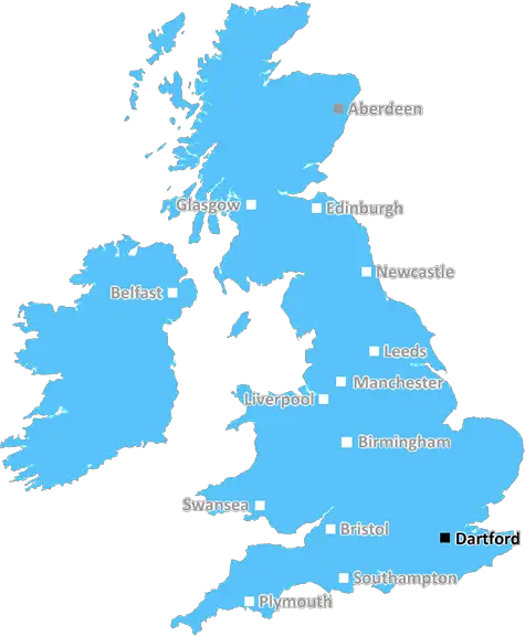
Dartford (DA6)
The DA6 postcode area is located in the Dartford postcode town region, within the county of Greater London, and contains a total of 411 individual postcodes.
There are 1 electoral wards in the DA6 postcode area, including Belvedere, Bexley, Bexleyheath, Dartford, Erith, Gravesend, Greenhithe, Longfield, Sidcup, Swanscombe, Welling which come under the local authority of the Bexley Council.
Combining the whole postcode region, 23% of people in DA6 are classed as having an AB social grade, (i.e. 'white-collar' middle-upper class), compared to 27% across the UK.
This does not mean that the people of DA6 are poorer than other areas, but it may give an indication that there are areas of deprivation.
The DA6 postcode covers the area of Bexley, in the Dartford district of the UK. The postal town for this postcode is Erith. It covers the southeastern parts of the London Borough of Bexley and includes part of the town of Erith in addition to parts of Belvedere and Slade Green.
Erith is the largest town in the postcode area, and is located on the River Thames. It is a vibrant commercial centre with many shops, pubs and restaurants, as well as a leisure centre and two primary schools.
The main road through the area is the A206, which connects Bexley with London. This road passes through Erith High Street, which is home to a market. It is also the location of the Erith Town Centre Masterplan, which sets out detailed proposals for the future of the town.
The Belvedere and Slade Green area of DA6 is a residential area, consisting mainly of family homes, with a few industrial and retail outlets. The area is served by a number of bus routes, and is within easy reach of the Crossrail Station at Abbey Wood.
The area is well served by parks, with Joyce Green City Park covering 20 acres. The park is home to a fishing lake, sports courts, play areas and a cafe. The Old Bexley Woods are another popular public amenity, with grassland, dense woodland and a variety of nature habitats.
House prices in the area have been steadily increasing, with a median price of �300,000 over the past year. The average rental price is around �1000 a month.
TheDA6 postcode area offers a great mix of city and rural living, with many amenities and excellent transport links. It is an ideal place for families, young professionals or those looking for an affordable place to rent in the Greater London area.

Demographics

Greater London

DA6 is located in the county of Greater London, in England.
Greater London has a total population of 8,778,500, making it the 1st largest county in the UK.
Greater London has a total area of 606 square miles, and a population density of 5594 people per square kilometre. For comparison, Greater London has a density of 5,618 people/km2.
| Outward Code | DA6 |
| Postal Town | Dartford |
| MSOA Name | Bexley 020 |
| LSOA Name | Bexley 020D |
| County | Greater London |
| Region | Greater London |
| Country | England |
| Local Authority | Bexley |
| Area Classification | Urban with Major Conurbation |
DA6 Electoral Wards
The postal region of DA6, includes the local towns, villages, electoral wards and stations of:
Dig even deeper into the DA6 postcode by clicking on a postcode below:
Click on an outward postal code below for more information about the area. Each 'outward' postcode give you a comprehensive list of all postcodes within the outward code area (DA) and estimated address.
Click on an 'outward' code for more information. For example, the outward postcode page 'EC2M' will give you an alphabetical list covering all postcodes located in the region, from 'EC2M 1BB' through to 'EC2M 7YA'.
Chris H
Sunday, May 12, 2024
We don't have any views of DA6 right now. If you live in DA6 or have visited it, please help us to help others by telling others what you think of this neighbourhood.
Add your view of DA6
People need your local expertise. If you live in DA6 or have first-hand knowledge of the neighbourhood, please consider sharing your views. It's completely anonymous - all we ask is for your initials.
Please tell us what you like about the DA6 postcode area, what you don't like, and what it's like to live or work here.
| LOCAL AMENITIES | |
| FAMILY FRIENDLY | |
| PARKING | |
| GREEN SPACES |
Local News Kent
Savills bolsters Chelmsford office with return of senior development director
Kibblewhite originally joined the agency in 1990 and spent 16 years working there.
Property WeekChris Mason: Sunak, Starmer and their small boats row
The issue of people crossing the Channel is so contested, even the terminology of the topic is disputed.
BBC NewsViaNautis signs 10-year lease for Unity Campus in Cambridge
Thelatest letting followsWelbeck Health Partners' leaseand Domainex's occupancy of the campus earlier this year.
Property WeekWarburtons signs pre-let at Symmetry Park Biggleswade
The bakery brand has agreed a 25-year lease withTritax Symmetry for65,847 sq ft.
Property WeekCouncillor 'lucky to be alive' after pickaxe hits cable
A volunteer escaped death after sending his pickaxe through an electrical cable buried in the ground while planting trees.
Kent OnlineKent's most expensive car parks revealed as councils cash in
Almost every Kent council hiked parking charges in their latest budgets - but where will you pay the most to leave your car for an hour?
Kent OnlineWeston Homes gets go-ahead for 33m resi scheme in Epping
The project will see the development of 62 homes and almost five acres of open space.
Property WeekEbbsfleet United secures greenlight on new stadium and 3,500 homes
The 50-acre Kent scheme by the River Thames is connected to Northfleet's harbour and will include 3,500 homes.
Property WeekFrom the Postcode Area blog

Deciphering Crime Rates - a Deep Dive Into UK Postcode Analysis
Ever wondered about the crime rate in your UK postcode? You're not alone. We've dug deep into the data, uncovering trends and patterns that'll make your head spin.

Death of the High Street?
The BBC reports that despite councils' attempts to kurb them, the UK's high streets have seen a huge growth in fast food outlets. Could this mark the death knell for the Great British high street, and what can we do about it to halt its decline?

Discrimination by Postcode
You really couldn't make it up, could you? Some of the country's most vulnerable people are missing out on their weekly £25 Cold Weather Payment, just because the system that's in operation is discriminating against them because payments are based on postcode, rather than geographic location.

The Redesign is Underway
Well, the current website was absolutely in dire need of a good redesign - from the ground up. So I set out to pull it all apart and get it up and running again to become the most comprehensive guide to every postcode in the UK. And it's been a long, tough job from start to finish - and quite possibly the biggest project I've ever undertaken.
SOCIAL GRADES
According to census records, 23% of people here have a social grade of AB (highest), compared to the national average of 27%.