darlington DL4 Postcodes
Spending a fortune on conveyancing?

Compare instant, low-cost online quotes from trusted conveyancing solicitors.
Backed by experts, our no-obligation service searches through the best conveyancing quotes on the market to save you time and money.
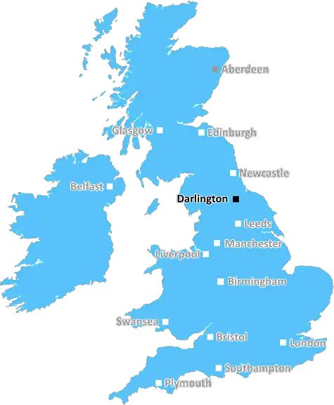
Darlington (DL4)
The DL4 postcode area is located in the Darlington postcode town region, within the county of Durham, and contains a total of 359 individual postcodes.
There are 12 electoral wards in the DL4 postcode area, including Barnard Castle, Bedale, Bishop Auckland, Catterick Garrison, Crook, Darlington, Ferryhill, Hawes, Leyburn, Newton Aycliffe, Northallerton, Richmond, Shildon, Spennymoor which come under the local authority of the County Durham Council.
Combining the whole postcode region, 13% of people in DL4 are classed as having an AB social grade, (i.e. 'white-collar' middle-upper class), compared to 27% across the UK.
This does not mean that the people of DL4 are poorer than other areas, but it may give an indication that there are areas of deprivation.
DL4 is a postcode area in the Darlington district of County Durham, England. It covers a large rural area, which includes Cowpen Bewley, Hurworth-on-Tees, Hurworth Place, Middleton St George, Neasham, Sadberge, Carlton, Whessoe and Long Newton. It has an estimated population of around 4,343.
The area is served by a number of primary and secondary schools, including Hurworth School, Sadberge Primary School and Middleton St George School. The area also has several leisure and recreation facilities, as well as a number of shops and businesses.
DL4 is well-connected for transport, with access to the A19 and A66 just a few miles away. There is also a local taxi service, and a number of bus services operating in the area.
The area offers some of the most scenic countryside in County Durham, as it is home to the beautiful River Tees and many wooded areas. It is also home to the Durham Wildlife Trust reserve, which is a great spot for wildlife watching.
The local economy is mainly based on farming and tourism. The region is also home to a number of ancient monuments, including a Neolithic burial mound and a medieval motte.
DL4 is known for its high quality of life, with its well-connected transport networks and its many local attractions. Residents benefit from good quality education opportunities, as well as access to recreational activities and natural beauty. House prices are usually attractive in the area, as employees of nearby major towns and cities such as Durham and Darlington are increasingly choosing to live in the area.

Demographics
Durham

DL4 is located in the county of Durham, in England.
Durham has a total population of 0, making it the largest county in the UK.
Durham has a total area of square miles, and a population density of people per square kilometre. For comparison, Greater London has a density of 5,618 people/km2.
| Outward Code | DL4 |
| Postal Town | Darlington |
| MSOA Name | County Durham 059 |
| LSOA Name | County Durham 059D |
| County | Durham |
| Region | Durham |
| Country | England |
| Local Authority | County Durham |
| Area Classification | Largely Rural (rural including hub towns 50-79%) |
DL4 Electoral Wards
The postal region of DL4, includes the local towns, villages, electoral wards and stations of:
Dig even deeper into the DL4 postcode by clicking on a postcode below:
Click on an outward postal code below for more information about the area. Each 'outward' postcode give you a comprehensive list of all postcodes within the outward code area (DL) and estimated address.
Click on an 'outward' code for more information. For example, the outward postcode page 'EC2M' will give you an alphabetical list covering all postcodes located in the region, from 'EC2M 1BB' through to 'EC2M 7YA'.
Chris H
Sunday, April 7, 2024
We don't have any views of DL4 right now. If you live in DL4 or have visited it, please help us to help others by telling others what you think of this neighbourhood.
Add your view of DL4
People need your local expertise. If you live in DL4 or have first-hand knowledge of the neighbourhood, please consider sharing your views. It's completely anonymous - all we ask is for your initials.
Please tell us what you like about the DL4 postcode area, what you don't like, and what it's like to live or work here.
| LOCAL AMENITIES | |
| FAMILY FRIENDLY | |
| PARKING | |
| GREEN SPACES |
Local News County Durham
What we thought of Serino's Deli at Eaglescliffe, Stockton
Neighbourhood restaurants/cafes are pretty thin on the ground in this part of the world - but we visited Serino's Deli at Eaglescliffe to check out what was on offer.
Northern EchoDarlington tip has been closed due to high winds today
Darlington tip has been closed due to the strong winds today
Northern EchoMiddleham Castle: Home plans near Richard III's childhood home
The historic setting of Richard III's childhood home Middleham Castle could be spoilt if plans to build 55 homes on nearby pastures are given the go-ahead, conservation groups have claimed.
Northern EchoSnug & Wynd in Norton, Stockton up for sale for under 50k
Snug & Wynd in Norton, Stockton is up for sale and has been described as an excellent opportunity for those looking to run their own bar
Northern EchoNewton Aycliffe man to be sentenced for affray at home of father
A man who was facing trial accused of making knife threats and assaulting his father in his own home is now to be sentenced having admitted a new charge of affray arising from the incident.
Northern EchoFA Cup Finals and Wimbledon among tickets gifted to MPs
North East MPs, including Dehenna Davison and Richard Holden, claimed more than 11,500 in gifted sports tickets in the last year, The Northern Echo can reveal.
Northern EchoNorthallerton girl bullied for weight is Miss England semi-finalist
Northallerton woman Sophie McGarva was picked on for her weight at school but has beat the bullies after slimming down and becoming a Miss England finalist.
Northern EchoPatients left with screw inside them in 'never event' NHS incidents
Patients at hospitals in the region were wrongly left with screws and wires in their bodies after surgeries in shocking never events', figures have revealed.
Northern EchoFrom the Postcode Area blog

Deciphering Crime Rates - a Deep Dive Into UK Postcode Analysis
Ever wondered about the crime rate in your UK postcode? You're not alone. We've dug deep into the data, uncovering trends and patterns that'll make your head spin.

Death of the High Street?
The BBC reports that despite councils' attempts to kurb them, the UK's high streets have seen a huge growth in fast food outlets. Could this mark the death knell for the Great British high street, and what can we do about it to halt its decline?

Discrimination by Postcode
You really couldn't make it up, could you? Some of the country's most vulnerable people are missing out on their weekly £25 Cold Weather Payment, just because the system that's in operation is discriminating against them because payments are based on postcode, rather than geographic location.

The Redesign is Underway
Well, the current website was absolutely in dire need of a good redesign - from the ground up. So I set out to pull it all apart and get it up and running again to become the most comprehensive guide to every postcode in the UK. And it's been a long, tough job from start to finish - and quite possibly the biggest project I've ever undertaken.
SOCIAL GRADES
According to census records, 13% of people here have a social grade of AB (highest), compared to the national average of 27%.