croydon CR5 Postcodes
Spending a fortune on conveyancing?

Compare instant, low-cost online quotes from trusted conveyancing solicitors.
Backed by experts, our no-obligation service searches through the best conveyancing quotes on the market to save you time and money.
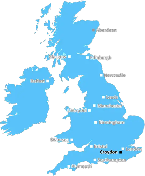
Croydon (CR5)
The CR5 postcode area is located in the Croydon postcode town region, within the county of Greater London, and contains a total of 964 individual postcodes.
There are 11 electoral wards in the CR5 postcode area, including Caterham, Coulsdon, Croydon, Kenley, Mitcham, Purley, South Croydon, Thornton Heath, Warlingham, Whyteleafe which come under the local authority of the Croydon Council.
Combining the whole postcode region, 32% of people in CR5 are classed as having an AB social grade, (i.e. 'white-collar' middle-upper class), compared to 27% across the UK.
This does not mean that the people of CR5 are wealthier - or higher class - than average, but it can be an indication that the area may be prospering and desirable to live in.
CR5 is a postcode in the UK, covering areas of South London such as Coulsdon, Old Coulsdon, Chipstead, Hooley, and Kenley. It is part of the London Metropolitan Area which has a population of over 16 million people, making it one of the largest cities in Europe.
The CR5 postcode area includes a range of amenities. Coulsdonhas a range of recreational facilities including a golf centre, leisure centre, library, and parks. Chipstead has a number of large farms, including one of the largest area's of protected heathland, which is managed by the National Trust. Old Coulsdon has a range of shops, pubs, restaurants, and a local cinema. Hooley has a popular local pub and a dry ski slope. Kenley is located in the Surrey Hills and boasts an airfield, Visitors Centre and is a popular local attraction.
The CR5 postcode area has excellent transport links. It is served by London Overground (Zone 6), and each of the five stations in the area have direct links to London Victoria and London Bridge. It is also served by the Tramlink network, which connects Croydon to Wimbledon. Residents of the area are well served by a range of bus links and the M25 motorway is nearby, allowing easy access to the rest of London and the surrounding area.
The area has a wide variety of property types. There are both period and new build homes available, giving something to suit everyone's taste and budget. The area is popular with commuters as the transport links make it easy to access London and other areas of the capital.
CR5 is a desirable area, filled with things to do and places to explore. With the transport links and range of amenities on offer, it is an attractive place to live for any family or individual looking for an interesting and vibrant area to call home.

Demographics
Greater London

CR5 is located in the county of Greater London, in England.
Greater London has a total population of 8,778,500, making it the 1st largest county in the UK.
Greater London has a total area of 606 square miles, and a population density of 5594 people per square kilometre. For comparison, Greater London has a density of 5,618 people/km2.
| Outward Code | CR5 |
| Postal Town | Croydon |
| MSOA Name | Croydon 043 |
| LSOA Name | Croydon 043A |
| County | Greater London |
| Region | Greater London |
| Country | England |
| Local Authority | Croydon |
| Area Classification | Urban with Major Conurbation |
CR5 Electoral Wards
The postal region of CR5, includes the local towns, villages, electoral wards and stations of:
Dig even deeper into the CR5 postcode by clicking on a postcode below:
Click on an outward postal code below for more information about the area. Each 'outward' postcode give you a comprehensive list of all postcodes within the outward code area (CR) and estimated address.
Click on an 'outward' code for more information. For example, the outward postcode page 'EC2M' will give you an alphabetical list covering all postcodes located in the region, from 'EC2M 1BB' through to 'EC2M 7YA'.
TG, Croydon
Saturday, January 2, 2021
cr5 postcode does not cover Caterhm, whytleafe or warlingham these are cr3 and cr6. I'm not sure abut Kenley either that is usally cr8
Add your view of CR5
People need your local expertise. If you live in CR5 or have first-hand knowledge of the neighbourhood, please consider sharing your views. It's completely anonymous - all we ask is for your initials.
Please tell us what you like about the CR5 postcode area, what you don't like, and what it's like to live or work here.
| LOCAL AMENITIES | |
| FAMILY FRIENDLY | |
| PARKING | |
| GREEN SPACES |
Local News Surrey
Crawley and MK Dons' play-off game postponed
The League Two play-off semi-final first leg between Crawley Town and Milton Keynes Dons is postponed because of a waterlogged pitch.
BBC NewsSurrey M25 drivers warned they will be hit with Ulez charge if they ignore diversion
The M25 will be closed in both directions between Junctions 9 and 10 in Surrey from 9pm on Friday until 6am on Monday while concrete beams for a new bridge and a gantry are lifted into place
Get SurreyMiss Surrey 2024 contestant joins pagent after concussion left her feeling like her brain had been 'rewired'
Chloe Ching, from Frimley, took classes to help with walking and talking after her injury
Get SurreyWaverley Local Election Results 2024 in full as by-election for Witley and Milford contested
One seat is available on Waverley Borough Council as a by-election is held in Witley and Milford
Get SurreyWestern Storm defeat South East Stars
Sunrisers top the Rachael Heyhoe Flint Trophy table after defeating Central Sparks by five wickets at Kidderminster.
BBC NewsBridge beams put in as residents invited to watch
The new bridge will replace a level crossing in Ash that closes about eight times an hour.
BBC NewsRail travellers face bus replacements over weekend
People are urged to check ahead as four separate pieces of work are taking place in the region.
BBC NewsSurrey's Local Election results mapped in full as Lib Dems and Greens make gains
Thousands of voters visited polling stations in Surrey
Get SurreyFrom the Postcode Area blog

Deciphering Crime Rates - a Deep Dive Into UK Postcode Analysis
Ever wondered about the crime rate in your UK postcode? You're not alone. We've dug deep into the data, uncovering trends and patterns that'll make your head spin.

Death of the High Street?
The BBC reports that despite councils' attempts to kurb them, the UK's high streets have seen a huge growth in fast food outlets. Could this mark the death knell for the Great British high street, and what can we do about it to halt its decline?

Discrimination by Postcode
You really couldn't make it up, could you? Some of the country's most vulnerable people are missing out on their weekly £25 Cold Weather Payment, just because the system that's in operation is discriminating against them because payments are based on postcode, rather than geographic location.

The Redesign is Underway
Well, the current website was absolutely in dire need of a good redesign - from the ground up. So I set out to pull it all apart and get it up and running again to become the most comprehensive guide to every postcode in the UK. And it's been a long, tough job from start to finish - and quite possibly the biggest project I've ever undertaken.
SOCIAL GRADES
According to census records, 32% of people here have a social grade of AB (highest), compared to the national average of 27%.