coventry CV5 Postcodes
Spending a fortune on conveyancing?

Compare instant, low-cost online quotes from trusted conveyancing solicitors.
Backed by experts, our no-obligation service searches through the best conveyancing quotes on the market to save you time and money.
Coventry (CV5)
The CV5 postcode area is located in the Coventry postcode town region, within the county of West Midlands, and contains a total of 1178 individual postcodes.
There are 24 electoral wards in the CV5 postcode area, including Atherstone, Bedworth, Coventry, Kenilworth, Leamington Spa, Nuneaton, Rugby, Shipston-On-Stour, Southam, Stratford-Upon-Avon, Warwick which come under the local authority of the Coventry Council.
Combining the whole postcode region, 25% of people in CV5 are classed as having an AB social grade, (i.e. 'white-collar' middle-upper class), compared to 27% across the UK.
This does not mean that the people of CV5 are poorer than other areas, but it may give an indication that there are areas of deprivation.
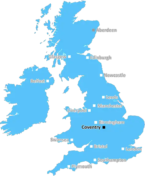
The CV5 postcode is in the Coventry district, in the West Midlands county of England.
The postcode area starts from the city centre of Coventry and continues toward the surrounding villages, reaching out to the south of Coventry and extending into Finham, Allesley Green, Radford Semele, Exhall and Ash Green. It contains the areas of Tile Hill, Mount Nod, Keresley, Potters Green and parts of Canley.
CV5 is an urban area with some much needed green space. The postcode contains several parks, including Church End Park, Higham Lane Park, Maybird Park, Parnell Park, Mount Nod recreation ground, Packhorse Green and Chase Meadow. There are also various sports facilities scattered around the postcode such as Coventry City Football Club, Allesley park Golf Club, Kenilworth golf club, Caludon Castle sports centre and Coventry athletic Football Club.
The CV5 postcode is served by several primary schools, such as Lime Tree Primary, Henley Green Primary and Holbrooks Primary. It has local secondary schools such as Sidney Stringer Academy, Higham Lane School and The Westwood Academy. The University of Warwick and Coventry University are also close by.
The postcode has a variety of shops in Tile Hill, Keresley and Allesley Green. There are supermarkets and banks, as well as pubs, restaurants and caf�s.
In terms of transport links, the postcode is covered by a good bus service. Tile Hill Railway Station provides a direct link into Coventry and Birmingham. Access to the M6 is also available from the CV5 postcode and the M69 provides a direct connection to Leicester.
Other notable landmarks in the CV5 postcode area include Allesley Park, Christ the King Church, Allesley Village Hall, the Kenilworth Greenway and Ryton Pools.
The postcode area represents a diverse mix of cultures, with residents of Indian, Pakistani, Caribbean and Irish backgrounds. The opening of Coventry's first Hindu temple, Subramanian Swami Temple, has also contributed to the cultural significance of the postcode.

Demographics
West Midlands

CV5 is located in the county of West Midlands, in England.
West Midlands has a total population of 2,864,900, making it the 2nd largest county in the UK.
West Midlands has a total area of 348 square miles, and a population density of 3177 people per square kilometre. For comparison, Greater London has a density of 5,618 people/km2.
| Outward Code | CV5 |
| Postal Town | Coventry |
| MSOA Name | Coventry 034 |
| LSOA Name | Coventry 034A |
| County | West Midlands |
| Region | West Midlands |
| Country | England |
| Local Authority | Coventry |
| Area Classification | Urban with City and Town |
CV5 Electoral Wards
The postal region of CV5, includes the local towns, villages, electoral wards and stations of:
Dig even deeper into the CV5 postcode by clicking on a postcode below:
Click on an outward postal code below for more information about the area. Each 'outward' postcode give you a comprehensive list of all postcodes within the outward code area (CV) and estimated address.
Click on an 'outward' code for more information. For example, the outward postcode page 'EC2M' will give you an alphabetical list covering all postcodes located in the region, from 'EC2M 1BB' through to 'EC2M 7YA'.
Chris H
Saturday, April 6, 2024
We don't have any views of CV5 right now. If you live in CV5 or have visited it, please help us to help others by telling others what you think of this neighbourhood.
Add your view of CV5
People need your local expertise. If you live in CV5 or have first-hand knowledge of the neighbourhood, please consider sharing your views. It's completely anonymous - all we ask is for your initials.
Please tell us what you like about the CV5 postcode area, what you don't like, and what it's like to live or work here.
| LOCAL AMENITIES | |
| FAMILY FRIENDLY | |
| PARKING | |
| GREEN SPACES |
Local News West Midlands
John Pye Auctions seals 10m deal for Birmingham shed
The site was formerlyowned by Dart Products Europe.
Property WeekMcLaren and Aventicum get go-ahead on 31-storey Birmingham PBSA tower
The redevelopment project will see the delivery of both student and BTR units.
Property WeekGreenlight wins approval for Redditch industrial scheme
The development will see the partial demolition of the existing buildings and the construction of126,715 sq ft of industrial space.
Property WeekHousing Ombudsman flags up severe maladministration by Birmingham Council
Housing watchdog lists damp and mould among six major findings of maladministration by the local authority landlord.
Property WeekStaffordshire manor house among more than 190 lots in Bond Wolfe March sale
The freehold manor house in Staffordshire guided at 1.76m-plus has potential for redevelopment.
Property WeekOwners of The Crooked House ordered to rebuild Britain's wonkiest pub
Local council orders pub to be restored after its demolition last year caused national outrage.
Property WeekGovernment watchdog moves to Coventry's Friargate scheme
Ofqual has taken 11,500 sq ft at the office building.
Property WeekQ4 sees Birmingham office take-up surge 54% above long-term average
Savills says the figures showstrong momentum in the Birmingham office market.
Property WeekFrom the Postcode Area blog

Deciphering Crime Rates - a Deep Dive Into UK Postcode Analysis
Ever wondered about the crime rate in your UK postcode? You're not alone. We've dug deep into the data, uncovering trends and patterns that'll make your head spin.

Death of the High Street?
The BBC reports that despite councils' attempts to kurb them, the UK's high streets have seen a huge growth in fast food outlets. Could this mark the death knell for the Great British high street, and what can we do about it to halt its decline?

Discrimination by Postcode
You really couldn't make it up, could you? Some of the country's most vulnerable people are missing out on their weekly £25 Cold Weather Payment, just because the system that's in operation is discriminating against them because payments are based on postcode, rather than geographic location.

The Redesign is Underway
Well, the current website was absolutely in dire need of a good redesign - from the ground up. So I set out to pull it all apart and get it up and running again to become the most comprehensive guide to every postcode in the UK. And it's been a long, tough job from start to finish - and quite possibly the biggest project I've ever undertaken.
SOCIAL GRADES
According to census records, 25% of people here have a social grade of AB (highest), compared to the national average of 27%.