colchester CO7 Postcodes
Spending a fortune on conveyancing?

Compare instant, low-cost online quotes from trusted conveyancing solicitors.
Backed by experts, our no-obligation service searches through the best conveyancing quotes on the market to save you time and money.
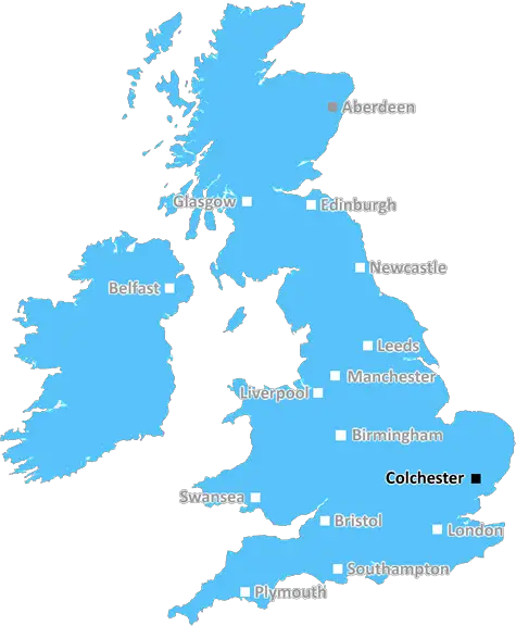
Colchester (CO7)
The CO7 postcode area is located in the Colchester postcode town region, within the county of Essex, and contains a total of 1505 individual postcodes.
There are 76 electoral wards in the CO7 postcode area, including Bures, Clacton-On-Sea, Colchester, Frinton-On-Sea, Halstead, Harwich, Manningtree, Sudbury, Walton On The Naze which come under the local authority of the Tendring Council.
Combining the whole postcode region, 28% of people in CO7 are classed as having an AB social grade, (i.e. 'white-collar' middle-upper class), compared to 27% across the UK.
This does not mean that the people of CO7 are wealthier - or higher class - than average, but it can be an indication that the area may be prospering and desirable to live in.
The CO7 postcode is in an area known as 'Colne Valley South'. It is located in the district of Colchester in the county of Essex, England. It includes the small market town of Frinton-on-Sea, as well as mainly rural areas which stretch east to the outskirts of Colchester and west to Thorpe-le-soken.
CO7 has a broad range of housing types and prices, from the more expensive executive housing in Frinton-on-Sea to small rural properties and cottages in all of the other local villages. The largest of these villages include Brightlingsea, St Osyth, Little Clacton, Weeley and Alresford.
The CO7 district has a strong agricultural tradition, with many farms and local businesses tied to primary industries such as arable farming, horticulture, poultry and more. Tourism is also an important part of the local economy, with attractions such as Frinton beach, the Colne Valley Country Park and Thornham Walks offering a variety of leisure activities.
Local amenities include pubs, shops, restaurants, post offices, local transport in the form of buses and taxis, and a variety of local schools from nurseries to secondary education. There are also a number of health centres and medical facilities such as doctor's surgeries in the neighbourhood.
The district has a number of places of religious worship, including Baptist, Catholic, Congregational, Methodist and United Reformed churches. The area also includes a charter sailing and water sports centre, local village halls, libraries, sports facilities, a bank and police station.
Surrounding the district are several large conservation areas, such as Mersea Island Nature Reserve, Pyefleet Channel Nature Reserve, Lower Colne Estuary Protected Nature Reserve, Dedham Vale AONB, and Tendring Hundred Ltd historic sites.
TheCO7 postcode offers a diverse mix of rural and urban areas including many amenities and attractions, along with a rich history and strong agricultural economy.

Demographics

Essex

CO7 is located in the county of Essex, in England.
Essex has a total population of 1,802,200, making it the 7th largest county in the UK.
Essex has a total area of 1417 square miles, and a population density of 491 people per square kilometre. For comparison, Greater London has a density of 5,618 people/km2.
| Outward Code | CO7 |
| Postal Town | Colchester |
| MSOA Name | Tendring 011 |
| LSOA Name | Tendring 011D |
| County | Essex |
| Region | Essex |
| Country | England |
| Local Authority | Tendring |
| Area Classification | Largely Rural (rural including hub towns 50-79%) |
CO7 Electoral Wards
The postal region of CO7, includes the local towns, villages, electoral wards and stations of:
Dig even deeper into the CO7 postcode by clicking on a postcode below:
Click on an outward postal code below for more information about the area. Each 'outward' postcode give you a comprehensive list of all postcodes within the outward code area (CO) and estimated address.
Click on an 'outward' code for more information. For example, the outward postcode page 'EC2M' will give you an alphabetical list covering all postcodes located in the region, from 'EC2M 1BB' through to 'EC2M 7YA'.
LW, Colchester
Tuesday, September 19, 2023
yea
Add your view of CO7
People need your local expertise. If you live in CO7 or have first-hand knowledge of the neighbourhood, please consider sharing your views. It's completely anonymous - all we ask is for your initials.
Please tell us what you like about the CO7 postcode area, what you don't like, and what it's like to live or work here.
| LOCAL AMENITIES | |
| FAMILY FRIENDLY | |
| PARKING | |
| GREEN SPACES |
Local News Essex
British Land seeks retail park acquisitions outside South East
Company is comfortable looking out into the regions, where there is more value, head of retail parks Matt Reed said.
Property WeekGreat Holland hall hosts Breast Friend charity quiz night
HUNDREDS of pounds have been raised for a cancer support group in Essex after teams of quietly-competitive quizzers put their knowledge to the test.
Daily GazetteWeston Homes gets go-ahead for 33m resi scheme in Epping
The project will see the development of 62 homes and almost five acres of open space.
Property WeekWarburtons signs pre-let at Symmetry Park Biggleswade
The bakery brand has agreed a 25-year lease withTritax Symmetry for65,847 sq ft.
Property WeekColchester residents reveal impacts of doubled ambulance waiting times
COLCHESTER residents are sharing their long waiting times for ambulances with many elderly relatives being impacted as all but one of England's ambulance services missed their targets.
Daily GazetteIron face 'big ask' in National League - Harrop
Braintree manager Angelo Harrop says his side face a big challenge to stay in the National League following their promotion.
BBC NewsA12 road closures unveiled for the summer ahead of August completion
National Highways has revealed its latest set of A12 closures for the summer ahead as the August completion date approaches.
Daily GazetteColchester woman, Nicola Shergold, sadly passes away
A Colchester nurse who was forced to quit her job due tomultiple sclerosis symptoms has sadly passed away.
Daily GazetteFrom the Postcode Area blog

Deciphering Crime Rates - a Deep Dive Into UK Postcode Analysis
Ever wondered about the crime rate in your UK postcode? You're not alone. We've dug deep into the data, uncovering trends and patterns that'll make your head spin.

Death of the High Street?
The BBC reports that despite councils' attempts to kurb them, the UK's high streets have seen a huge growth in fast food outlets. Could this mark the death knell for the Great British high street, and what can we do about it to halt its decline?

Discrimination by Postcode
You really couldn't make it up, could you? Some of the country's most vulnerable people are missing out on their weekly £25 Cold Weather Payment, just because the system that's in operation is discriminating against them because payments are based on postcode, rather than geographic location.

The Redesign is Underway
Well, the current website was absolutely in dire need of a good redesign - from the ground up. So I set out to pull it all apart and get it up and running again to become the most comprehensive guide to every postcode in the UK. And it's been a long, tough job from start to finish - and quite possibly the biggest project I've ever undertaken.
SOCIAL GRADES
According to census records, 28% of people here have a social grade of AB (highest), compared to the national average of 27%.