colchester CO10 Postcodes
Spending a fortune on conveyancing?

Compare instant, low-cost online quotes from trusted conveyancing solicitors.
Backed by experts, our no-obligation service searches through the best conveyancing quotes on the market to save you time and money.
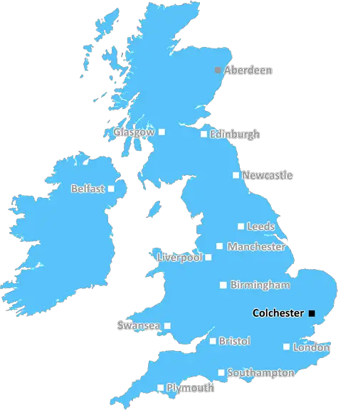
Colchester (CO10)
The CO10 postcode area is located in the Colchester postcode town region, within the county of Suffolk, and contains a total of 2282 individual postcodes.
There are 178 electoral wards in the CO10 postcode area, including Bures, Clacton-On-Sea, Colchester, Frinton-On-Sea, Halstead, Harwich, Manningtree, Sudbury, Walton On The Naze which come under the local authority of the Babergh Council.
Combining the whole postcode region, 22% of people in CO10 are classed as having an AB social grade, (i.e. 'white-collar' middle-upper class), compared to 27% across the UK.
This does not mean that the people of CO10 are poorer than other areas, but it may give an indication that there are areas of deprivation.
CO10 is a postcode area located in East Anglia in Essex, in the Colchester district. It covers the villages of Bures, Leavenheath, Langham, Great Horkesley, Little Horkesley, Alphamstone, Lamarsh, Wissington, Belchamp Otten, Belchamp St Paul, Foxearth and Liston.
The area is situated within the Suffolk border and is only 15 miles from the town of Colchester. It is surrounded by picturesque countryside where people can enjoy activities such as walking, cycling and horseback riding. The area is home to various historical sites, including Belchamp Hall and Bucklesham Castle.
In terms of transport links, the northern-most settlement, Foxearth, is served by Braintree and Bocking railway station, providing links to London Liverpool Street and Cambridge.
CO10 contains a range of amenities including pubs, restaurants, shops and services for the local community. The area is renowned for its quietness and sense of community, meaning it is ideal for families and those who are looking for a peaceful and pleasant environment to settle.
The village of Bures is the largest settlement in the postcode and is a popular tourist destination. It is located on the banks of the River Stour and includes a range of amenities such as cafes, pubs, shops, banks and a Post Office. Bures is renowned for its Saxon church and the ancient Prebendal House, which is a historic 13th Century manor house.
The postcode also contains primary and secondary schools, such as Bures Church of England Primary School, Alphamstone Primary School and Langham Primary School, as well as Colne Community College.
CO10 is a desirable area with its peacefulness, plenty of leisure activities and its range of amenities for both the local and wider community.

Demographics

Suffolk

CO10 is located in the county of Suffolk, in England.
Suffolk has a total population of 745,300, making it the 32nd largest county in the UK.
Suffolk has a total area of 1500 square miles, and a population density of 196 people per square kilometre. For comparison, Greater London has a density of 5,618 people/km2.
| Outward Code | CO10 |
| Postal Town | Colchester |
| MSOA Name | Babergh 007 |
| LSOA Name | Babergh 007E |
| County | Suffolk |
| Region | Suffolk |
| Country | England |
| Local Authority | Babergh |
| Area Classification | Mainly Rural (rural including hub towns >=80%) |
CO10 Electoral Wards
The postal region of CO10, includes the local towns, villages, electoral wards and stations of:
Dig even deeper into the CO10 postcode by clicking on a postcode below:
Click on an outward postal code below for more information about the area. Each 'outward' postcode give you a comprehensive list of all postcodes within the outward code area (CO) and estimated address.
Click on an 'outward' code for more information. For example, the outward postcode page 'EC2M' will give you an alphabetical list covering all postcodes located in the region, from 'EC2M 1BB' through to 'EC2M 7YA'.
AB, colchester
Sunday, February 24, 2019
I like it because it is a quiet neighborhood with access to services
Add your view of CO10
People need your local expertise. If you live in CO10 or have first-hand knowledge of the neighbourhood, please consider sharing your views. It's completely anonymous - all we ask is for your initials.
Please tell us what you like about the CO10 postcode area, what you don't like, and what it's like to live or work here.
| LOCAL AMENITIES | |
| FAMILY FRIENDLY | |
| PARKING | |
| GREEN SPACES |
Local News Suffolk
Plan for 485 new homes rejected over identity fears
Councillors also say the development would have "unacceptable impact on highway safety".
BBC NewsSuffolk is UK's warmest place as storm blows in
Flights and ferry services are cancelled as the UK experiences strong winds but also the warmest day of the year.
BBC NewsIpswich veteran blending coffee and mental health
Combat2Coffee founder, Nigel Seaman, on how he began his business with a brew.
BBC NewsMan in court accused of 14 child sex offences
Kevin Brett is released on bail until his next hearing in May.
BBC NewsThe fans don't know the full story - Downes
Flynn Downes shares his frustrations after being booed by his former club's supporters.
BBC NewsEast Anglian derby police make 11 arrests
Despite the arrests, officers praise the majority of fans for their "good spirit and humour".
BBC NewsMcKenna, Farke & Rosenior nominated for EFL awards
Ipswich's Kieran McKenna, Leeds' Daniel Farke and Hull City's Liam Rosenior are nominated for Championship manager of the season.
BBC NewsNess Point to the Dingle Peninsula in a 2CV
Matt Hollis is driving from the British Isles' most easterly point to its most westerly.
BBC NewsFrom the Postcode Area blog

Deciphering Crime Rates - a Deep Dive Into UK Postcode Analysis
Ever wondered about the crime rate in your UK postcode? You're not alone. We've dug deep into the data, uncovering trends and patterns that'll make your head spin.

Death of the High Street?
The BBC reports that despite councils' attempts to kurb them, the UK's high streets have seen a huge growth in fast food outlets. Could this mark the death knell for the Great British high street, and what can we do about it to halt its decline?

Discrimination by Postcode
You really couldn't make it up, could you? Some of the country's most vulnerable people are missing out on their weekly £25 Cold Weather Payment, just because the system that's in operation is discriminating against them because payments are based on postcode, rather than geographic location.

The Redesign is Underway
Well, the current website was absolutely in dire need of a good redesign - from the ground up. So I set out to pull it all apart and get it up and running again to become the most comprehensive guide to every postcode in the UK. And it's been a long, tough job from start to finish - and quite possibly the biggest project I've ever undertaken.
SOCIAL GRADES
According to census records, 22% of people here have a social grade of AB (highest), compared to the national average of 27%.