-
 Census 2021 Data
 -
 Homes & Property
 -
 Law and Order
 -
 Jobs & Economy
 -
 Learning & Schools
 -
 Essential Services
 -
 Travel & Transport
 -
 Local Amenities
 -
 Leisure & Recreation
 -
 Environment
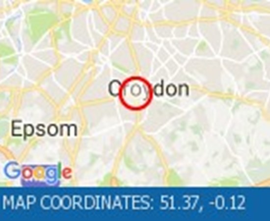
Traffic Conditions
Anton Crescent, Sutton
SM1 2NT Sutton London Boro
Incidents, road closures and roadworks affecting SM1 2NT
The essential traffic update hub for the SM1 2NT area, with real-time information on traffic incidents, road closures, accidents, and roadworks impacting your daily commute around the SM1 2NT postcode. Stay informed on all traffic developments in your area, including accident reports and road maintenance.
Bishopsford Road All Directions
Middleton Road (Both Directions) between Bishopsford Road and St Helier Avenue - road closure to facilitate carriageway resurfacing. Local diversion in place.

Middleton Road (Both Directions) between Bishopsford Road and St Helier Avenue - road closure to facilitate carriageway resurfacing. Local diversion in place.
1.5 mi from Camberwell
Category: Roadworks
11 May 2025 at 19:29
Region: Greater London
1.6 mi from SM1 2NT
Source: TfL
Burlington Road Roundabout All Directions
Burlington Road between High Street and Malden Way (Kingston By Pass) - road is closed due to a fire.

Burlington Road between High Street and Malden Way (Kingston By Pass) - road is closed due to a fire. Traffic is flowing well.
2.1 mi from Kingston Upon Thames
Category: Other Unplanned
11 May 2025 at 19:29
Region: Greater London
2.5 mi from SM1 2NT
Source: TfL
Cambridge Road All Directions
High Street (Both Directions) at the junction of Cambridge Road - 2-way temporary traffic signals in operation to facilitate new gas connection now removed.

High Street (Both Directions) at the junction of Cambridge Road - 2-way temporary traffic signals in operation to facilitate new gas connection now removed. Traffic is moving well.
1.5 mi from Kingston Upon Thames
Category: Roadworks
11 May 2025 at 19:29
Region: Greater London
3 mi from SM1 2NT
Source: TfL
Fairmead All Directions
Tolworth Rise North (Northbound) - Lane restriction on on-slip to northbound A3 at the junction of Fairmead due to emergency gas works.

Tolworth Rise North (Northbound) - Lane restriction on on-slip to northbound A3 at the junction of Fairmead due to emergency gas works. Restrictions have been removed. All lanes open.
0.9 mi from Surbiton
Category: Emergency
11 May 2025 at 19:29
Region: Greater London
3.2 mi from SM1 2NT
Source: TfL
Tolworth Roundabout All Directions
On Tolworth Broadway (Southbound) at the junction with A3 Tolworth Roundabout, there is a broken down vehicle blocking lane two of three). Approach with caution.
On Tolworth Broadway (Southbound) at the junction with A3 Tolworth Roundabout, there is a broken down vehicle blocking lane two of three). Approach with caution. All lanes have reopened.
Traffic is flowing well.
0.9 mi from Surbiton
Category: Broken Down Vehicle
11 May 2025 at 19:29
Region: Greater London
3.3 mi from SM1 2NT
Source: TfL
Trojan Way All Directions
Purley Way (Northbound) between Whitestone Way and Commerce Way - Lane restrictions to facilitate carriageway chamber access works for new connections. (Night works only)
Purley Way (Northbound) between Whitestone Way and Commerce Way - Lane restrictions to facilitate carriageway chamber access works for new connections. (Night works only).
1.1 mi from Croydon
Category: Roadworks
11 May 2025 at 19:29
Region: Greater London
3.7 mi from SM1 2NT
Source: TfL
Drury Crescent All Directions
Purley Way (Northbound) between Whitestone Way and Commerce Way - Lane closure for BT works.
Purley Way (Northbound) between Whitestone Way and Commerce Way - Lane closure for BT works.
1 mi from Croydon
Category: Roadworks
11 May 2025 at 19:29
Region: Greater London
3.7 mi from SM1 2NT
Source: TfL
Streatham High Road All Directions
Greyhound Lane (Both Directions) at the junction of Streatham High Road - 2 way temporary traffic signals in operation to facilitate carriageway resurfacing.

Greyhound Lane (Both Directions) at the junction of Streatham High Road - 2 way temporary traffic signals in operation to facilitate carriageway resurfacing.
0.4 mi from Streatham
Category: Roadworks
11 May 2025 at 19:29
Region: Greater London
4.7 mi from SM1 2NT
Source: TfL
Eatonville Road All Directions
Trinity Road (Both Directions) at the junction of Eatonville Road - Temporary traffic signals will be in place to facilitate water works.

Trinity Road (Both Directions) at the junction of Eatonville Road - Temporary traffic signals will be in place to facilitate water works.
1.5 mi from Balham
Category: Roadworks
11 May 2025 at 19:29
Region: Greater London
4.9 mi from SM1 2NT
Source: TfL
A3 Northbound
A3 northbound between A244 and A309 | Northbound | Road Works

Location : The A3 northbound between the junctions with the A244 and the A309. Lane Closures : Lane one will be closed. Reason : Road repairs are planned.
Status : Pending. Schedule : Expect disruption everyday between 22:00 and 05:30 from 12 May 2025 to 14 May 2025. Lanes Closed : There will be one of two lanes closed.
1.3 mi from Surbiton
Category: Roadworks
11 May 2025 at 19:30
Region: Surrey
4.9 mi from SM1 2NT
Source: Highways Agency
A3 Southbound
A3 southbound between A309 and A244 | Southbound | Road Works
Location : The A3 southbound between the junctions with the A309 and the A244. Lane Closures : Lane one will be closed. Reason : Roadworks are planned.
Status : Pending. Schedule : From 22:00 on 15 May 2025 to 05:30 on 16 May 2025. Lanes Closed : There will be one of three lanes closed.
1.3 mi from Chessington
Category: Roadworks
11 May 2025 at 19:30
Region: Surrey
5 mi from SM1 2NT
Source: Highways Agency
A3 Northbound
A3 northbound between A244 and A309 | Northbound | Road Works

Location : The A3 northbound between the A244 and the junction with the A309. Lane Closures : Lane one will be closed. Reason : Road repairs are planned.
Status : Pending. Schedule : Expect disruption everyday between 22:00 and 05:30 from 12 May 2025 to 14 May 2025. Lanes Closed : There will be one of three lanes closed.
1.3 mi from Chessington
Category: Roadworks
11 May 2025 at 19:30
Region: Surrey
5 mi from SM1 2NT
Source: Highways Agency
Bedford Hill All Directions
Balham Station Road (Both Directions) between Bedford Hill and Balham High Road - Road closed to facilitate carriageway resurfacing.

Balham Station Road (Both Directions) between Bedford Hill and Balham High Road - Road closed to facilitate carriageway resurfacing. Use other routes.
0.9 mi from Balham
Category: Roadworks
11 May 2025 at 19:29
Region: Greater London
5.3 mi from SM1 2NT
Source: TfL
Fairoak Lane All Directions
Leatherhead Road (Northbound). Traffic is moving well.

Leatherhead Road (Northbound). Traffic is moving well. Traffic is moving well.
1.1 mi from Chessington
Category: Congestion
11 May 2025 at 19:29
Region: Greater London
5.5 mi from SM1 2NT
Source: TfL
Bolingbroke Grove All Directions
Nightingale Lane (Both Directions) between Bolingbroke Grove and Balham Hill - road closed to facilitate carriageway resurfacing.

Nightingale Lane (Both Directions) between Bolingbroke Grove and Balham Hill - road closed to facilitate carriageway resurfacing. Expect delays on approach.
1.3 mi from Balham
Category: Roadworks
11 May 2025 at 19:29
Region: Greater London
5.5 mi from SM1 2NT
Source: TfL
West Hill All Directions
West Hill (westbound) between Keswick Road and Portinscale Road. Partial lane one restriction.

West Hill (westbound) between Keswick Road and Portinscale Road. Partial lane one restriction. All lanes have reopened on West Hill -Works are complete - Traffic flows have returned to normal.
0.5 mi from Wandsworth
Category: Emergency
11 May 2025 at 19:29
Region: Greater London
5.6 mi from SM1 2NT
Source: TfL
Upper Richmond Road All Directions
West Hill (Westbound) at the junction of Upper Richmond Road - Lane two blocked due to broken down van.

West Hill (Westbound) at the junction of Upper Richmond Road - Lane two blocked due to broken down van. The broken down van has been recovered and traffic flows ahve returned to normal.
0.5 mi from Wandsworth
Category: Broken Down Vehicle
11 May 2025 at 19:29
Region: Greater London
5.8 mi from SM1 2NT
Source: TfL
Purley Downs Road All Directions
Sanderstead Hill (Both Directions) at the junction of Sundown Avenue - Possible lane closures because of a collision.

Sanderstead Hill (Both Directions) at the junction of Sundown Avenue - Possible lane closures because of a collision. The road has reopened.
3 mi from Carshalton
Category: Accident
11 May 2025 at 19:29
Region: Greater London
5.8 mi from SM1 2NT
Source: TfL
A215 All Directions
Norwood Road (Southbound) at the junction of Robson Road - Waterworks completed.

Norwood Road (Southbound) at the junction of Robson Road - Waterworks completed. Traffic is moving well.
1.5 mi from East Dulwich
Category: Roadworks
11 May 2025 at 19:29
Region: Greater London
6 mi from SM1 2NT
Source: TfL
Clapham Common All Directions
The Avenue (Southbound) at the junction of Windmill Drive - Lane one restrictions with single alternate lane traffic controlled by STOP / GO boards for BT works.

The Avenue (Southbound) at the junction of Windmill Drive - Lane one restrictions with single alternate lane traffic controlled by STOP / GO boards for BT works. Traffic is flowing well in the area.
0.9 mi from Balham
Category: Roadworks
11 May 2025 at 19:29
Region: Greater London
6.2 mi from SM1 2NT
Source: TfL
St John's Road All Directions
Battersea Rise (Eastbound) at the junction of St John's Road - Lane one closure in place to remove and build a bus shelter.

Battersea Rise (Eastbound) at the junction of St John's Road - Lane one closure in place to remove and build a bus shelter.
1.4 mi from Camden Town
Category: Roadworks
11 May 2025 at 19:29
Region: Greater London
6.3 mi from SM1 2NT
Source: TfL
St John's Road All Directions
Lavender Hill (All Directions) at the junction of Falcon Road - Four-way temporary signals in operation to facilitate gully repairs.
Lavender Hill (All Directions) at the junction of Falcon Road - Four-way temporary signals in operation to facilitate gully repairs.
1.4 mi from Camden Town
Category: Roadworks
11 May 2025 at 19:29
Region: Greater London
6.4 mi from SM1 2NT
Source: TfL
Dover House Road All Directions
Dover House Road (Both Directions) at the junction of Upper Richmond Road - There will be stop / go boards in operation due to works in the area.

Dover House Road (Both Directions) at the junction of Upper Richmond Road - There will be stop / go boards in operation due to works in the area. Works have now finished.
0.9 mi from Fulham
Category: Roadworks
11 May 2025 at 19:29
Region: Greater London
6.5 mi from SM1 2NT
Source: TfL
A23 Northbound
A23 northbound between B2031 and A237 | Northbound | Congestion

Location : The A23 northbound between the junctions with the M23 and the A237. Reason : Congestion. Status : Currently Active.
Return To Normal : Normal traffic conditions are expected between 19:30 and 19:45 on 11 May 2025. Delay : There are currently delays of 10 minutes against expected traffic.
3.3 mi from Caterham
Category: Congestion
11 May 2025 at 19:30
Region: Surrey
6.5 mi from SM1 2NT
Source: Highways Agency
A23 Northbound
A23 northbound between B2031 and A237 | Northbound | Congestion
Location : The A23 northbound between the junctions with the M23 and the A237. Reason : Congestion. Status : Currently Active.
Return To Normal : Normal traffic conditions are expected between 18:00 and 18:15 on 11 May 2025. Delay : There are currently delays of 10 minutes against expected traffic.
3.3 mi from Caterham
Category: Congestion
11 May 2025 at 18:00
Region: Surrey
6.5 mi from SM1 2NT
Source: Highways Agency
Long Road All Directions
Clapham Common North Side (Eastbound) at the junction of Long Road - lane restriction to facilitate footway resurfacing works lifted.

Clapham Common North Side (Eastbound) at the junction of Long Road - lane restriction to facilitate footway resurfacing works lifted. Traffic is moving well.
0.9 mi from Balham
Category: Roadworks
11 May 2025 at 19:29
Region: Greater London
6.6 mi from SM1 2NT
Source: TfL
Long Road All Directions
Clapham Common North Side (Eastbound) at the junction of Long Road .
Clapham Common North Side (Eastbound) at the junction of Long Road. Road reopened and traffic is moving well.
0.9 mi from Balham
Category: Accident
11 May 2025 at 19:29
Region: Greater London
6.6 mi from SM1 2NT
Source: TfL
Battersea Bridge Road All Directions
Battersea Park Road (Eastbound) at the junction of Battersea Bridge Road - Lane one is closed due to an emergency gas leak

Battersea Park Road (Eastbound) at the junction of Battersea Bridge Road - Lane one is closed due to an emergency gas leak Traffic flows are normal for the time of day.
1 mi from Kensington
Category: Emergency
11 May 2025 at 19:29
Region: Greater London
7.1 mi from SM1 2NT
Source: TfL
Ryecotes Mead All Directions
Dulwich Common (Both Directions) at the junction of Ryecotes Mead - All lanes are now open.

Dulwich Common (Both Directions) at the junction of Ryecotes Mead - All lanes are now open. All lanes are now open. Traffic is flowing well in the area.
0.5 mi from East Dulwich
Category: Accident
11 May 2025 at 19:29
Region: Greater London
7.2 mi from SM1 2NT
Source: TfL
Grotto Road All Directions
Cross Deep (All Directions) junction with Grotto Road.

Cross Deep (All Directions) junction with Grotto Road. All closures have been removed - Traffic flows have returned to normal in the area.
1 mi from Twickenham
Category: Accident
11 May 2025 at 19:29
Region: Greater London
7.4 mi from SM1 2NT
Source: TfL
King's Road All Directions
Lane closure to facilitate water works

Lane closure to facilitate water works There are no reports of congestion in the area.
0.1 mi from Kensington
Category: Roadworks
11 May 2025 at 19:29
Region: Greater London
7.6 mi from SM1 2NT
Source: TfL
Lingham Street All Directions
Clapham Road (Both Directions) at the junction of Lingham Street- there is a collision at this location.

Clapham Road (Both Directions) at the junction of Lingham Street- there is a collision at this location. Road reopened - accident cleared.
1.5 mi from Balham
Category: Accident
11 May 2025 at 19:29
Region: Greater London
7.6 mi from SM1 2NT
Source: TfL
M25 Northbound
M25 anti-clockwise between J10 and J9 | Anti-Clockwise | Road Works

Location : The M25 anticlockwise between junctions J10 and J9. Reason : Horticultural works are planned. Status : Pending.
Schedule : Expect disruption everyday between 09:30 and 16:00 from 12 May 2025 to 16 May 2025. Schedule : Expect disruption everyday between 09:30 and 16:00 from 19 May 2025 to 22 May 2025.
2.6 mi from Esher
Category: Roadworks
11 May 2025 at 19:30
Region: Surrey
7.9 mi from SM1 2NT
Source: Highways Agency
Grosvenor Road All Directions
High Street (All Directions) at the junction of Grosvenor Road - two way temporary traffic signals will be in operation to facilitate gas works.

High Street (All Directions) at the junction of Grosvenor Road - two way temporary traffic signals will be in operation to facilitate gas works. There are no restrictions in place at the present time. Traffic is flowing normally.
0.7 mi from Beckenham
Category: Roadworks
11 May 2025 at 19:29
Region: Greater London
7.9 mi from SM1 2NT
Source: TfL
Larkbere Road All Directions
Sydenham Road (Both Directions) at the junction of Larkbere Road - Reports of an accident at this location.

Sydenham Road (Both Directions) at the junction of Larkbere Road - Reports of an accident at this location. Traffic is flowing well.
1.9 mi from Lewisham
Category: Accident
11 May 2025 at 19:29
Region: Greater London
8 mi from SM1 2NT
Source: TfL
Gliddon Road All Directions
Talgarth Road (Westbound) between Gliddon Road North End Road - Lane one is blocked following a collision.

Talgarth Road (Westbound) between Gliddon Road North End Road - Lane one is blocked following a collision. Traffic is slow moving on approach, expect delays.
0.7 mi from Shepherds Bush
Category: Accident
11 May 2025 at 19:29
Region: Greater London
8.1 mi from SM1 2NT
Source: TfL
Hammersmith Flyover Both Directions
Hammersmith Flyover - lane 2 will be closed in both directions overnight for inspection works.

Hammersmith Flyover - lane 2 will be closed in both directions overnight for inspection works.
0.6 mi from Shepherds Bush
Category: Roadworks
11 May 2025 at 19:29
Region: Greater London
8.2 mi from SM1 2NT
Source: TfL
Cranley Gardens All Directions
Cranley Gardens junction with Old Brompton Road (All directions). Temporary traffic signals in operation to facilitate roadworks

Cranley Gardens junction with Old Brompton Road (All directions). Temporary traffic signals in operation to facilitate roadworks No reported delays in the area.
0.6 mi from Kensington
Category: Roadworks
11 May 2025 at 19:29
Region: Greater London
8.2 mi from SM1 2NT
Source: TfL
Nine Elms Lane East Bound
Nine Elms Lane (Eastbound) at the junction of St George's Wharf - Lane one closed to facilitate the removal of hoarding.

Nine Elms Lane (Eastbound) at the junction of St George's Wharf - Lane one closed to facilitate the removal of hoarding.
1.1 mi from Covent Garden
Category: Other Unplanned
11 May 2025 at 19:29
Region: Greater London
8.4 mi from SM1 2NT
Source: TfL
M25 Eastbound
M25 clockwise between J9 and J10 | Clockwise | Road Works

Location : The M25 clockwise between junctions J9 and J10. Reason : Horticultural works are planned. Status : Pending.
Schedule : Expect disruption everyday between 09:30 and 16:00 from 12 May 2025 to 13 May 2025.
2.7 mi from Esher
Category: Roadworks
11 May 2025 at 19:30
Region: Surrey
8.5 mi from SM1 2NT
Source: Highways Agency
Kensington High Street All Directions
Warwick Road (Northbound) at the junction of Kensington High Street - Lane 1 closure for water works

Warwick Road (Northbound) at the junction of Kensington High Street - Lane 1 closure for water works.
0.5 mi from Shepherds Bush
Category: Roadworks
11 May 2025 at 19:29
Region: Greater London
8.5 mi from SM1 2NT
Source: TfL
Kennington Oval All Directions
Harleyford Road junction with Kennington Oval (Northbound) There is a collision at this location.

Harleyford Road junction with Kennington Oval (Northbound) There is a collision at this location. Traffic is moving well.
1.1 mi from London
Category: Accident
11 May 2025 at 19:29
Region: Greater London
8.6 mi from SM1 2NT
Source: TfL
M4 Westbound
M4 westbound within J1 | Westbound | Road Works

Location : The M4 westbound at junction J1. Lane Closures : Lane two will be closed. Reason : Roadworks are planned.
Status : Pending. Schedule : From 22:00 on 15 May 2025 to 05:30 on 16 May 2025. Schedule : From 23:00 on 16 May 2025 to 06:00 on 17 May 2025.
Schedule : Expect disruption everyday between 22:00 and 05:30 from 19 May 2025 to 23 May 2025. Lanes Closed : There will be one of two lanes closed.
0.7 mi from Chiswick
Category: Roadworks
11 May 2025 at 19:30
Region: Greater London Authority
8.7 mi from SM1 2NT
Source: Highways Agency
M4 Westbound
M4 westbound within J3 | Westbound | Road Works
Location : The M4 westbound between junctions J1 and J3. Reason : Roadworks are planned. Status : Pending.
Schedule : From 22:00 on 15 May 2025 to 05:30 on 16 May 2025. Schedule : From 23:00 on 16 May 2025 to 06:00 on 17 May 2025. Schedule : Expect disruption everyday between 22:00 and 05:30 from 19 May 2025 to 23 May 2025.
Lanes Closed : All lanes will be closed.
0.8 mi from Chiswick
Category: Roadworks
11 May 2025 at 19:30
Region: Greater London Authority
8.8 mi from SM1 2NT
Source: Highways Agency
Scott's Lane All Directions
Beckenham Grove (Both Directions) between Scott's Lane and Shortlands Road - road closure to facilitate carriageway resurfacing.

Beckenham Grove (Both Directions) between Scott's Lane and Shortlands Road - road closure to facilitate carriageway resurfacing. Use other route.
1.9 mi from Beckenham
Category: Roadworks
11 May 2025 at 19:29
Region: Greater London
8.9 mi from SM1 2NT
Source: TfL
Power Road All Directions
Gunnersbury Avenue (North Circular Road) (Southbound) at the junction of Power Road - Collision vehicles have now been cleared.
Gunnersbury Avenue (North Circular Road) (Southbound) at the junction of Power Road - Collision vehicles have now been cleared. Traffic flowing well in the area.
1 mi from Chiswick
Category: Accident
11 May 2025 at 19:29
Region: Greater London
8.9 mi from SM1 2NT
Source: TfL
Page Street All Directions
Marsham Street (All Directions) at the junction of Page Street - Lane restrictions controlled by three-way temporary traffic signals to facilitate telecomm ducting works.

Marsham Street (All Directions) at the junction of Page Street - Lane restrictions controlled by three-way temporary traffic signals to facilitate telecomm ducting works. Restrictions have been removed and all lanes are open.
0.5 mi from Covent Garden
Category: Roadworks
11 May 2025 at 19:29
Region: Greater London
9 mi from SM1 2NT
Source: TfL
Bressenden Place All Directions
Victoria Street (Westbound) between Bressenden Place and Artillery Row - closed to facilitate drainage works.

Victoria Street (Westbound) between Bressenden Place and Artillery Row - closed to facilitate drainage works.
0.4 mi from Marylebone
Category: Roadworks
11 May 2025 at 19:29
Region: Greater London
9 mi from SM1 2NT
Source: TfL
Hobart Place All Directions
Grosvenor Gardens (All Directions) at the junction of Hobart Place one lane closed northbound and one lane closed eastbound on Hobart Place for works by Thames Water.

Grosvenor Gardens (All Directions) at the junction of Hobart Place one lane closed northbound and one lane closed eastbound on Hobart Place for works by Thames Water. All lane restrictions have now been removed on Grosvenor Gardens and Hobart Place. Traffic flows have returned to normal in the area.
0.2 mi from Marylebone
Category: Roadworks
11 May 2025 at 19:29
Region: Greater London
9 mi from SM1 2NT
Source: TfL
Ambrosden Avenue All Directions
Victoria Street (Westbound) between Artillery Row and Bressenden Place. There will be a westbound closure to facilitate drainage works.
Victoria Street (Westbound) between Artillery Row and Bressenden Place. There will be a westbound closure to facilitate drainage works.
0.3 mi from Covent Garden
Category: Roadworks
11 May 2025 at 19:29
Region: Greater London
9 mi from SM1 2NT
Source: TfL
M4 Westbound
M4 J2 westbound exit | Westbound | Road Works

Location : The M4 westbound exit slip at junction J2. Reason : Roadworks are planned. Status : Pending.
Schedule : From 22:00 on 15 May 2025 to 05:30 on 16 May 2025. Schedule : From 23:00 on 16 May 2025 to 06:00 on 17 May 2025. Schedule : Expect disruption everyday between 22:00 and 05:30 from 19 May 2025 to 23 May 2025.
Lanes Closed : All lanes will be closed.
1.2 mi from Ealing
Category: Roadworks
11 May 2025 at 19:30
Region: Greater London Authority
9 mi from SM1 2NT
Source: Highways Agency
M4 Westbound
M4 J2 westbound access | Westbound | Road Works
Location : The M4 westbound entry slip at junction J2. Reason : Roadworks are planned. Status : Pending.
Schedule : From 22:00 on 15 May 2025 to 05:30 on 16 May 2025. Schedule : From 23:00 on 16 May 2025 to 06:00 on 17 May 2025. Schedule : Expect disruption everyday between 22:00 and 05:30 from 19 May 2025 to 23 May 2025.
Lanes Closed : All lanes will be closed.
1.1 mi from Ealing
Category: Roadworks
11 May 2025 at 19:30
Region: Greater London Authority
9 mi from SM1 2NT
Source: Highways Agency
Palace Street All Directions
Buckingham Palace Road (All Directions) at the junction of Buckingham Gate - Temporary traffic signals in operation to facilitate road works.
Buckingham Palace Road (All Directions) at the junction of Buckingham Gate - Temporary traffic signals in operation to facilitate road works. The temporary traffic lights have been removed and traffic flows have returned to normal.
0.3 mi from Marylebone
Category: Other Unplanned
11 May 2025 at 19:29
Region: Greater London
9.1 mi from SM1 2NT
Source: TfL
M4 Eastbound
M4 J2 eastbound exit | Eastbound | Road Works

Location : The M4 eastbound exit slip at junction J2. Reason : Road repairs are planned. Status : Pending.
Schedule : From 22:30 on 11 May 2025 to 05:30 on 12 May 2025. Lanes Closed : All lanes will be closed.
1 mi from Ealing
Category: Roadworks
11 May 2025 at 19:30
Region: Greater London Authority
9.1 mi from SM1 2NT
Source: Highways Agency
M4 Eastbound
M4 J2 eastbound exit | Eastbound | Road Works
Location : The M4 eastbound exit slip at junction J2. Reason : Road repairs are planned. Status : Pending.
Schedule : From 22:00 on 17 May 2025 to 06:00 on 18 May 2025. Schedule : From 22:30 on 18 May 2025 to 05:30 on 19 May 2025. Lanes Closed : All lanes will be closed.
1 mi from Ealing
Category: Roadworks
11 May 2025 at 19:30
Region: Greater London Authority
9.1 mi from SM1 2NT
Source: Highways Agency
M4 Eastbound
M4 J2 eastbound exit | Eastbound | Road Works
Location : The M4 eastbound exit slip at junction J2. Reason : Road repairs are planned. Status : Pending.
Schedule : Expect disruption everyday between 22:00 and 05:30 from 12 May 2025 to 16 May 2025. Schedule : From 23:00 on 16 May 2025 to 06:00 on 17 May 2025. Schedule : Expect disruption everyday between 22:00 and 05:30 from 19 May 2025 to 23 May 2025.
Lanes Closed : All lanes will be closed.
1 mi from Ealing
Category: Roadworks
11 May 2025 at 19:30
Region: Greater London Authority
9.1 mi from SM1 2NT
Source: Highways Agency
M4 Eastbound
M4 J2 eastbound access | Eastbound | Road Works
Location : The M4 eastbound entry slip at junction J2. Reason : Road repairs are planned. Status : Pending.
Schedule : From 22:00 on 17 May 2025 to 06:00 on 18 May 2025. Schedule : From 22:30 on 18 May 2025 to 05:30 on 19 May 2025. Lanes Closed : All lanes will be closed.
1 mi from Ealing
Category: Roadworks
11 May 2025 at 19:30
Region: Greater London Authority
9.1 mi from SM1 2NT
Source: Highways Agency
M4 Eastbound
M4 J2 eastbound access | Eastbound | Road Works
Location : The M4 eastbound entry slip at junction J2. Reason : Road repairs are planned. Status : Pending.
Schedule : From 22:30 on 11 May 2025 to 05:30 on 12 May 2025. Lanes Closed : All lanes will be closed.
1 mi from Ealing
Category: Roadworks
11 May 2025 at 19:30
Region: Greater London Authority
9.1 mi from SM1 2NT
Source: Highways Agency
Knightsbridge All Directions
Knightsbridge (Westbound) at the junction of Wilton Place - Restriction has been lifted.

Knightsbridge (Westbound) at the junction of Wilton Place - Restriction has been lifted. All lanes are open.
0.3 mi from Marylebone
Category: Roadworks
11 May 2025 at 19:29
Region: Greater London
9.2 mi from SM1 2NT
Source: TfL
Oldstead Road All Directions
Bromley Road (All Directions) at the junction of Beckenham Hill Road - Temporary Traffic Signals in operation to facilitate works

Bromley Road (All Directions) at the junction of Beckenham Hill Road - Temporary Traffic Signals in operation to facilitate works.
1.6 mi from Lewisham
Category: Roadworks
11 May 2025 at 19:29
Region: Greater London
9.2 mi from SM1 2NT
Source: TfL
Piccadilly All Directions
Park Lane (Southbound) at the junction of Hyde Park Corner - Congestion on approach.
Park Lane (Southbound) at the junction of Hyde Park Corner - Congestion on approach. Congestion has cleared.
0.2 mi from Marylebone
Category: Congestion
11 May 2025 at 19:29
Region: Greater London
9.3 mi from SM1 2NT
Source: TfL
Campden Hill Road All Directions
Notting Hill Gate (Westbound) at the junction of Campden Hill Road. Road closure following a collision.

Notting Hill Gate (Westbound) at the junction of Campden Hill Road. Road closure following a collision. Notting Hill Gate westbound has reopened following the earlier road trafic collision.
Traffic is flowing well in the area.
0.9 mi from Paddington
Category: Accident
11 May 2025 at 19:29
Region: Greater London
9.4 mi from SM1 2NT
Source: TfL
Old Bond Street All Directions
A4 Piccadilly (Both Directions) at the junction of Old Bond Street - Lane restrictions in both directions to facilitate building maintenance works.

A4 Piccadilly (Both Directions) at the junction of Old Bond Street - Lane restrictions in both directions to facilitate building maintenance works. Lane restrictions have been cleared.
0.7 mi from Covent Garden
Category: Roadworks
11 May 2025 at 19:29
Region: Greater London
9.8 mi from SM1 2NT
Source: TfL
Old Bond Street All Directions
A4 Piccadilly (Eastbound) at the junction of Old Bond Street - lane restriction due in to facilitate crane operation.
A4 Piccadilly (Eastbound) at the junction of Old Bond Street - lane restriction due in to facilitate crane operation. Currently no visible restrictions. Traffic flow is light with no delays.
0.7 mi from Covent Garden
Category: Roadworks
11 May 2025 at 19:29
Region: Greater London
9.8 mi from SM1 2NT
Source: TfL
Alexandra Road All Directions
Lampton Road (Both Directions) at the junction of Alexandra Road - Temporary Traffic Signals to facilitate junction improvements works

Lampton Road (Both Directions) at the junction of Alexandra Road - Temporary Traffic Signals to facilitate junction improvements works Traffic is flowing well.
0.8 mi from Hounslow
Category: Roadworks
11 May 2025 at 19:29
Region: Greater London
9.8 mi from SM1 2NT
Source: TfL
Alexandra Road All Directions
Lampton Road (Both Directions) at the junction of Alexandra Road - Temporary signals in operation to facilitate resurfacing works.
Lampton Road (Both Directions) at the junction of Alexandra Road - Temporary signals in operation to facilitate resurfacing works.
0.8 mi from Hounslow
Category: Roadworks
11 May 2025 at 19:29
Region: Greater London
9.8 mi from SM1 2NT
Source: TfL
Rectory Road All Directions
Horn Lane (All Directions) at the junction of Rectory Road - Three-way temporary signals in operation to facilitate works by BT.

Horn Lane (All Directions) at the junction of Rectory Road - Three-way temporary signals in operation to facilitate works by BT. Traffic is flowing well in the area.
1.2 mi from Acton
Category: Roadworks
11 May 2025 at 19:29
Region: Greater London
9.8 mi from SM1 2NT
Source: TfL
A3 Southbound
A3 southbound between A245 and M25 | Southbound | Road Works

Location : The A3 southbound between the A245 and the junction with the M25. Lane Closures : The hard shoulder is closed. Reason : Roadworks.
Status : Currently Active. Period : expect disruption until 23:59 on 31 May 2025.
1.8 mi from Byfleet
Category: Roadworks
11 May 2025 at 19:30
Region: Surrey
9.9 mi from SM1 2NT
Source: Highways Agency
Marble Arch All Directions
Oxford Street (Eastbound) at the junction of Marble Arch - lane closure to facilitate bus shelter maintenance.

Oxford Street (Eastbound) at the junction of Marble Arch - lane closure to facilitate bus shelter maintenance.
1 mi from Marylebone
Category: Roadworks
11 May 2025 at 19:29
Region: Greater London
9.9 mi from SM1 2NT
Source: TfL
Spring Street All Directions
Praed Street (All Directions) at the junction of Spring Street - Temporary traffic signals in operation to facilitate water works

Praed Street (All Directions) at the junction of Spring Street - Temporary traffic signals in operation to facilitate water works Traffic is flowing well.
1.1 mi from Paddington
Category: Roadworks
11 May 2025 at 19:29
Region: Greater London
9.9 mi from SM1 2NT
Source: TfL


