
St. Albans
St Albans Cathedral on a sunny day


St. Albans (AL) Postcode Area
St. Albans: Historic cathedral city, Roman origins, picturesque medieval streets, vibrant market, and surrounded by scenic Hertfordshire countryside. A city blending ancient history with modern amenities in the heart of England.
St. Albans Postcode Area includes:
St. Albans, Harpenden, Welwyn Garden City, Hatfield.
Discover everything you need to know about St. Albans with PostcodeArea. Scroll down to uncover demographics, property prices, crime stats, amenities and more.
Most Desirable Postcodes
Here are the top 10 most desirable postcode areas in St. Albans (AL), based on a unique scoring system that weighs key factors like safety, schools, diversity, and affordability.
Whether you're a renter, homebuyer, or property investor, this tool lets you customise the score to focus on what matters most to you, helping you make smarter, data-driven decisions.
How are Desirability Scores calculated?
Our custom algorithm calculates a unique "Desirability Score" for any UK postcode by analysing a range of factors - including Census 2021 data, third-party insights, and socio-economic knowledge, to provide a tailored rating.
Explain more
Primary Industries
Professional & Scientific
St. Albans has a large proportion of professional and scientific businesses, which makes it a hub for specialised industries like law firms, consulting agencies, tech companies, or research labs. This suggests a high level of expertise and innovation, attracting professionals such as engineers, scientists, lawyers, and consultants. The St. Albans area might have a more polished, business-focused atmosphere, with modern offices and co-working spaces. It's often well-connected, with good transport links and amenities to support a skilled workforce. Property prices could be higher, as these areas tend to attract well-paid professionals. It might not be the most vibrant or social place, but it will have a reputation for being smart, efficient, and future-focused.
Construction
St. Albans has a strong presence of construction businesses, which usually means there's a lot of building going on - whether it's new homes, commercial spaces, or infrastructure. This can be a good sign that the St. Albans area is growing and attracting investment. It could also mean there's a strong local economy, with plenty of work available for builders and tradespeople. On the flip side, it might suggest there's a fair bit of property in need of repair or updating. Either way, it tells you the St. Albans area is pretty active and could be on the up.
Information & Communication
St. Albans has a large percentage of Information & Communication businesses, making it a tech-savvy, modern, and highly connected place. These industries include IT services, telecommunications, media, and software development companies, so the area might have a strong digital infrastructure and attract tech professionals, creatives, and innovators. It suggests the St. Albans area is dynamic and forward-thinking, often with a mix of startups and established firms working in cutting-edge fields like software, digital marketing, or broadcasting. You'll likely find a lot of modern office spaces, co-working hubs, and good transport links to support these businesses. The vibe could feel energetic and entrepreneurial, but also professional, with a focus on innovation and staying connected.
Business Administration
If a postcode area such as AL has a lot of business administration services, such as accounting firms, HR consultancies, and management services, it's likely a centre for corporate and operational support. These businesses help other companies run smoothly, so the area might be more business-centric, attracting professionals like administrators, accountants, and consultants. The local economy could be quite strong, driven by a steady demand for services that keep companies ticking over. It's not necessarily the most exciting or creative environment, but it would be efficient, organised, and perhaps well-connected with reliable transport links. You'd expect to see a lot of office spaces in St. Albans and maybe even shared workspaces catering to small and medium-sized businesses. The area could feel more formal and professional, with less of a residential or leisure focus.
Major Employers
Major employers and businesses in the AL postcode area include:
Crest Nicholson
Housebuilding, St Albans
A leading housebuilder in the UK, developing residential properties and employing in project management, construction, and sales.
Postcode Location: AL1
EA Technology
Energy Consultancy, St Albans
Specialises in energy management and consultancy services, particularly for electricity networks and renewables.
Postcode Location: AL1
Aon
Insurance & Risk Management, St Albans
A leading global insurance and risk management firm, offering roles in advisory, broking, and management.
Postcode Location: AL1
Premier Foods
Food Manufacturing, St Albans
Home to brands like Mr Kipling and Ambrosia, Premier Foods employs staff in manufacturing, R&D, and logistics.
Postcode Location: AL1
Aecom
Engineering & Construction, St Albans
A global infrastructure and engineering consultancy, providing services in design, project management, and environmental planning.
Postcode Location: AL1
St Albans City & District Council
Public Administration, St Albans
Local government authority responsible for services including planning, education, and waste management.
Postcode Location: AL1
Data showing the activity, size and location is from the Inter Departmental Business Register 2024, produced by the ONS.
Key Statistics
St. Albans AL, part of the ceremonial county of Hertfordshire in England, presents a substantial geographical area with 10 outward codes (the first half of a postcode, e.g. AL 1AA). Its population stands at 266,475 individuals, reflecting a density of 2,168 people per square kilometre. The average household income here is £59,485 , which is 70.0% higher than the average UK median household income (£35,000), indicating a stable economic profile within the region.
Postcode Area
St. Albans
Total Outward Codes
Postcodes
Population
People
Population Density
People/km2
Average Income
Per household
What's St. Albans like to live and work in?

St Albans Cathedral on a sunny day
Adobe Stock
St. Albans, a historic city in Hertfordshire, is renowned for its Roman heritage and vibrant community. Falling within the AL postcode area, it hosts a population of around 147,000.
The city features iconic landmarks such as St Albans Cathedral and the Roman Theatre, reflecting its rich past. The local economy thrives on retail, education, and services. Excellent transport links, including the M25 motorway and frequent train services to London, make St. Albans easily accessible.
With its charming blend of historical sites, green spaces like Verulamium Park, and a bustling market, St. Albans offers a captivating and welcoming environment for residents and visitors alike.
This page contains a list of postcode districts for St. Albans area. Select a postcode to see the map location, demographics, house prices, local information, tourist guides and statistics:
St. Albans (AL) Postcode Districts
Hertfordshire
The wider county
Hertfordshire is a county that was traditionally made up of pastoral farmland, although some of this seems to be slowly disappearing as London continues its gradual sprawl outwards.
Nevertheless, Hertfordshire is still beautiful to travel around and offers woods and green fields at every turn as well as the stunning central town of St Albans with its Georgian architecture and glut of Roman remains.
Read more about Hertfordshire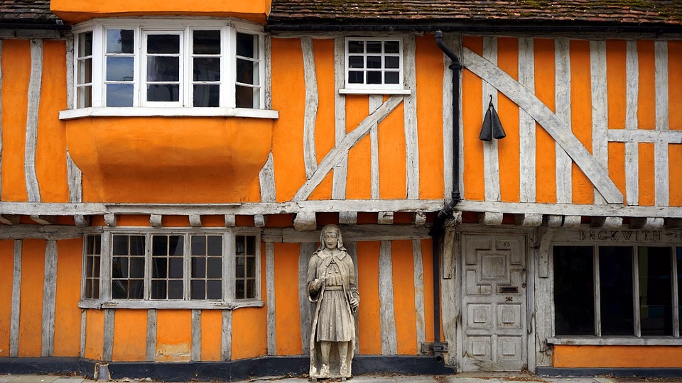
Local Transport
Transportation in the AL Postal Area
The AL postal area, encompassing towns like St Albans, Harpenden, and surrounding villages, offers a variety of transport options, making it an attractive choice for commuters and families alike.
Rail
The AL area is well-served by rail, with major stations such as St Albans City and Harpenden. Regular trains to London St Pancras take around 20-30 minutes, ideal for those commuting to the capital. There are also services to Luton, Bedford, and Gatwick Airport.
Air
For international travel, London Luton Airport is conveniently close, approximately a 20-minute drive from St Albans. Both Heathrow and Stansted airports are also accessible within an hour, offering a plethora of flight options.
Commuting by Car
With the M1 and M25 motorways nearby, the AL area provides excellent road links to London, the Midlands, and beyond. Ample parking facilities make commuting by car a viable option.
Buses
Local bus services connect the towns and villages within the AL postal area, as well as neighbouring regions. Regular services ensure ease of travel for local errands and school runs.
Train Stations
The following railway stations are within the AL postcode region:
Bricket Wood Railway Station

Brookman's Park Railway Station

Harpenden Railway Station
Hatfield Railway Station
How Wood (Hertfordshire) Railway Station
Park Street Railway Station
St.Albans Abbey Railway Station
St.Albans City Railway Station
Welham Green Railway Station
Welwyn Garden City Railway Station
Welwyn North Railway Station
Local Authorities
AL Postcode area
Local Authorities are government organisations responsible for providing local services and facilities such as education, housing, and social services within a specific area. The AL postcode area includes the following local authorities:
Central Bedfordshire
Central Bedfordshire Council manages a mix of rural and urban areas, focusing on sustainable development, education, and improving infrastructure to support economic growth and community well-being.
Dacorum
Dacorum Borough Council promotes urban regeneration, community development, and economic growth while maintaining the area's historical heritage and providing comprehensive public services.
East Hertfordshire
East Hertfordshire District Council supports both rural and urban communities, focusing on sustainable development, economic growth, and providing high-quality public services to enhance residents' quality of life.
+ 4 more
East Hertfordshire
Hertsmere
North Hertfordshire
St Albans
Welwyn Hatfield
View all Local AuthoritiesGDP (Gross Domestic Product)
Economic Output
GDP (Gross Domestic Product) measures the total economic output of a country, region, or Local Authority. It tells us how much money is being made within a particular area. This includes everything from a business selling cars or consumers getting their hair cut.
This list of the Local Authorities within the St. Albans (AL) postcode town gives us a snapshot of how much money is being generated at current market prices, based on what people are spending and earning. It's an important way to understand the economic health and activity levels across the UK.
For comparison purposes, we've included the top and bottom two local authorities across the UK in terms of GDP.
Local Authority
GDP (£)
GDP trends over time
The graph below shows the total GDP values for all Local Authorities within the St. Albans (AL) area:
When we talk about GDP at current market prices, we're looking at the total value of all goods and services produced in an area, but the key bit here is "current market prices." This means it includes the value of goods and services as they're bought and sold right now, without adjusting for inflation or changes in prices over time.
So, for example a figure of £2,363 GDP means that, on average, each person within an area contributes this amount to the UK economy each year.
Republished from the ONS regional gross domestic product: local authorities under the Open Government Licence v3.0. Latest available data: April 2022.
Education
Highest Rated Schools in AL
As rated by Ofsted
- Hatfield Community Free School
Briars Lane, Hatfield, AL10 8ES
Primary School (4-11)Outstanding - High Beeches Primary School
Aldwickbury Crescent, Harpenden, AL5 5SD
Primary School (5-11)Outstanding - Fleetville Infant and Nursery School
Royal Road, St Albans, AL1 4LX
Primary School (3-7)Outstanding - Crabtree Junior School
Crabtree Lane, Harpenden, AL5 5PU
Primary School (7-11)Outstanding - Wood End School
Yeomans Avenue, Harpenden, AL5 3EF
Primary School (4-11)Outstanding - Roundwood Park School
Roundwood Park, Harpenden, AL5 3AE
Secondary School (11-18)Outstanding - Sir John Lawes School
Manland Way, Harpenden, AL5 4QP
Secondary School (11-18)Outstanding - Nicholas Breakspear Catholic School
Colney Heath Lane, St Albans, AL4 0TT
Secondary School (11-18)Outstanding - Beaumont School
Austen Way, St Albans, AL4 0XB
Secondary School (11-18)Outstanding - St Albans Girls' School
Sandridgebury Lane, St Albans, AL3 6DB
Secondary School (11-18)Outstanding

Unlock the full power of postcode insights.
Data is meaningless without context. Reveal the stories behind a neighbourhood, and make smarter decisions with data you can trust. Gain unlimited access to detailed statistics, exclusive reports, and essential tools.
PostcodeArea is grateful to our sponsors for their support.


