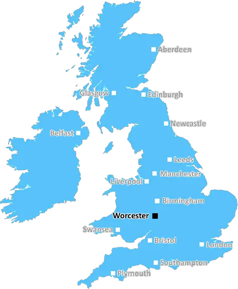
worcester WR5 Postcodes
Spending a fortune on conveyancing?

Compare instant, low-cost online quotes from trusted conveyancing solicitors.
Backed by experts, our no-obligation service searches through the best conveyancing quotes on the market to save you time and money.
Worcester (WR5)
The WR5 postcode area is located in the Worcester postcode town region, within the county of Worcestershire, and contains a total of 971 individual postcodes.
There are 29 electoral wards in the WR5 postcode area, including Broadway, Droitwich, Evesham, Malvern, Pershore, Tenbury Wells, Worcester which come under the local authority of the Worcester Council.
Combining the whole postcode region, 28% of people in WR5 are classed as having an AB social grade, (i.e. 'white-collar' middle-upper class), compared to 27% across the UK.
This does not mean that the people of WR5 are wealthier - or higher class - than average, but it can be an indication that the area may be prospering and desirable to live in.
WR5 postcode is a postcode district located in the district of Worcester, in the county of Worcestershire, in the West Midlands administrative region of England. WR5 postcode covers an area including the following localities: Chawson, Ronkswood, Whittington, and parts of Cropthorne, Hallow, Salwarpe, Kempsey, and Martin Hussingtree.
WR5 postcode has excellent transportation links, with easy access to M5 motorway as well as multiple bus routes into Worcester city centre. The nearest railway station is Worcester Shrub Hill, which is located a 8 minute drive away.
WR5 postcode also benefits from multiple supermarkets in the surrounding area, including Morrisons, Aldi, and the Co-Op. There is also a wide array of chain restaurants, bars, and independent retailers nearby.
The postcode district is mostly residential, with a mixture of detached, semi-detached, and terraced houses as well as some flats and bungalows. Prices for both rent and purchase of properties are typically more affordable in the WR5 postcode district when compared to similar areas in Worcester.
Residents of the WR5 postcode district have access to multiple leisure and recreational facilities, including local parks and gardens, sports grounds, golf clubs and sports centres. The nearby riverside village of Barmouth is within walking distance and is a popular spot for scenic walks or for relaxing near the river.
There are several schools located within the WR5 postcode district, ranging from primary to secondary and even higher education institutions, such as Worcester University. The district is also well connected to healthcare facilities and community services, providing easy access to medical professionals and amenities.

Demographics

Worcestershire

WR5 is located in the county of Worcestershire, in England.
Worcestershire has a total population of 583,100, making it the 38th largest county in the UK.
Worcestershire has a total area of 670 square miles, and a population density of 334 people per square kilometre. For comparison, Greater London has a density of 5,618 people/km2.
| Outward Code | WR5 |
| Postal Town | Worcester |
| MSOA Name | Worcester 011 |
| LSOA Name | Worcester 011F |
| County | Worcestershire |
| Region | Worcestershire |
| Country | England |
| Local Authority | Worcester |
| Area Classification | Urban with City and Town |
WR5 Electoral Wards
The postal region of WR5, includes the local towns, villages, electoral wards and stations of:
Dig even deeper into the WR5 postcode by clicking on a postcode below:
Click on an outward postal code below for more information about the area. Each 'outward' postcode give you a comprehensive list of all postcodes within the outward code area (WR) and estimated address.
Click on an 'outward' code for more information. For example, the outward postcode page 'EC2M' will give you an alphabetical list covering all postcodes located in the region, from 'EC2M 1BB' through to 'EC2M 7YA'.
Chris H
Monday, April 8, 2024
We don't have any views of WR5 right now. If you live in WR5 or have visited it, please help us to help others by telling others what you think of this neighbourhood.
Add your view of WR5
People need your local expertise. If you live in WR5 or have first-hand knowledge of the neighbourhood, please consider sharing your views. It's completely anonymous - all we ask is for your initials.
Please tell us what you like about the WR5 postcode area, what you don't like, and what it's like to live or work here.
| LOCAL AMENITIES | |
| FAMILY FRIENDLY | |
| PARKING | |
| GREEN SPACES |
Local News Worcestershire
Worcester's green-fingered social media superstar
Meet Ben, whose exploits on social media as Worcester Terrariums are seen by millions!
BBC NewsKashif ton puts Worcestershire on top at Bears
Kashif Ali scores his maiden first-class century as Worcestershire enjoy a good first day with the bat at Warwickshire.
BBC NewsTwo missing dogs found under trees using drone
They were missing for about six hours but a drone locates them within 15 minutes, its operator says.
BBC NewsBarnard helps give Bears edge over Worcestershire
Ed Barnard shines against former county Worcestershire as Warwickshire build a strong position on day two of their County Championship meeting.
BBC NewsNew electric library bus funded with 300k grant
The council says its new Worcestershire bus will provide school visits and digital skills sessions.
BBC NewsWorcester's Richards wins British title
Current and former world champions Freya Colbert and Matt Richards secure their places at the Paris Olympics by winning British titles in London.
BBC NewsKidderminster Harriers 0-2 FC Halifax Town
Max Wright scores twice to fire Halifax into the National League play-off places with a 2-0 win at struggling Kidderminster.
BBC NewsBears, Pears, rain, more rain and some cricket?
Warwickshire host Worcestershire in what looks likely to be a weather-hit County Championship season opener at Edgbaston.
BBC NewsFrom the Postcode Area blog

Deciphering Crime Rates - a Deep Dive Into UK Postcode Analysis
Ever wondered about the crime rate in your UK postcode? You're not alone. We've dug deep into the data, uncovering trends and patterns that'll make your head spin.

Death of the High Street?
The BBC reports that despite councils' attempts to kurb them, the UK's high streets have seen a huge growth in fast food outlets. Could this mark the death knell for the Great British high street, and what can we do about it to halt its decline?

Discrimination by Postcode
You really couldn't make it up, could you? Some of the country's most vulnerable people are missing out on their weekly £25 Cold Weather Payment, just because the system that's in operation is discriminating against them because payments are based on postcode, rather than geographic location.

The Redesign is Underway
Well, the current website was absolutely in dire need of a good redesign - from the ground up. So I set out to pull it all apart and get it up and running again to become the most comprehensive guide to every postcode in the UK. And it's been a long, tough job from start to finish - and quite possibly the biggest project I've ever undertaken.
SOCIAL GRADES
According to census records, 28% of people here have a social grade of AB (highest), compared to the national average of 27%.