wolverhampton WV1 Postcodes
Spending a fortune on conveyancing?

Compare instant, low-cost online quotes from trusted conveyancing solicitors.
Backed by experts, our no-obligation service searches through the best conveyancing quotes on the market to save you time and money.
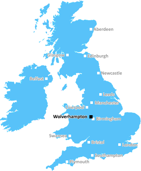
Wolverhampton (WV1)
The WV1 postcode area is located in the Wolverhampton postcode town region, within the county of West Midlands, and contains a total of 1487 individual postcodes.
There are 8 electoral wards in the WV1 postcode area, including Bilston, Bridgnorth, Willenhall, Wolverhampton which come under the local authority of the Wolverhampton Council.
Combining the whole postcode region, 11% of people in WV1 are classed as having an AB social grade, (i.e. 'white-collar' middle-upper class), compared to 27% across the UK.
This does not mean that the people of WV1 are poorer than other areas, but it may give an indication that there are areas of deprivation.
The WV1 postcode district in the West Midlands region of England is centred around Wolv erhampton. It is one of the larger postcodes in the city and is bordered by the WV2, WV3, WV4, WV5 and WV11 postcodes. The area is home to approximately 8,000 people and covers a large area including the city centre as well as many residential areas in surrounding neighbourhoods.
The area is well known for its excellent transport connections, with Wolverhampton rail station � part of the West Midlands Railway network � situated close by, and Wolverhampton bus station located nearby. This makes it easy for people living in the area to get around to neighbouring towns and cities for work and leisure.
The WV1 district is served by a number of primary and secondary schools, making it a family-friendly area. Many of the secondary schools have sixth-form centres, offering 16�19 year-olds a chance to continue with their studies and gain essential qualifications.
There is also plenty of retailers in the district, ranging from independent stores to chain stores like Tesco, Costa and Starbucks. There is also a variety of pubs and restaurants nearby � ideal for nights out with friends and family.
The area itself is home to a wealth of historic buildings, many of which are grade two listed. Places of interest include the St Andrew's War Memorial Church, St Phillip's Church and St George's Church. These are just a few of the many landmarks situated within the WV1 district.
For recreational activities, Wolverhampton Racecourse and West Park are within easy reach of this postcode. There are also a number of leisure centres in the vicinity � including the Wolverhampton Swimming and Fitness Centre, offering a range of sporting and fitness activities.
The WV1 postcode district is a great place to live or visit and offers plenty of amenities, attractions and places of interest to discover.

Demographics

West Midlands

WV1 is located in the county of West Midlands, in England.
West Midlands has a total population of 2,864,900, making it the 2nd largest county in the UK.
West Midlands has a total area of 348 square miles, and a population density of 3177 people per square kilometre. For comparison, Greater London has a density of 5,618 people/km2.
| Outward Code | WV1 |
| Postal Town | Wolverhampton |
| MSOA Name | Wolverhampton 015 |
| LSOA Name | Wolverhampton 015B |
| County | West Midlands |
| Region | West Midlands |
| Country | England |
| Local Authority | Wolverhampton |
| Area Classification | Urban with Major Conurbation |
WV1 Electoral Wards
The postal region of WV1, includes the local towns, villages, electoral wards and stations of:
Dig even deeper into the WV1 postcode by clicking on a postcode below:
Click on an outward postal code below for more information about the area. Each 'outward' postcode give you a comprehensive list of all postcodes within the outward code area (WV) and estimated address.
Click on an 'outward' code for more information. For example, the outward postcode page 'EC2M' will give you an alphabetical list covering all postcodes located in the region, from 'EC2M 1BB' through to 'EC2M 7YA'.
Chris H
Sunday, April 7, 2024
We don't have any views of WV1 right now. If you live in WV1 or have visited it, please help us to help others by telling others what you think of this neighbourhood.
Add your view of WV1
People need your local expertise. If you live in WV1 or have first-hand knowledge of the neighbourhood, please consider sharing your views. It's completely anonymous - all we ask is for your initials.
Please tell us what you like about the WV1 postcode area, what you don't like, and what it's like to live or work here.
| LOCAL AMENITIES | |
| FAMILY FRIENDLY | |
| PARKING | |
| GREEN SPACES |
Local News Staffordshire
Main Stafford road set to undergo major repairs
A main route into Stafford will be undergoing major improvements from this Monday March 4. The A449 Wolverhampton Road will be resurfaced on the stretch from the roundabout close to the town centre to&hellip
Staffordshire County Council53 death notices in Stoke-on-Trent and North Staffordshire this week
Our thoughts and prayers are with their loved ones
Stoke SentinelTown centre transport improvement scheme moves to next phase
A regeneration project to improve roads and routes for cycling and walking in Cannock town centre moves to its final phase on Monday April 8.
Staffordshire County CouncilPlanning approval granted for top grade electric vehicle charging facility at i54
Planning approval has been granted for a GRIDSERVE Electric Forecourt at i54 South Staffordshire.
Staffordshire County CouncilFormer Dignity Champion urges others to nominate
A former Staffordshire Dignity in Care award winner is now urging others to nominate for this year's awards.
Staffordshire County CouncilThe price of feeding deer is dear, warns countryside officers
Feeding deer makes them vulnerable to disease, poaching and overpopulation, so rangers are urging country park users to buck the trend.
Staffordshire County CouncilMain Burton road set for daytime closures due to utility works
A short section of Shobnall Road in Burton will undergo a series of daytime closures over the next fortnight due to planned utility works.
Staffordshire County CouncilMother's plea after son killed by speeding driver
"There is no need for anyone else to know what this pain feels like," Jakki Hartland says.
BBC NewsFrom the Postcode Area blog

Deciphering Crime Rates - a Deep Dive Into UK Postcode Analysis
Ever wondered about the crime rate in your UK postcode? You're not alone. We've dug deep into the data, uncovering trends and patterns that'll make your head spin.

Death of the High Street?
The BBC reports that despite councils' attempts to kurb them, the UK's high streets have seen a huge growth in fast food outlets. Could this mark the death knell for the Great British high street, and what can we do about it to halt its decline?

Discrimination by Postcode
You really couldn't make it up, could you? Some of the country's most vulnerable people are missing out on their weekly £25 Cold Weather Payment, just because the system that's in operation is discriminating against them because payments are based on postcode, rather than geographic location.

The Redesign is Underway
Well, the current website was absolutely in dire need of a good redesign - from the ground up. So I set out to pull it all apart and get it up and running again to become the most comprehensive guide to every postcode in the UK. And it's been a long, tough job from start to finish - and quite possibly the biggest project I've ever undertaken.
SOCIAL GRADES
According to census records, 11% of people here have a social grade of AB (highest), compared to the national average of 27%.