wigan WN1 Postcodes
Spending a fortune on conveyancing?

Compare instant, low-cost online quotes from trusted conveyancing solicitors.
Backed by experts, our no-obligation service searches through the best conveyancing quotes on the market to save you time and money.
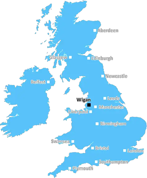
Wigan (WN1)
The WN1 postcode area is located in the Wigan postcode town region, within the county of Greater Manchester, and contains a total of 1172 individual postcodes.
There are 13 electoral wards in the WN1 postcode area, including Leigh, Skelmersdale, Wigan which come under the local authority of the Wigan Council.
Combining the whole postcode region, 18% of people in WN1 are classed as having an AB social grade, (i.e. 'white-collar' middle-upper class), compared to 27% across the UK.
This does not mean that the people of WN1 are poorer than other areas, but it may give an indication that there are areas of deprivation.
WN1 is a postcode district within the Wigan district, located in North West England. It includes areas of Wigan, including the city centre, as well as parts of Ashton-in-Makerfield, Haigh, and Shevington Vale.
WN1 encompasses a total area of 5.8 square miles, with a population of approximately 67,000 people. The area is represented by the Member of Parliament of Wigan constituency.
The district has three main communities: Wigan town centre, Haigh, and Shevington Vale. Wigan town centre includes a large variety of shops, businesses, and other attractions, such as the Grand Arcade shopping centre and historic Leigh Grand Arcade.
Haigh is known for its rural beauty, with lots of open green space and countryside landscapes. Shevington Vale is an older neighbourhood surrounded by greenbelt protected land.
From a transport perspective, WN1 is served by Wigan North Western station, which is on the West Coast Main Line and has connections to Manchester, Liverpool, and Birmingham. There are several bus routes that run across WN1, which connect the area to other districts and suburbs.
In terms of education, there are a range of independent and state-run schools within WN1. Popular schools in the area include St Peter's Catholic Primary School, Wigan and Leigh College, and Hope Academy.
WN1 is known for its diverse range of cultural and entertainment opportunities. Popular museums in the area include the Wigan Little Theatre, the Museum of Wigan Life, and the fascinating Mab's Cross Local History Centre. There are also a number of parks, pubs, clubs, and other local attractions.
TheWN1 postcode area offers a range of amenities, attractions, and opportunities regardless of age and interests. From the scenic rural surroundings of Haigh to the bustling city centre of Wigan, WN1 is an excellent place to live and visit.

Demographics
Greater Manchester

WN1 is located in the county of Greater Manchester, in England.
Greater Manchester has a total population of 2,782,100, making it the 3rd largest county in the UK.
Greater Manchester has a total area of 492 square miles, and a population density of 2180 people per square kilometre. For comparison, Greater London has a density of 5,618 people/km2.
| Outward Code | WN1 |
| Postal Town | Wigan |
| MSOA Name | Wigan 008 |
| LSOA Name | Wigan 008C |
| County | Greater Manchester |
| Region | Greater Manchester |
| Country | England |
| Local Authority | Wigan |
| Area Classification | Urban with Major Conurbation |
WN1 Electoral Wards
The postal region of WN1, includes the local towns, villages, electoral wards and stations of:
Dig even deeper into the WN1 postcode by clicking on a postcode below:
Click on an outward postal code below for more information about the area. Each 'outward' postcode give you a comprehensive list of all postcodes within the outward code area (WN) and estimated address.
Click on an 'outward' code for more information. For example, the outward postcode page 'EC2M' will give you an alphabetical list covering all postcodes located in the region, from 'EC2M 1BB' through to 'EC2M 7YA'.
Chris H
Sunday, April 7, 2024
We don't have any views of WN1 right now. If you live in WN1 or have visited it, please help us to help others by telling others what you think of this neighbourhood.
Add your view of WN1
People need your local expertise. If you live in WN1 or have first-hand knowledge of the neighbourhood, please consider sharing your views. It's completely anonymous - all we ask is for your initials.
Please tell us what you like about the WN1 postcode area, what you don't like, and what it's like to live or work here.
| LOCAL AMENITIES | |
| FAMILY FRIENDLY | |
| PARKING | |
| GREEN SPACES |
From the Postcode Area blog

Deciphering Crime Rates - a Deep Dive Into UK Postcode Analysis
Ever wondered about the crime rate in your UK postcode? You're not alone. We've dug deep into the data, uncovering trends and patterns that'll make your head spin.

Death of the High Street?
The BBC reports that despite councils' attempts to kurb them, the UK's high streets have seen a huge growth in fast food outlets. Could this mark the death knell for the Great British high street, and what can we do about it to halt its decline?

Discrimination by Postcode
You really couldn't make it up, could you? Some of the country's most vulnerable people are missing out on their weekly £25 Cold Weather Payment, just because the system that's in operation is discriminating against them because payments are based on postcode, rather than geographic location.

The Redesign is Underway
Well, the current website was absolutely in dire need of a good redesign - from the ground up. So I set out to pull it all apart and get it up and running again to become the most comprehensive guide to every postcode in the UK. And it's been a long, tough job from start to finish - and quite possibly the biggest project I've ever undertaken.
SOCIAL GRADES
According to census records, 18% of people here have a social grade of AB (highest), compared to the national average of 27%.