warrington WA3 Postcodes
Spending a fortune on conveyancing?

Compare instant, low-cost online quotes from trusted conveyancing solicitors.
Backed by experts, our no-obligation service searches through the best conveyancing quotes on the market to save you time and money.
Warrington (WA3)
The WA3 postcode area is located in the Warrington postcode town region, within the county of Greater Manchester, and contains a total of 1908 individual postcodes.
There are 61 electoral wards in the WA3 postcode area, including Altrincham, Frodsham, Knutsford, Lymm, Newton-Le-Willows, Runcorn, St Helens, Warrington, Widnes which come under the local authority of the Wigan Council.
Combining the whole postcode region, 24% of people in WA3 are classed as having an AB social grade, (i.e. 'white-collar' middle-upper class), compared to 27% across the UK.
This does not mean that the people of WA3 are poorer than other areas, but it may give an indication that there are areas of deprivation.
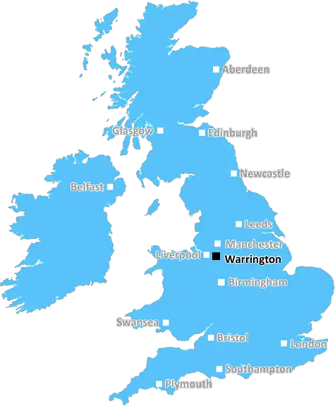
The WA3 postcode is located in the north-west of the Warrington district of England. It covers an area that includes the Warrington town centre, Winwick, Croft, Lowton and Culcheth. It also includes the town's two retail parks, Gemini Retail Park and the Golden Square Shopping Centre.
The WA3 postcode mainly extends east and west from the Warrington town centre, as well as the Bank Quay area and Woolston. To the south it includes Culcheth and Glazebury, and to the north it covers Winwick and Lowton.
WA3 is well served by public transport with many bus routes operating through it taking passengers to Warrington town centre and beyond. It is served by Warrington Bank Quay railway station which has services running to Manchester and Liverpool. There is also the nearby Warrington Central train station, which runs train connections to the North West and further afield.
Crime rates within WA3 are generally on the low side with reports of crime falling slightly each year for the past five years. There are several schools located within the postcode including Culcheth High School and Beechwood Primary School. There are also several shopping opportunities in WA3, such as the Gemini Retail Park and the Golden Square Shopping Centre.
The Warrington Marathon is held annually in WA3, which has become a local tradition and is popular with many. In addition, there are several parks and open spaces located in and around the postcode, including Walton Hall Park and Boteler's Park.
The postcode has excellent sports facilities, with some of the most popular sports including rugby, cricket, football, tennis and golf. A local golf course at Hollinfare is very popular with those living in the postcode.
In addition, there is a wide range of leisure activities available in and around WA3, such as bowling, karting, swimming and cinema at Warrington's Multiplex. The postcode is also home to the National Waterways Museum, which is a popular visitor attraction.

Demographics
Greater Manchester

WA3 is located in the county of Greater Manchester, in England.
Greater Manchester has a total population of 2,782,100, making it the 3rd largest county in the UK.
Greater Manchester has a total area of 492 square miles, and a population density of 2180 people per square kilometre. For comparison, Greater London has a density of 5,618 people/km2.
| Outward Code | WA3 |
| Postal Town | Warrington |
| MSOA Name | Wigan 040 |
| LSOA Name | Wigan 040C |
| County | Greater Manchester |
| Region | Greater Manchester |
| Country | England |
| Local Authority | Wigan |
| Area Classification | Urban with Major Conurbation |
WA3 Electoral Wards
The postal region of WA3, includes the local towns, villages, electoral wards and stations of:
Dig even deeper into the WA3 postcode by clicking on a postcode below:
Click on an outward postal code below for more information about the area. Each 'outward' postcode give you a comprehensive list of all postcodes within the outward code area (WA) and estimated address.
Click on an 'outward' code for more information. For example, the outward postcode page 'EC2M' will give you an alphabetical list covering all postcodes located in the region, from 'EC2M 1BB' through to 'EC2M 7YA'.
Chris H
Tuesday, April 9, 2024
We don't have any views of WA3 right now. If you live in WA3 or have visited it, please help us to help others by telling others what you think of this neighbourhood.
Add your view of WA3
People need your local expertise. If you live in WA3 or have first-hand knowledge of the neighbourhood, please consider sharing your views. It's completely anonymous - all we ask is for your initials.
Please tell us what you like about the WA3 postcode area, what you don't like, and what it's like to live or work here.
| LOCAL AMENITIES | |
| FAMILY FRIENDLY | |
| PARKING | |
| GREEN SPACES |
From the Postcode Area blog

Deciphering Crime Rates - a Deep Dive Into UK Postcode Analysis
Ever wondered about the crime rate in your UK postcode? You're not alone. We've dug deep into the data, uncovering trends and patterns that'll make your head spin.

Death of the High Street?
The BBC reports that despite councils' attempts to kurb them, the UK's high streets have seen a huge growth in fast food outlets. Could this mark the death knell for the Great British high street, and what can we do about it to halt its decline?

Discrimination by Postcode
You really couldn't make it up, could you? Some of the country's most vulnerable people are missing out on their weekly £25 Cold Weather Payment, just because the system that's in operation is discriminating against them because payments are based on postcode, rather than geographic location.

The Redesign is Underway
Well, the current website was absolutely in dire need of a good redesign - from the ground up. So I set out to pull it all apart and get it up and running again to become the most comprehensive guide to every postcode in the UK. And it's been a long, tough job from start to finish - and quite possibly the biggest project I've ever undertaken.
SOCIAL GRADES
According to census records, 24% of people here have a social grade of AB (highest), compared to the national average of 27%.