warrington WA11 Postcodes
Spending a fortune on conveyancing?

Compare instant, low-cost online quotes from trusted conveyancing solicitors.
Backed by experts, our no-obligation service searches through the best conveyancing quotes on the market to save you time and money.
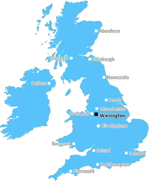
Warrington (WA11)
The WA11 postcode area is located in the Warrington postcode town region, within the county of Merseyside, and contains a total of 1204 individual postcodes.
There are 43 electoral wards in the WA11 postcode area, including Altrincham, Frodsham, Knutsford, Lymm, Newton-Le-Willows, Runcorn, St Helens, Warrington, Widnes which come under the local authority of the St. Helens Council.
Combining the whole postcode region, 18% of people in WA11 are classed as having an AB social grade, (i.e. 'white-collar' middle-upper class), compared to 27% across the UK.
This does not mean that the people of WA11 are poorer than other areas, but it may give an indication that there are areas of deprivation.
The WA11 postcode in the UK is located within the Prescot, St Helens and Rainhill areas of Merseyside. It covers the villages of Clock Face, Rainford, Carr Mill, Eccleston, and Parr. It also contains parts of the Sankey Valley Country Park and the St. Helens marina on the Sankey Canal.
The postcode region is home to several historical landmarks and places of interest, such as the Clock Face Colliery, St. Helens Railway Station, St. Mark's Church, and St. Jude's Cathedral. The area is also known for its industrial heritage, with many factories that remain from the Industrial Revolution.
The postcode also provides excellent transport links to Manchester, Warrington, and Liverpool. The main train route that runs through the area is the West Coast Main Line which connects Prescot to Watford and London. The Liverpool-Manchester Metrolink serves the area, providing convenient access to Warrington, Widnes, Warrington, and Liverpool. There are also regular bus services from St. Mary's Church in Rainford and St. Helens Station.
The town of St. Helens is the nearest shopping center, offering a variety of shops, supermarkets, cafes, and bars. This is also the site of the Haydock Racecourse and the Haydock British Touring Car Championship.
In terms of education, there are several local primary schools located in the postcode area, offering a range of programs and resources to cater for children of all ages. Locally, children can attend Rainford High Technology College and St. Julie's Catholic High School. The local university is the University of Central Lancashire, located in nearby Preston.
The postcode features a number of parks and open spaces, including Sankey Valley, Lower Derwent Valley, Carr Mill Dam, and Burtonwood Adventure Park. Locally, there are many local activities and attractions to take part in, from the annual Blackbrook Fair in St. Helens to the many nearby golf courses and lakes.
TheWA11 postcode is an ideal place to live for those looking for easy transport links, an abundance of education options, and a variety of activities to enjoy. It provides a great combination of urban and rural living, making it a perfect location for anyone looking for a place to call home.

Demographics
Merseyside

WA11 is located in the county of Merseyside, in England.
Merseyside has a total population of 1,406,400, making it the 9th largest county in the UK.
Merseyside has a total area of 250 square miles, and a population density of 2174 people per square kilometre. For comparison, Greater London has a density of 5,618 people/km2.
| Outward Code | WA11 |
| Postal Town | Warrington |
| MSOA Name | St. Helens 008 |
| LSOA Name | St. Helens 008F |
| County | Merseyside |
| Region | Merseyside |
| Country | England |
| Local Authority | St. Helens |
| Area Classification | Urban with Major Conurbation |
WA11 Electoral Wards
The postal region of WA11, includes the local towns, villages, electoral wards and stations of:
Dig even deeper into the WA11 postcode by clicking on a postcode below:
Click on an outward postal code below for more information about the area. Each 'outward' postcode give you a comprehensive list of all postcodes within the outward code area (WA) and estimated address.
Click on an 'outward' code for more information. For example, the outward postcode page 'EC2M' will give you an alphabetical list covering all postcodes located in the region, from 'EC2M 1BB' through to 'EC2M 7YA'.
Chris H
Monday, April 8, 2024
We don't have any views of WA11 right now. If you live in WA11 or have visited it, please help us to help others by telling others what you think of this neighbourhood.
Add your view of WA11
People need your local expertise. If you live in WA11 or have first-hand knowledge of the neighbourhood, please consider sharing your views. It's completely anonymous - all we ask is for your initials.
Please tell us what you like about the WA11 postcode area, what you don't like, and what it's like to live or work here.
| LOCAL AMENITIES | |
| FAMILY FRIENDLY | |
| PARKING | |
| GREEN SPACES |
Local News Merseyside
Grand National changes after 'taking opinions'
Voices from across the racing world and welfare groups have informed changes to this year's race.
BBC NewsCouncil boss defends leisure centre demolition
The Woodchurch leisure centre will be knocked down despite efforts by community groups to save it.
BBC NewsWhere in the UK can you see Monday's solar eclipse?
People in the UK can also see the solar eclipse happening in the US next week
BBC NewsAnderson 'nervous for the pain' after illness
Olympic gold medallist Freya Anderson says she was "nervous for the pain" after she returned to the pool following her glandular fever diagnosis.
BBC NewsGreat-grandad, 111, is world's oldest living man
John Tinniswood, from Merseyside, took the title after the death of the previous record-holder.
BBC NewsCity's green projects win climate change funding
A grant will pay for a green wall, eco-friendly paving and more planting in Liverpool, the council says.
BBC NewsThree-year-old girl rescued after falling into lake
Officers saved the child after she wandered out of a house and fell in a nearby lake, police say.
BBC NewsSurrey only face 21 balls on rain-affected day
Openers Rory Burns and Dom Sibley are only able to add four runs as rain ruins Surrey's reply to Lancashire's 202.
BBC NewsFrom the Postcode Area blog

Deciphering Crime Rates - a Deep Dive Into UK Postcode Analysis
Ever wondered about the crime rate in your UK postcode? You're not alone. We've dug deep into the data, uncovering trends and patterns that'll make your head spin.

Death of the High Street?
The BBC reports that despite councils' attempts to kurb them, the UK's high streets have seen a huge growth in fast food outlets. Could this mark the death knell for the Great British high street, and what can we do about it to halt its decline?

Discrimination by Postcode
You really couldn't make it up, could you? Some of the country's most vulnerable people are missing out on their weekly £25 Cold Weather Payment, just because the system that's in operation is discriminating against them because payments are based on postcode, rather than geographic location.

The Redesign is Underway
Well, the current website was absolutely in dire need of a good redesign - from the ground up. So I set out to pull it all apart and get it up and running again to become the most comprehensive guide to every postcode in the UK. And it's been a long, tough job from start to finish - and quite possibly the biggest project I've ever undertaken.
SOCIAL GRADES
According to census records, 18% of people here have a social grade of AB (highest), compared to the national average of 27%.