walsall WS7 Postcodes
Spending a fortune on conveyancing?

Compare instant, low-cost online quotes from trusted conveyancing solicitors.
Backed by experts, our no-obligation service searches through the best conveyancing quotes on the market to save you time and money.
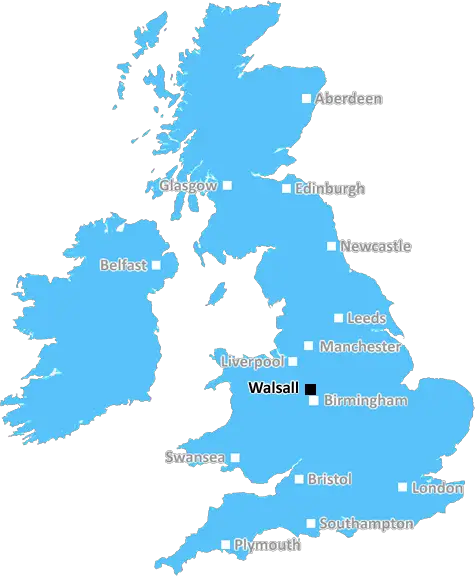
Walsall (WS7)
The WS7 postcode area is located in the Walsall postcode town region, within the county of Staffordshire, and contains a total of 1114 individual postcodes.
There are 15 electoral wards in the WS7 postcode area, including Burntwood, Cannock, Lichfield, Rugeley, Walsall, Wednesbury which come under the local authority of the Lichfield Council.
Combining the whole postcode region, 19% of people in WS7 are classed as having an AB social grade, (i.e. 'white-collar' middle-upper class), compared to 27% across the UK.
This does not mean that the people of WS7 are poorer than other areas, but it may give an indication that there are areas of deprivation.
WS7 is a postcode district in the WS (Walsall) postcode area in the West Midlands of England. The main town in the postcode area is Walsall, with 25% of all residents in the WS7 postcode living there. Other towns and villages in the district are Stonall, Bournehill, Norton Canes, and Chasetown.
The district of WS7 covers an area of 26.04 square miles and has a population of 24,775. The most recent census data shows that the population of WS7 has seen a 3.1% increase in the last 10 years. The district has consistently seen positive population growth since 2011 and the majority of this growth can be attributed to young people aged between 20 and 29 moving into the area.
WS7 has become increasingly popular with commuters in recent years due to its excellent transport connections and there is a variety of housing opportunities within it. The area contains a number of residential areas as well as a healthy green belt to the north and west. The district has been ranked as one of the top 20 rural postcode areas in the country in terms of access to services, employment, educational establishments, and leisure facilities.
The area is served by Walsall Wood railway station, located on the Walsall to Bescot railway line. The A5 road passes through the area, running from the Metropolitan Borough of Wolverhampton in the north-west to Cannock in the south-east. Additionally, the M6 motorway junction 9 is close to the postcode area.
The postcode district is home to a variety of different educational establishments, such as Walsall Academy, St. Thomas More Catholic Primary School, and Norton Canes Primary School. There are also opportunities for further education at Walsall College and a number of private schools in the area, such as Blue Coat School and Queen Mary's High School.
Within WS7 there is a range of retail, cafe, and restaurant options, plus leisure activities, including The Mount Sports Centre, Walsall Wood Golf Course, and the Forestry Commission's Woods Nature Reserve. The area is home to a number of churches including All Saints' Church, St. Michael's Church, Chasetown Methodist Church, and Walsall Wood Baptist Church.
WS7 also has a strong industrial heritage, and although there has been a decline in recent years, the area does offer a good range of employment options including manufacturing, engineering, and retail jobs, as well as a few local employers such as Eisemanns Bakery and Urenco UK.

Demographics

Staffordshire

WS7 is located in the county of Staffordshire, in England.
Staffordshire has a total population of 1,120,300, making it the 17th largest county in the UK.
Staffordshire has a total area of 1047 square miles, and a population density of 412 people per square kilometre. For comparison, Greater London has a density of 5,618 people/km2.
| Outward Code | WS7 |
| Postal Town | Walsall |
| MSOA Name | Lichfield 010 |
| LSOA Name | Lichfield 010C |
| County | Staffordshire |
| Region | Staffordshire |
| Country | England |
| Local Authority | Lichfield |
| Area Classification | Urban with Significant Rural (rural including hub towns 26-49%) |
WS7 Electoral Wards
The postal region of WS7, includes the local towns, villages, electoral wards and stations of:
Dig even deeper into the WS7 postcode by clicking on a postcode below:
Click on an outward postal code below for more information about the area. Each 'outward' postcode give you a comprehensive list of all postcodes within the outward code area (WS) and estimated address.
Click on an 'outward' code for more information. For example, the outward postcode page 'EC2M' will give you an alphabetical list covering all postcodes located in the region, from 'EC2M 1BB' through to 'EC2M 7YA'.
Chris H
Sunday, April 7, 2024
We don't have any views of WS7 right now. If you live in WS7 or have visited it, please help us to help others by telling others what you think of this neighbourhood.
Add your view of WS7
People need your local expertise. If you live in WS7 or have first-hand knowledge of the neighbourhood, please consider sharing your views. It's completely anonymous - all we ask is for your initials.
Please tell us what you like about the WS7 postcode area, what you don't like, and what it's like to live or work here.
| LOCAL AMENITIES | |
| FAMILY FRIENDLY | |
| PARKING | |
| GREEN SPACES |
Local News Staffordshire
Highways improvements to start in Lichfield next week
A major highways improvements scheme in Lichfield will start on Monday 25 March.
Staffordshire County CouncilFarm shop and caf plan for derelict North Staffordshire pub hit by delays
The plans had been recommended for refusal by planning officers at Staffordshire Moorlands District Council
Stoke SentinelMajor highways works completed in Burton
A major highways improvement scheme to resurface the A511 Horninglow Road North in Burton has been completed.
Staffordshire County CouncilMain Stafford road set to undergo major repairs
A main route into Stafford will be undergoing major improvements from this Monday March 4. The A449 Wolverhampton Road will be resurfaced on the stretch from the roundabout close to the town centre to&hellip
Staffordshire County CouncilMillions could be owed WASPI compensation - see if you're eligible
Check if you are eligible using our interactive gadget
Stoke SentinelNHS trust declares critical incident amid 'extreme pressures'
University Hospitals of North Midlands NHS Trust reports A&Es to be experiencing highest demand.
BBC NewsCouncil in talks over future of one of Stoke-on-Trent's oldest homes
Staffordshire Police are investigating the latest arson attack on Ford Green House, in Smallthorne
Stoke SentinelShini from Stafford becomes Blue Peter's 43rd presenter
Shini Muthukrishnan on her new Blue Peter role and what it means to her at the age of 22.
BBC NewsFrom the Postcode Area blog

Deciphering Crime Rates - a Deep Dive Into UK Postcode Analysis
Ever wondered about the crime rate in your UK postcode? You're not alone. We've dug deep into the data, uncovering trends and patterns that'll make your head spin.

Death of the High Street?
The BBC reports that despite councils' attempts to kurb them, the UK's high streets have seen a huge growth in fast food outlets. Could this mark the death knell for the Great British high street, and what can we do about it to halt its decline?

Discrimination by Postcode
You really couldn't make it up, could you? Some of the country's most vulnerable people are missing out on their weekly £25 Cold Weather Payment, just because the system that's in operation is discriminating against them because payments are based on postcode, rather than geographic location.

The Redesign is Underway
Well, the current website was absolutely in dire need of a good redesign - from the ground up. So I set out to pull it all apart and get it up and running again to become the most comprehensive guide to every postcode in the UK. And it's been a long, tough job from start to finish - and quite possibly the biggest project I've ever undertaken.
SOCIAL GRADES
According to census records, 19% of people here have a social grade of AB (highest), compared to the national average of 27%.