walsall WS10 Postcodes
Spending a fortune on conveyancing?

Compare instant, low-cost online quotes from trusted conveyancing solicitors.
Backed by experts, our no-obligation service searches through the best conveyancing quotes on the market to save you time and money.
Walsall (WS10)
The WS10 postcode area is located in the Walsall postcode town region, within the county of West Midlands, and contains a total of 1218 individual postcodes.
There are 20 electoral wards in the WS10 postcode area, including Burntwood, Cannock, Lichfield, Rugeley, Walsall, Wednesbury which come under the local authority of the Sandwell Council.
Combining the whole postcode region, 8% of people in WS10 are classed as having an AB social grade, (i.e. 'white-collar' middle-upper class), compared to 27% across the UK.
This does not mean that the people of WS10 are poorer than other areas, but it may give an indication that there are areas of deprivation.
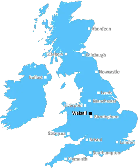
The WS10 postcode belongs to the Walsall district in the West Midlands, England. It includes parts of the Blakenall, Leamore, Short Heath, Pleck and Paddock districts. The postcode is situated to the east of Walsall town centre, approximately 4 miles away from central Birmingham and 7 miles away from Wolverhampton.
The WS10 postcode district covers a variety of properties ranging from large detached houses to new housing developments to high rise flats. One of the main residential areas in the district is Blakenall, which has seen a large investment in new housing developments. Leamore is another residential area of the district, and is a mixture of older style terraced housing, larger modern housing developments, and smaller areas of grassed open spaces.
The district also contains a variety of facilities and local amenities, including two local primary schools, Parkfield Primary School and Old Park Primary School. In terms of leisure and recreation, there is a wide range of activities available, including bowling, swimming, horse riding, football and rugby clubs, and golf courses. There is also a shopping centre located in Willenhall, providing plenty of general retail and leisure outlets.
The area is well connected, with easy access to the M6 motorway and other major roads. Moxley railway station serves the district, providing direct access to Birmingham city centre in just a few minutes. Additionally, there are several bus routes operating in the district, providing further public transport links.
TheWS10 postcode district provides a mix of residential properties, local facilities and easy access to the city centres of Birmingham and Wolverhampton, making it a desirable place for individuals and families to live.

Demographics

West Midlands

WS10 is located in the county of West Midlands, in England.
West Midlands has a total population of 2,864,900, making it the 2nd largest county in the UK.
West Midlands has a total area of 348 square miles, and a population density of 3177 people per square kilometre. For comparison, Greater London has a density of 5,618 people/km2.
| Outward Code | WS10 |
| Postal Town | Walsall |
| MSOA Name | Sandwell 005 |
| LSOA Name | Sandwell 005C |
| County | West Midlands |
| Region | West Midlands |
| Country | England |
| Local Authority | Sandwell |
| Area Classification | Urban with Major Conurbation |
WS10 Electoral Wards
The postal region of WS10, includes the local towns, villages, electoral wards and stations of:
Dig even deeper into the WS10 postcode by clicking on a postcode below:
Click on an outward postal code below for more information about the area. Each 'outward' postcode give you a comprehensive list of all postcodes within the outward code area (WS) and estimated address.
Click on an 'outward' code for more information. For example, the outward postcode page 'EC2M' will give you an alphabetical list covering all postcodes located in the region, from 'EC2M 1BB' through to 'EC2M 7YA'.
Chris H
Wednesday, April 10, 2024
We don't have any views of WS10 right now. If you live in WS10 or have visited it, please help us to help others by telling others what you think of this neighbourhood.
Add your view of WS10
People need your local expertise. If you live in WS10 or have first-hand knowledge of the neighbourhood, please consider sharing your views. It's completely anonymous - all we ask is for your initials.
Please tell us what you like about the WS10 postcode area, what you don't like, and what it's like to live or work here.
| LOCAL AMENITIES | |
| FAMILY FRIENDLY | |
| PARKING | |
| GREEN SPACES |
Local News Staffordshire
Duck shot in the head in 'horrifying' Hanley Park attack
The RSPCA is now appealing for help to catch the culprit
Stoke SentinelFormer Staffordshire smokers share their experiences to help others quit
Three former smokers from Staffordshire are sharing their positive experiences of quitting, following help from a free stop smoking service funded by Staffordshire County Council.
Staffordshire County CouncilThree fire engines scrambled as caravan torched in arson attack
Cheshire Police are appealing for witnesses over the blaze on Congleton's Royle Street
Stoke SentinelI'm a working mum who gets shamed for being naturally pretty with a good figure
Amee Gleadell, 35, says other mums are jealous as she's not had to use fillers or Botox
Stoke SentinelMajor highways improvement scheme to start in Newcastle
A major highways improvements scheme on the A34 Talke Road in Newcastle is due to start on Monday 11 March.
Staffordshire County CouncilTragedy as man, 32, found dead by police
Police were called due to 'concerns for the welfare of a man'
Stoke SentinelBudget statement by the leader of Staffordshire County Council
"The further reduction in National Insurance contributions will be welcome news to our residents in helping them to meet daily cost of living challenges by putting more money in their pocket. This wil&hellip
Staffordshire County CouncilThree weeks of bridge repairs - and other roadworks to avoid
The repairs are being carried out on a bridge crossing the River Trent in Milton
Stoke SentinelFrom the Postcode Area blog

Deciphering Crime Rates - a Deep Dive Into UK Postcode Analysis
Ever wondered about the crime rate in your UK postcode? You're not alone. We've dug deep into the data, uncovering trends and patterns that'll make your head spin.

Death of the High Street?
The BBC reports that despite councils' attempts to kurb them, the UK's high streets have seen a huge growth in fast food outlets. Could this mark the death knell for the Great British high street, and what can we do about it to halt its decline?

Discrimination by Postcode
You really couldn't make it up, could you? Some of the country's most vulnerable people are missing out on their weekly £25 Cold Weather Payment, just because the system that's in operation is discriminating against them because payments are based on postcode, rather than geographic location.

The Redesign is Underway
Well, the current website was absolutely in dire need of a good redesign - from the ground up. So I set out to pull it all apart and get it up and running again to become the most comprehensive guide to every postcode in the UK. And it's been a long, tough job from start to finish - and quite possibly the biggest project I've ever undertaken.
SOCIAL GRADES
According to census records, 8% of people here have a social grade of AB (highest), compared to the national average of 27%.