wakefield WF2 Postcodes
Spending a fortune on conveyancing?

Compare instant, low-cost online quotes from trusted conveyancing solicitors.
Backed by experts, our no-obligation service searches through the best conveyancing quotes on the market to save you time and money.
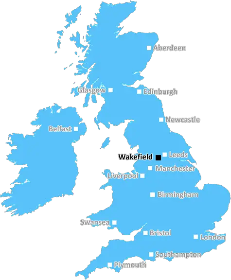
Wakefield (WF2)
The WF2 postcode area is located in the Wakefield postcode town region, within the county of West Yorkshire, and contains a total of 1554 individual postcodes.
There are 67 electoral wards in the WF2 postcode area, including Batley, Castleford, Dewsbury, Heckmondwike, Knottingley, Liversedge, Mirfield, Normanton, Ossett, Pontefract, Wakefield which come under the local authority of the Wakefield Council.
Combining the whole postcode region, 20% of people in WF2 are classed as having an AB social grade, (i.e. 'white-collar' middle-upper class), compared to 27% across the UK.
This does not mean that the people of WF2 are poorer than other areas, but it may give an indication that there are areas of deprivation.
WF2 is a postcode area in the Wakefield district of West Yorkshire, England. It includes Wakefield itself, Featherstone, Castleford, Pontefract, Altofts, Normanton, Ossett and surrounding villages.
WF2 postcode covers an area of approximately 260 square kilometres of parts of both East and West Yorkshire. It is the most populous area in Wakefield, with over 140,000 people living in the area. WF2 also contains two of the largest towns in the region, which are Wakefield and Castleford.
WF2 is served by Wakefield, Pontefract, Featherstone, Castleford and Normanton railway stations, as well as several major roads.
The postcode is shared by the Leeds City Region's West Yorkshire Combined Authority, meaning that residents benefit from a range of local services and transport links designed to promote economic growth. It is also home to Wakefield College, a further education college, and there are over 400 businesses located in the area.
WF2 has some of the best attractions in the region; Wakefield is a vibrant and diverse city, with museums, art galleries, theatres, shopping districts and more. Castleford has a historic market, along with a variety of businesses and attractions. Pontefract is home to two world-famous Yorkshire pubs, and is famous for its liquorice confectionery.
The area is home to a range of quality schools and nurseries, with a number of �Outstanding' Ofsted ratings. Meanwhile, Featherstone, Altofts and Normanton are smaller, more rural areas which are popular with commuters looking for homes and villages with excellent transport links.
The area also benefits from a number of green spaces, including the nearby Yorkshire Sculpture Park, Wakefield Country Park, the Trans Pennine Trail and the vast St. Helen's Wood.
In addition, WF2 is home to many sporting facilities including a football stadium, ice rink, indoor and outdoor football pitches, cricket grounds and swimming baths. There are also plenty of leisure centres, golf courses, and public parks to enjoy.

Demographics
West Yorkshire

WF2 is located in the county of West Yorkshire, in England.
West Yorkshire has a total population of 2,299,700, making it the 4th largest county in the UK.
West Yorkshire has a total area of 783 square miles, and a population density of 1133 people per square kilometre. For comparison, Greater London has a density of 5,618 people/km2.
| Outward Code | WF2 |
| Postal Town | Wakefield |
| MSOA Name | Wakefield 022 |
| LSOA Name | Wakefield 022E |
| County | West Yorkshire |
| Region | West Yorkshire |
| Country | England |
| Local Authority | Wakefield |
| Area Classification | Urban with City and Town |
WF2 Electoral Wards
The postal region of WF2, includes the local towns, villages, electoral wards and stations of:
Dig even deeper into the WF2 postcode by clicking on a postcode below:
Click on an outward postal code below for more information about the area. Each 'outward' postcode give you a comprehensive list of all postcodes within the outward code area (WF) and estimated address.
Click on an 'outward' code for more information. For example, the outward postcode page 'EC2M' will give you an alphabetical list covering all postcodes located in the region, from 'EC2M 1BB' through to 'EC2M 7YA'.
ZM, Wakefield
Tuesday, October 4, 2022
An amazing area to live in. Have lived here for nearly a year. It's super quiet. Lots of families and kids about. Schools both primary and secondary are really good. People are friendly and local shops and nice restaurants are round the corner.
Add your view of WF2
People need your local expertise. If you live in WF2 or have first-hand knowledge of the neighbourhood, please consider sharing your views. It's completely anonymous - all we ask is for your initials.
Please tell us what you like about the WF2 postcode area, what you don't like, and what it's like to live or work here.
| LOCAL AMENITIES | |
| FAMILY FRIENDLY | |
| PARKING | |
| GREEN SPACES |
Local News West Yorkshire
Tom Holmes: Bradford Bulls full-back targets playing return after rare illness
Bradford Bulls full-back Tom Holmes is looking to make a "special" return to playing after having a rare form of skin lymphoma.
BBC NewsHorbury: Plans to convert WW2 gas site into caf rejected
Objectors say the project would "fail to preserve the special historic interest" of the structure.
BBC NewsPlans for former Leeds school site put forward
Sports pitches, shops, housing and a special needs school have all been lined up by Leeds Council.
BBC NewsWakefield council tax rise agreed amid angry scenes at meeting
A Wakefield Council budget meeting is adjourned after a heated debate over spending cuts.
BBC NewsDeaf team assistant condemns 'offensive' jibes
Footballers in the Leeds team are regularly mocked for having impaired hearing, Matt Dixon says.
BBC NewsCoroner raises concern over indefinite jail terms after man's death
John Hobson has urged the Ministry of Justice to consider the impact on offender's mental health.
BBC News1970 FA Cup final: The most brutal game in English football history
As Chelsea get set to face Leeds in the FA Cup fifth round, BBC Sport looks back at the notoriously ferocious 1970 FA Cup final replay between the two sides.
BBC NewsNational Coal Mining Museum hosts miners' memories of 1980s strike
Memories of the 1984 miners' strike at centre of 40th anniversary exhibition.
BBC NewsFrom the Postcode Area blog

Deciphering Crime Rates - a Deep Dive Into UK Postcode Analysis
Ever wondered about the crime rate in your UK postcode? You're not alone. We've dug deep into the data, uncovering trends and patterns that'll make your head spin.

Death of the High Street?
The BBC reports that despite councils' attempts to kurb them, the UK's high streets have seen a huge growth in fast food outlets. Could this mark the death knell for the Great British high street, and what can we do about it to halt its decline?

Discrimination by Postcode
You really couldn't make it up, could you? Some of the country's most vulnerable people are missing out on their weekly £25 Cold Weather Payment, just because the system that's in operation is discriminating against them because payments are based on postcode, rather than geographic location.

The Redesign is Underway
Well, the current website was absolutely in dire need of a good redesign - from the ground up. So I set out to pull it all apart and get it up and running again to become the most comprehensive guide to every postcode in the UK. And it's been a long, tough job from start to finish - and quite possibly the biggest project I've ever undertaken.
SOCIAL GRADES
According to census records, 20% of people here have a social grade of AB (highest), compared to the national average of 27%.